 |
|
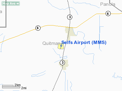
Location & QuickFacts
| FAA Information Effective: | 2008-09-25 |
| Airport Identifier: | MMS |
| Airport Status: | Operational |
| Longitude/Latitude: | 090-17-22.4230W/34-13-53.2430N
-90.289562/34.231456 (Estimated) |
| Elevation: | 162 ft / 49.38 m (Surveyed) |
| Land: | 55 acres |
| From nearest city: | 2 nautical miles SW of Marks, MS |
| Location: | Quitman County, MS |
| Magnetic Variation: | 01E (2000) |
Owner & Manager
| Ownership: | Publicly owned |
| Owner: | Quitman County |
| Address: | 230 Chestnut St.
Marks, MS 38646 |
| Phone number: | 662-326-3161 |
| Manager: | Kevin Rushing |
| Address: | 733 Airport Road, P.o. Box 370
Marks, MS 38646 |
| Phone number: | 662-326-4736 |
Airport Operations and Facilities
| Airport Use: | Open to public |
| Wind indicator: | Yes |
| Segmented Circle: | No |
| Control Tower: | No |
| Lighting Schedule: | DUSK-DAWN |
| Landing fee charge: | No |
| Sectional chart: | Memphis |
| Region: | ASO - Southern |
| Boundary ARTCC: | ZME - Memphis |
| Tie-in FSS: | GWO - Greenwood |
| FSS on Airport: | No |
| FSS Toll Free: | 1-800-WX-BRIEF |
| NOTAMs Facility: | GWO (NOTAM-d service avaliable) |
Airport Communications
Airport Services
| Fuel available: | 100LL
FUEL AVBL 24 HR SELF-SERVE WITH CREDIT CARD. |
| Airframe Repair: | MAJOR |
| Power Plant Repair: | MAJOR |
| Bottled Oxygen: | NONE |
| Bulk Oxygen: | NONE |
Runway Information
Runway 02/20
| Dimension: | 3348 x 70 ft / 1020.5 x 21.3 m |
| Surface: | ASPH, Fair Condition |
| Weight Limit: | Single wheel: 10000 lbs. |
| Edge Lights: | Medium |
| |
Runway 02 |
Runway 20 |
| Longitude: | 090-17-28.2300W | 090-17-16.6140W |
| Latitude: | 34-13-37.3990N | 34-14-09.0840N |
| Elevation: | 161.00 ft | 161.00 ft |
| Alignment: | 17 | 127 |
| Traffic Pattern: | Left | Left |
| Markings: | Basic, Good Condition | Basic, Good Condition |
| Obstruction: | , 50:1 slope to clear | 48 ft trees, 1800.0 ft from runway, 125 ft left of centerline, 33:1 slope to clear
PAVED ROAD 160 FT FROM THLD. |
|
Radio Navigation Aids
| ID |
Type |
Name |
Ch |
Freq |
Var |
Dist |
| CKM | NDB | Clarksdale | | 341.00 | 02E | 11.8 nm |
| HEE | NDB | Thompson-robbins | | 251.00 | 01E | 28.0 nm |
| SBQ | NDB | Scobey | | 245.00 | 01E | 29.1 nm |
| RNV | NDB | Renova | | 272.00 | 04E | 34.7 nm |
| FCY | NDB | Forrest City | | 332.00 | 01E | 48.9 nm |
| IDL | NDB | Indianola | | 284.00 | 03E | 49.1 nm |
| UJM | VOR/DME | Marvell | 033X | 109.60 | 01E | 28.1 nm |
| SQS | VORTAC | Sidon | 094X | 114.70 | 03E | 46.1 nm |
| MEM | VORTAC | Memphis | 122X | 117.50 | 01E | 49.5 nm |
Images and information placed above are from
http://www.airport-data.com/airport/MMS/
We thank them for the data!
| General Info
|
| Country |
United States
|
| State |
MISSISSIPPI
|
| FAA ID |
MMS
|
| Latitude |
34-13-53.243N
|
| Longitude |
090-17-22.423W
|
| Elevation |
162 feet
|
| Near City |
MARKS
|
We don't guarantee the information is fresh and accurate. The data may
be wrong or outdated.
For more up-to-date information please refer to other sources.
|
|


