 |
|
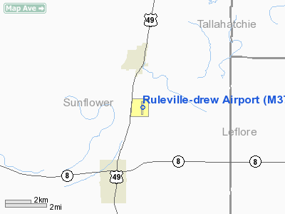
Location & QuickFacts
| FAA Information Effective: | 2008-09-25 |
| Airport Identifier: | M37 |
| Airport Status: | Operational |
| Longitude/Latitude: | 090-31-30.0300W/33-46-35.0100N
-90.525008/33.776392 (Estimated) |
| Elevation: | 137 ft / 41.76 m (Surveyed) |
| Land: | 55 acres |
| From nearest city: | 2 nautical miles S of Drew, MS |
| Location: | Sunflower County, MS |
| Magnetic Variation: | 03E (1985) |
Owner & Manager
| Ownership: | Publicly owned |
| Owner: | Town Of Ruleville And Drew |
| Address: | 130 Shaw Ave
Drew, MS 38737 |
| Phone number: | 662-745-8556 |
| Manager: | Jimmy Chandler
THE HONORABLE JEFFERY KILPATRICK, MAYOR CITY OF DREW 662-745-8556 |
| Address: | 1183 Hwy. 8
Ruleville, MS 38771 |
| Phone number: | 662-756-2192 |
Airport Operations and Facilities
| Airport Use: | Open to public |
| Wind indicator: | Yes |
| Segmented Circle: | Yes |
| Control Tower: | No |
| Lighting Schedule: | DUSK-DAWN
MIRL RY 18/36 OPERS DUSK-2200; AFTER 2200 ACTVT - CTAF. PAPI RY 18/36 ON CONT. |
| Beacon Color: | Clear-Green (lighted land airport) |
| Landing fee charge: | No |
| Sectional chart: | Memphis |
| Region: | ASO - Southern |
| Boundary ARTCC: | ZME - Memphis |
| Tie-in FSS: | GWO - Greenwood |
| FSS on Airport: | No |
| FSS Toll Free: | 1-800-WX-BRIEF |
| NOTAMs Facility: | GWO (NOTAM-d service avaliable) |
| Federal Agreements: | NGY |
Airport Communications
Airport Services
| Airframe Repair: | NONE |
| Power Plant Repair: | NONE |
| Bottled Oxygen: | NONE |
| Bulk Oxygen: | NONE |
Runway Information
Runway 18/36
| Dimension: | 3000 x 60 ft / 914.4 x 18.3 m |
| Surface: | ASPH, Fair Condition |
| Weight Limit: | Single wheel: 16000 lbs. |
| Edge Lights: | Medium |
| |
Runway 18 |
Runway 36 |
| Longitude: | 090-31-29.8700W | 090-31-30.1560W |
| Latitude: | 33-46-49.8450N | 33-46-20.1710N |
| Elevation: | 137.00 ft | 133.00 ft |
| Alignment: | 127 | 0 |
| Traffic Pattern: | Left | Left |
| Markings: | Basic, Good Condition | Basic, Good Condition |
| Crossing Height: | 40.00 ft | 40.00 ft |
| VASI: | 2-light PAPI on left side | 2-light PAPI on left side |
| Visual Glide Angle: | 3.00° | 3.00° |
|
Radio Navigation Aids
| ID |
Type |
Name |
Ch |
Freq |
Var |
Dist |
| RNV | NDB | Renova | | 272.00 | 04E | 12.0 nm |
| IDL | NDB | Indianola | | 284.00 | 03E | 19.3 nm |
| CKM | NDB | Clarksdale | | 341.00 | 02E | 31.1 nm |
| MTQ | NDB | Metcalf | | 359.00 | 03E | 31.1 nm |
| SBQ | NDB | Scobey | | 245.00 | 01E | 33.2 nm |
| HEE | NDB | Thompson-robbins | | 251.00 | 01E | 48.4 nm |
| GLH | VOR/DME | Greenville | 039X | 110.20 | 04E | 27.5 nm |
| UJM | VOR/DME | Marvell | 033X | 109.60 | 01E | 48.6 nm |
| SQS | VORTAC | Sidon | 094X | 114.70 | 03E | 22.5 nm |
Images and information placed above are from
http://www.airport-data.com/airport/M37/
We thank them for the data!
| General Info
|
| Country |
United States
|
| State |
MISSISSIPPI
|
| FAA ID |
M37
|
| Latitude |
33-46-35.010N
|
| Longitude |
090-31-30.030W
|
| Elevation |
137 feet
|
| Near City |
DREW
|
We don't guarantee the information is fresh and accurate. The data may
be wrong or outdated.
For more up-to-date information please refer to other sources.
|
|


