 |
|
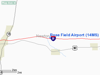
Location & QuickFacts
| FAA Information Effective: | 2008-09-25 |
| Airport Identifier: | 14MS |
| Airport Status: | Operational |
| Longitude/Latitude: | 089-02-03.0000W/32-20-43.0000N
-89.034167/32.345278 (Estimated) |
| Elevation: | 400 ft / 121.92 m (Estimated) |
| Land: | 0 acres |
| From nearest city: | 2 nautical miles NW of Hickory, MS |
| Location: | Newton County, MS |
| Magnetic Variation: | 00E (2000) |
Owner & Manager
| Ownership: | Privately owned |
| Owner: | Tommy E Rose |
| Address: | 284 Mobile Home Dr
Hickory, MS 39322 |
| Phone number: | 601-635-4500 |
| Manager: | Tommy R Rose |
| Address: | 284 Mobile Home Dr
Hickory, MS 39332 |
| Phone number: | 601-635-4500 |
Airport Operations and Facilities
| Airport Use: | Private |
| Wind indicator: | Yes |
| Segmented Circle: | No |
| Control Tower: | No |
| Sectional chart: | Memphis |
| Region: | ASO - Southern |
| Boundary ARTCC: | ZME - Memphis |
| Tie-in FSS: | GWO - Greenwood |
| FSS Toll Free: | 1-800-WX-BRIEF |
Runway Information
Runway 03/21
| Dimension: | 1600 x 75 ft / 487.7 x 22.9 m |
| Surface: | TURF,
RY 08/26 IS 16 FT WIDE ASPH THE ENTIRE LENGTH; THE REMAINING WIDTH IS TURF THE ENTIRE LENGTH. |
| |
Runway 03 |
Runway 21 |
| Traffic Pattern: | Left | Left |
|
Runway 08/26
| Dimension: | 3500 x 75 ft / 1066.8 x 22.9 m |
| Surface: | ASPH-TURF,
RY 08/26 IS 16 FT WIDE ASPH THE ENTIRE LENGTH; THE REMAINING WIDTH IS TURF THE ENTIRE LENGTH. |
| |
Runway 08 |
Runway 26 |
| Traffic Pattern: | Left | Left |
|
Radio Navigation Aids
| ID |
Type |
Name |
Ch |
Freq |
Var |
Dist |
| ME | NDB | Savoy | | 356.00 | 01E | 14.6 nm |
| MPE | NDB | Philadelphia | | 219.00 | 01E | 27.6 nm |
| THJ | NDB | Tallahala | | 346.00 | 00E | 40.3 nm |
| LMS | NDB | Louisville | | 212.00 | 00E | 48.0 nm |
| BCZ | NDB | Choctaw | | 228.00 | 01E | 48.4 nm |
| NMM | TACAN | Meridian | 056X | | 01E | 28.5 nm |
| NJW | TACAN | Joe Williams | 61Y | | 01E | 28.9 nm |
| MEI | VORTAC | Meridian | 117X | 117.00 | 05E | 11.8 nm |
| EWA | VORTAC | Kewanee | 085X | 113.80 | 04E | 29.3 nm |
Remarks
- 250 FT TOWER 300 FT SOUTH OF ARPT.
- OWNER DESIRES CHARTING.
- PROVIDED VFR OPNS, PRIVATE USE, AND THE LANDING AREA IS LIMITED TO ACFT HAVING APCH SPEEDS LESS THAN 121 KTS - FAA ACFT APCH CATEGORIES A AND B.
Images and information placed above are from
http://www.airport-data.com/airport/14MS/
We thank them for the data!
| General Info
|
| Country |
United States
|
| State |
MISSISSIPPI
|
| FAA ID |
14MS
|
| Latitude |
32-20-43.000N
|
| Longitude |
089-02-03.000W
|
| Elevation |
400 feet
|
| Near City |
HICKORY
|
We don't guarantee the information is fresh and accurate. The data may
be wrong or outdated.
For more up-to-date information please refer to other sources.
|
|


