 |
|
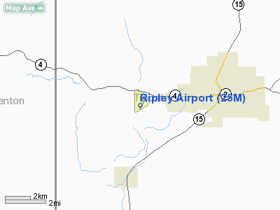
Location & QuickFacts
| FAA Information Effective: | 2008-09-25 |
| Airport Identifier: | 25M |
| Airport Status: | Operational |
| Longitude/Latitude: | 089-00-54.1800W/34-43-20.1600N
-89.015050/34.722267 (Estimated) |
| Elevation: | 465 ft / 141.73 m (Surveyed) |
| Land: | 86 acres |
| From nearest city: | 3 nautical miles W of Ripley, MS |
| Location: | Tippah County, MS |
| Magnetic Variation: | 01W (2005) |
Owner & Manager
| Ownership: | Publicly owned |
| Owner: | City Of Ripley & Tippah County
JOHNNY COOMBS, CHAIRMAN CO ARPT BOARD 662-837-9341/9359. |
| Address: | 407 Jackson St
Ripley, MS 38663 |
| Phone number: | 662-837-7374 |
| Manager: | Johnny Coombs |
| Address: | Po Box 127
Blue Mountain, MS 38610 |
| Phone number: | 662-587-7070 |
Airport Operations and Facilities
| Airport Use: | Open to public |
| Wind indicator: | Yes |
| Segmented Circle: | Yes |
| Control Tower: | No |
| Lighting Schedule: | DUSK-DAWN
AFTER 2200 ACTVT MIRL RY 03/21 & PAPI RY 03 & 21 - CTAF. |
| Beacon Color: | Clear-Green (lighted land airport)
BCN DOES NOT ROTATE. |
| Landing fee charge: | No |
| Sectional chart: | Memphis |
| Region: | ASO - Southern |
| Boundary ARTCC: | ZME - Memphis |
| Tie-in FSS: | GWO - Greenwood |
| FSS on Airport: | No |
| FSS Toll Free: | 1-800-WX-BRIEF |
| NOTAMs Facility: | GWO (NOTAM-d service avaliable) |
| Federal Agreements: | NGY |
Airport Communications
| CTAF: | 122.800 |
| Unicom: | 122.800 |
Airport Services
| Fuel available: | 100LL
SELF SVC CREDIT CARD FUEL AVBL 24 HRS. |
| Airframe Repair: | NONE |
| Power Plant Repair: | NONE |
| Bottled Oxygen: | NONE |
| Bulk Oxygen: | NONE |
Runway Information
Runway 03/21
| Dimension: | 4400 x 75 ft / 1341.1 x 22.9 m |
| Surface: | ASPH, Good Condition |
| Weight Limit: | Single wheel: 20000 lbs. |
| Edge Lights: | Medium |
| |
Runway 03 |
Runway 21 |
| Longitude: | 089-01-06.7800W | 089-00-39.0490W |
| Latitude: | 34-43-03.3400N | 34-43-40.3550N |
| Elevation: | 437.00 ft | 465.00 ft |
| Alignment: | 32 | 127 |
| Traffic Pattern: | Left | Left |
| Markings: | Basic, Good Condition | Basic, Good Condition |
| Crossing Height: | 15.00 ft | 16.00 ft |
| VASI: | 2-light PAPI on left side | 2-light PAPI on left side |
| Visual Glide Angle: | 3.25° | 3.50° |
| Obstruction: | 40 ft tree, 1370.0 ft from runway, 29:1 slope to clear | 68 ft tree, 1505.0 ft from runway, 253 ft right of centerline, 19:1 slope to clear |
|
Radio Navigation Aids
| ID |
Type |
Name |
Ch |
Freq |
Var |
Dist |
| BAV | NDB | Hardeman | | 404.00 | 01E | 29.6 nm |
| FYE | NDB | Somerville | | 255.00 | 00E | 34.5 nm |
| SZY | NDB | Sibley | | 386.00 | 01E | 39.5 nm |
| OLV | NDB | Olive Branch | | 275.00 | 01E | 41.2 nm |
| OTB | VOR/DME | Tupelo | 035X | 109.80 | 04E | 31.8 nm |
| HLI | VORTAC | Holly Springs | 071X | 112.40 | 03E | 24.0 nm |
Images and information placed above are from
http://www.airport-data.com/airport/25M/
We thank them for the data!
| General Info
|
| Country |
United States
|
| State |
MISSISSIPPI
|
| FAA ID |
25M
|
| Latitude |
34-43-20.164N
|
| Longitude |
089-00-54.178W
|
| Elevation |
465 feet
|
| Near City |
RIPLEY
|
We don't guarantee the information is fresh and accurate. The data may
be wrong or outdated.
For more up-to-date information please refer to other sources.
|
|


