 |
|
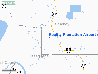
Reality Plantation Airport |
Location & QuickFacts
| FAA Information Effective: | 2008-09-25 |
| Airport Identifier: | MS34 |
| Airport Status: | Operational |
| Longitude/Latitude: | 090-56-47.3730W/32-41-53.4800N
-90.946493/32.698189 (Estimated) |
| Elevation: | 98 ft / 29.87 m (Estimated) |
| Land: | 0 acres |
| From nearest city: | 2 nautical miles S of Onward, MS |
| Location: | Sharkey County, MS |
| Magnetic Variation: | 03E (1985) |
Owner & Manager
| Ownership: | Privately owned |
| Owner: | Reality Plantation, Inc. |
| Address: | 109 Hwy 61 South
Rolling Fork, MS 39159 |
| Phone number: | 601-873-2604 |
| Manager: | James Hand Iii |
| Address: | 109 Hwy 61 South
Rolling Fork, MS 39159 |
| Phone number: | 601-873-2661 |
Airport Operations and Facilities
| Airport Use: | Private |
| Wind indicator: | Yes |
| Segmented Circle: | No |
| Control Tower: | No |
| Landing fee charge: | No |
| Sectional chart: | Memphis |
| Region: | ASO - Southern |
| Boundary ARTCC: | ZME - Memphis |
| Tie-in FSS: | GWO - Greenwood |
| FSS on Airport: | No |
| FSS Toll Free: | 1-800-WX-BRIEF |
Airport Services
| Airframe Repair: | NONE |
| Power Plant Repair: | NONE |
Runway Information
Runway 08/26
| Dimension: | 2100 x 90 ft / 640.1 x 27.4 m |
| Surface: | TURF, |
| |
Runway 08 |
Runway 26 |
| Traffic Pattern: | Left | Left |
|
Radio Navigation Aids
| ID |
Type |
Name |
Ch |
Freq |
Var |
Dist |
| BLE | NDB | Lake Providence | | 278.00 | 03E | 14.7 nm |
| TV | NDB | Savry | | 344.00 | 02E | 27.5 nm |
| VKS | NDB | Vicksburg | | 382.00 | 03E | 28.0 nm |
| RYB | NDB | Raymond | | 375.00 | 03E | 36.1 nm |
| JH | NDB | Brenz | | 260.00 | 02E | 38.7 nm |
| MTQ | NDB | Metcalf | | 359.00 | 03E | 43.7 nm |
| MRK | NDB | Molly Ridge | | 338.00 | 02E | 45.4 nm |
| BQP | NDB | Bastrop | | 329.00 | 03E | 47.5 nm |
| IDL | NDB | Indianola | | 284.00 | 03E | 48.9 nm |
| GLH | VOR/DME | Greenville | 039X | 110.20 | 04E | 49.6 nm |
| JAN | VORTAC | Jackson | 073X | 112.60 | 05E | 41.1 nm |
Remarks
- EXISTED PRIOR TO 05/15/59
Images and information placed above are from
http://www.airport-data.com/airport/MS34/
We thank them for the data!
| General Info
|
| Country |
United States
|
| State |
MISSISSIPPI
|
| FAA ID |
MS34
|
| Latitude |
32-41-53.480N
|
| Longitude |
090-56-47.373W
|
| Elevation |
98 feet
|
| Near City |
ONWARD
|
We don't guarantee the information is fresh and accurate. The data may
be wrong or outdated.
For more up-to-date information please refer to other sources.
|
|


