 |
|
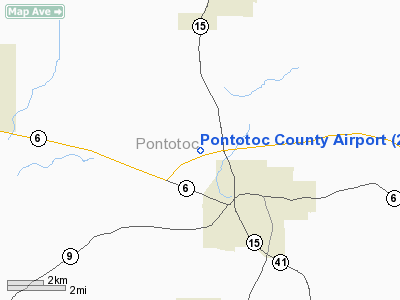
Location & QuickFacts
| FAA Information Effective: | 2008-09-25 |
| Airport Identifier: | 22M |
| Airport Status: | Operational |
| Longitude/Latitude: | 089-02-18.2290W/34-16-33.3780N
-89.038397/34.275938 (Estimated) |
| Elevation: | 440 ft / 134.11 m (Estimated) |
| Land: | 47 acres |
| From nearest city: | 2 nautical miles NW of Pontotoc, MS |
| Location: | Pontotoc County, MS |
| Magnetic Variation: | 02E (1985) |
Owner & Manager
| Ownership: | Publicly owned |
| Owner: | Ponotoc County |
| Address: | Po Box 209
Pontotoc, MS 38863 |
| Phone number: | 662-489-3900
CHANCERY CLERK'S OFFICE. |
| Manager: | Ted Mcvay
MR TED MCVAY, CHAIRMAN OF AIRPORT BOARD. |
| Address: | Po Box 209
Pontotoc, MS 38863-0209 |
| Phone number: | 662-489-8926 |
Airport Operations and Facilities
| Airport Use: | Open to public |
| Wind indicator: | Yes |
| Segmented Circle: | Yes |
| Control Tower: | No |
| Lighting Schedule: | DUSK-DAWN |
| Landing fee charge: | No |
| Sectional chart: | Memphis |
| Region: | ASO - Southern |
| Boundary ARTCC: | ZME - Memphis |
| Tie-in FSS: | GWO - Greenwood |
| FSS on Airport: | No |
| FSS Toll Free: | 1-800-WX-BRIEF |
| NOTAMs Facility: | GWO (NOTAM-d service avaliable) |
| Federal Agreements: | NGY |
Airport Communications
| CTAF: | 122.800 |
| Unicom: | 122.800
UNICOM OTS INDEFLY. |
Airport Services
| Fuel available: | 100LL |
| Airframe Repair: | MAJOR |
| Power Plant Repair: | MAJOR |
| Bottled Oxygen: | NONE |
| Bulk Oxygen: | NONE |
Runway Information
Runway 11/29
| Dimension: | 3000 x 50 ft / 914.4 x 15.2 m |
| Surface: | ASPH, Good Condition |
| Weight Limit: | Single wheel: 16000 lbs. |
| Edge Lights: | Medium |
| |
Runway 11 |
Runway 29 |
| Traffic Pattern: | Left | Left |
| Markings: | Basic, Good Condition | Basic, Good Condition |
| Obstruction: | 44 ft trees, 1350.0 ft from runway, 26:1 slope to clear | 63 ft tree, 1400.0 ft from runway, 200 ft left of centerline, 19:1 slope to clear |
|
Radio Navigation Aids
| ID |
Type |
Name |
Ch |
Freq |
Var |
Dist |
| SBQ | NDB | Scobey | | 245.00 | 01E | 47.6 nm |
| OTB | VOR/DME | Tupelo | 035X | 109.80 | 04E | 12.4 nm |
| HLI | VORTAC | Holly Springs | 071X | 112.40 | 03E | 37.4 nm |
| CBM | VORTAC | Caledonia | 099X | 115.20 | 00E | 48.5 nm |
Remarks
- RWY 11/29 TERRAIN DROPS ABRUPTLY 100' FROM BOTH ENDS OF RWY.
Images and information placed above are from
http://www.airport-data.com/airport/22M/
We thank them for the data!
| General Info
|
| Country |
United States
|
| State |
MISSISSIPPI
|
| FAA ID |
22M
|
| Latitude |
34-16-33.378N
|
| Longitude |
089-02-18.229W
|
| Elevation |
440 feet
|
| Near City |
PONTOTOC
|
We don't guarantee the information is fresh and accurate. The data may
be wrong or outdated.
For more up-to-date information please refer to other sources.
|
|


