 |
|
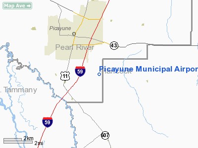
Picayune Municipal Airport |
Location & QuickFacts
| FAA Information Effective: | 2008-09-25 |
| Airport Identifier: | MJD |
| Airport Status: | Operational |
| Longitude/Latitude: | 089-39-04.3000W/30-29-14.9000N
-89.651194/30.487472 (Estimated) |
| Elevation: | 55 ft / 16.76 m (Surveyed) |
| Land: | 231 acres |
| From nearest city: | 2 nautical miles SE of Picayune, MS |
| Location: | Pearl River County, MS |
| Magnetic Variation: | 01E (2000) |
Owner & Manager
| Ownership: | Publicly owned |
| Owner: | City Of Picayune |
| Address: | 815 N. Beech St.
Picayune, MS 39466 |
| Phone number: | 601-798-9770 |
| Manager: | Andy Greenwood
HARVEY MILLER, INTERIM CITY MGR. |
| Address: | 148 Runway Road
Picayune, MS 39466 |
| Phone number: | 601-799-5550 |
Airport Operations and Facilities
| Airport Use: | Open to public |
| Wind indicator: | Yes |
| Segmented Circle: | Yes |
| Control Tower: | No |
| Lighting Schedule: | DUSK-DAWN
ACTVT MIRL RY 18/36 - CTAF. |
| Beacon Color: | Clear-Green (lighted land airport) |
| Sectional chart: | New Orleans |
| Region: | ASO - Southern |
| Boundary ARTCC: | ZHU - Houston |
| Tie-in FSS: | GWO - Greenwood |
| FSS Toll Free: | 1-800-WX-BRIEF |
| NOTAMs Facility: | GWO (NOTAM-d service avaliable) |
| Federal Agreements: | NGY |
Airport Communications
| CTAF: | 122.800 |
| Unicom: | 122.800 |
Airport Services
| Fuel available: | 100LLA
FUEL AVBL 24 HRS WITH CREDIT CARD. |
| Airframe Repair: | MAJOR |
| Power Plant Repair: | MAJOR |
Runway Information
Runway 18/36
| Dimension: | 5000 x 75 ft / 1524.0 x 22.9 m |
| Surface: | ASPH, Good Condition |
| Weight Limit: | Single wheel: 30000 lbs. |
| Edge Lights: | Medium |
| |
Runway 18 |
Runway 36 |
| Longitude: | 089-39-04.2610W | 089-39-04.3353W |
| Latitude: | 30-29-39.6844N | 30-28-50.2102N |
| Elevation: | 55.00 ft | 49.00 ft |
| Alignment: | 127 | 0 |
| Traffic Pattern: | Left | Left |
| Markings: | Non-precision instrument, Good Condition | Non-precision instrument, Good Condition |
| Crossing Height: | 36.00 ft | 43.00 ft |
| VASI: | 2-light PAPI on left side | 2-light PAPI on left side |
| Visual Glide Angle: | 3.00° | 3.00° |
| Obstruction: | 57 ft trees, 1715.0 ft from runway, 26:1 slope to clear | 22 ft trees, 850.0 ft from runway, 100 ft left of centerline, 29:1 slope to clear |
|
Radio Navigation Aids
| ID |
Type |
Name |
Ch |
Freq |
Var |
Dist |
| MJD | NDB | Picayune | | 276.00 | 01E | 0.4 nm |
| FNA | NDB | Florenville | | 371.00 | 03E | 9.8 nm |
| AYI | NDB | Hanco | | 221.00 | 03E | 10.4 nm |
| HS | NDB | Hanco | | 221.00 | 01E | 10.4 nm |
| DEF | NDB | Slidell | | 256.00 | 03E | 14.9 nm |
| BX | NDB | Carma | | 353.00 | 02E | 26.1 nm |
| MS | NDB | Kinte | | 338.00 | 03E | 47.8 nm |
| FOH | NDB | Foxworth | | 331.00 | 05E | 49.4 nm |
| BIX | TACAN | Keesler | 055X | | 01E | 37.7 nm |
| HMU | VOR | Hammond | | 109.60 | 03E | 39.7 nm |
| PCU | VOR/DME | Picayune | 059X | 112.20 | 05E | 6.0 nm |
| GPT | VOR/DME | Gulfport | 27X | 109.00 | 02E | 30.3 nm |
| HRV | VORTAC | Harvey | 088X | 114.10 | 02E | 42.4 nm |
| NEW | VOT | New Orleans Lakefront | | 111.00 | | 33.2 nm |
Remarks
- PRVDD VFR OPNS & EXISTING PICAYUNE ARPT IS CLSD WHEN NEW AIRPORT IS OPNL.
Images and information placed above are from
http://www.airport-data.com/airport/MJD/
We thank them for the data!
| General Info
|
| Country |
United States
|
| State |
MISSISSIPPI
|
| FAA ID |
MJD
|
| Latitude |
30-29-14.945N
|
| Longitude |
089-39-04.295W
|
| Elevation |
56 feet
|
| Near City |
PICAYUNE
|
We don't guarantee the information is fresh and accurate. The data may
be wrong or outdated.
For more up-to-date information please refer to other sources.
|
|


