 |
|
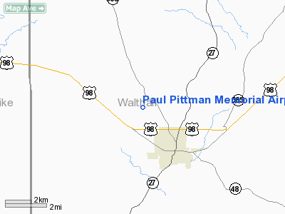
Paul Pittman Memorial Airport |
Location & QuickFacts
| FAA Information Effective: | 2008-09-25 |
| Airport Identifier: | T36 |
| Airport Status: | Operational |
| Longitude/Latitude: | 090-10-05.3220W/31-08-45.6400N
-90.168145/31.146011 (Estimated) |
| Elevation: | 384 ft / 117.04 m (Estimated) |
| Land: | 40 acres |
| From nearest city: | 3 nautical miles NW of Tylertown, MS |
| Location: | Walthall County, MS |
| Magnetic Variation: | 03E (1985) |
Owner & Manager
| Ownership: | Publicly owned |
| Owner: | Walthall County
MRS MARY F GARNER, CHAIRPERSON AIRPORT BOARD. |
| Address: | 141 Airport Road
Tylertown, MS 39667 |
| Phone number: | 601-876-9327 |
| Manager: | Ms. Mary F. Garner
CHAIRMAN OF AIRPORT BOARD |
| Address: | 3099 Hwy 48 East Extension
Magnolia, MS 39652 |
| Phone number: | 601-783-6067 |
Airport Operations and Facilities
| Airport Use: | Open to public |
| Wind indicator: | Yes |
| Segmented Circle: | Yes |
| Control Tower: | No |
| Lighting Schedule: | DUSK-DAWN
MIRL RY 18/36 PRESET LOW INTST DUSK-DAWN; TO INCREASE INTST ACTVT - CTAF. PAPIS OPERATE CONT. |
| Beacon Color: | Clear-Green (lighted land airport) |
| Landing fee charge: | No |
| Sectional chart: | New Orleans |
| Region: | ASO - Southern |
| Boundary ARTCC: | ZHU - Houston |
| Tie-in FSS: | GWO - Greenwood |
| FSS on Airport: | No |
| FSS Toll Free: | 1-800-WX-BRIEF |
| NOTAMs Facility: | GWO (NOTAM-d service avaliable) |
| Federal Agreements: | NGY |
Airport Communications
| CTAF: | 122.800 |
| Unicom: | 122.800 |
Airport Services
| Fuel available: | 100LL
FUEL AVAILABLE 24 HRS WITH CREDIT CARD. |
| Bottled Oxygen: | NONE |
| Bulk Oxygen: | NONE |
Runway Information
Runway 18/36
| Dimension: | 3000 x 60 ft / 914.4 x 18.3 m |
| Surface: | ASPH, Good Condition |
| Weight Limit: | Single wheel: 20000 lbs. |
| Edge Lights: | Medium |
| |
Runway 18 |
Runway 36 |
| Traffic Pattern: | Left | Left |
| Markings: | Basic, Good Condition | Basic, Good Condition |
| VASI: | 2-light PAPI on left side | 2-light PAPI on left side |
| Visual Glide Angle: | 3.00° | 3.00° |
| Obstruction: | 50 ft trees, 1510.0 ft from runway, 300 ft left of centerline, 26:1 slope to clear | , 50:1 slope to clear |
|
Radio Navigation Aids
| ID |
Type |
Name |
Ch |
Freq |
Var |
Dist |
| MC | NDB | Ferni | | 413.00 | 03E | 18.8 nm |
| FOH | NDB | Foxworth | | 331.00 | 05E | 20.1 nm |
| BX | NDB | Carma | | 353.00 | 02E | 22.4 nm |
| BVV | NDB | Brookhaven | | 407.00 | 03E | 30.4 nm |
| MJD | NDB | Picayune | | 276.00 | 01E | 47.3 nm |
| FNA | NDB | Florenville | | 371.00 | 03E | 47.4 nm |
| HMU | VOR | Hammond | | 109.60 | 03E | 39.8 nm |
| PCU | VOR/DME | Picayune | 059X | 112.20 | 05E | 41.8 nm |
| MCB | VORTAC | Mc Comb | 114X | 116.70 | 03E | 10.6 nm |
| LBY | VORTAC | Eaton | 043X | 110.60 | 05E | 45.7 nm |
Remarks
- PUBLIC TELEPHONE 601-876-9327.
Images and information placed above are from
http://www.airport-data.com/airport/T36/
We thank them for the data!
| General Info
|
| Country |
United States
|
| State |
MISSISSIPPI
|
| FAA ID |
T36
|
| Latitude |
31-08-45.640N
|
| Longitude |
090-10-05.322W
|
| Elevation |
384 feet
|
| Near City |
TYLERTOWN
|
We don't guarantee the information is fresh and accurate. The data may
be wrong or outdated.
For more up-to-date information please refer to other sources.
|
|


