 |
|
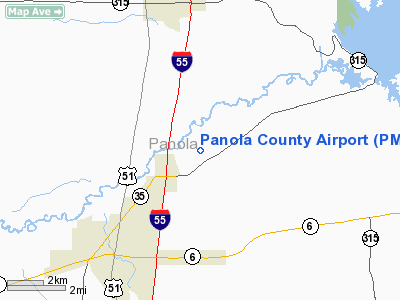
Location & QuickFacts
| FAA Information Effective: | 2008-09-25 |
| Airport Identifier: | PMU |
| Airport Status: | Operational |
| Longitude/Latitude: | 089-53-34.4000W/34-21-48.6000N
-89.892889/34.363500 (Estimated) |
| Elevation: | 221 ft / 67.36 m (Surveyed) |
| Land: | 237 acres |
| From nearest city: | 4 nautical miles NE of Batesville, MS |
| Location: | Panola County, MS |
| Magnetic Variation: | 02E (1985) |
Owner & Manager
| Ownership: | Publicly owned |
| Owner: | Panola County
TOMMY K. WELLS, CHAIRMAN PANOLA COUNTY AIRPORT BOARD. |
| Address: | P.o. Box 807
Batesville, MS 38606 |
| Phone number: | 662-563-5700 |
| Manager: | Randy Turman |
| Address: | P.o. Box 1124
Batesville, MS 38606 |
| Phone number: | 662-563-4100
CELL PHONE (662) 654-0389. |
Airport Operations and Facilities
| Airport Use: | Open to public |
| Wind indicator: | Yes |
| Segmented Circle: | Yes |
| Control Tower: | No |
| Lighting Schedule: | DUSK-DAWN |
| Beacon Color: | Clear-Green (lighted land airport) |
| Landing fee charge: | No |
| Sectional chart: | Memphis |
| Region: | ASO - Southern |
| Boundary ARTCC: | ZME - Memphis |
| Tie-in FSS: | GWO - Greenwood |
| FSS on Airport: | No |
| FSS Toll Free: | 1-800-WX-BRIEF |
| NOTAMs Facility: | GWO (NOTAM-d service avaliable) |
| Federal Agreements: | NGY |
Airport Communications
| CTAF: | 122.800 |
| Unicom: | 122.800 |
Airport Services
| Fuel available: | 100LLA
SELF-SERVICE ON 100LL WITH CREDIT CARD. |
| Airframe Repair: | MAJOR |
| Power Plant Repair: | MAJOR |
| Bottled Oxygen: | NONE |
| Bulk Oxygen: | NONE |
Runway Information
Runway 01/19
| Dimension: | 5000 x 75 ft / 1524.0 x 22.9 m |
| Surface: | ASPH, Good Condition |
| Weight Limit: | Single wheel: 30000 lbs. |
| Edge Lights: | Medium
RY 01/19 LGTS OTS INDEFLY. |
| |
Runway 01 |
Runway 19 |
| Longitude: | 089-53-39.4026W | 089-53-29.3069W |
| Latitude: | 34-21-24.2260N | 34-22-12.9670N |
| Elevation: | 221.00 ft | 218.00 ft |
| Alignment: | 10 | 127 |
| ILS Type: | | LOC/DME
|
| Traffic Pattern: | Left | Left |
| Markings: | Basic, Fair Condition | Basic, Fair Condition |
| Crossing Height: | 39.00 ft | 39.00 ft |
| Displaced threshold: | 590.00 ft | 0.00 ft |
| VASI: | 2-light PAPI on left side | 2-light PAPI on left side |
| Visual Glide Angle: | 4.00° | 4.00° |
| Obstruction: | 112 ft trees, 1600.0 ft from runway, 50 ft left of centerline, 12:1 slope to clear
20:1 GLIDE SLOPE TO DSPLCD THLD. | 51 ft trees, 920.0 ft from runway, 100 ft right of centerline, 14:1 slope to clear |
|
Radio Navigation Aids
| ID |
Type |
Name |
Ch |
Freq |
Var |
Dist |
| SBQ | NDB | Scobey | | 245.00 | 01E | 28.4 nm |
| CKM | NDB | Clarksdale | | 341.00 | 02E | 31.2 nm |
| OLV | NDB | Olive Branch | | 275.00 | 01E | 37.4 nm |
| HEE | NDB | Thompson-robbins | | 251.00 | 01E | 40.8 nm |
| ME | NDB | Elvis | | 287.00 | 01E | 42.9 nm |
| AWM | NDB | West Memphis | | 362.00 | 01E | 49.6 nm |
| UJM | VOR/DME | Marvell | 033X | 109.60 | 01E | 40.8 nm |
| HLI | VORTAC | Holly Springs | 071X | 112.40 | 03E | 31.3 nm |
| MEM | VORTAC | Memphis | 122X | 117.50 | 01E | 39.4 nm |
| MEM | VOT | Memphis Metropolitn | | 111.00 | | 41.5 nm |
Remarks
- ULTRALIGHT ACTVTY ON AND INVOF ARPT.
Images and information placed above are from
http://www.airport-data.com/airport/PMU/
We thank them for the data!
| General Info
|
| Country |
United States
|
| State |
MISSISSIPPI
|
| FAA ID |
PMU
|
| Latitude |
34-22-00.388N
|
| Longitude |
089-54-00.321W
|
| Elevation |
219 feet
|
| Near City |
BATESVILLE
|
We don't guarantee the information is fresh and accurate. The data may
be wrong or outdated.
For more up-to-date information please refer to other sources.
|
|


