|
 |
|
||||
|
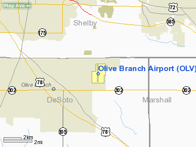
Olive Branch Airport (IATA: OLV, ICAO: KOLV, FAA LID: OLV) is a civil, privately-owned airport open to the public. It located three nautical miles (6 km) northeast of the central business district of Olive Branch, a city in DeSoto County, Mississippi, United States. It is also only about a 30 minute drive from Memphis, Tennessee, making it an easily-accessible satellite airport for the general aviation and business air travel communities wanting to access the East Memphis/Germantown/Collierville area. It is owned and operated by Metro Industrial Park Ltd. HistoryIn the early 1970's, Holiday Inn announced they would construct what would be called Holiday Inn University and Conference Center in Olive Branch, Mississippi. Simultaneous with construction of the University, Holiday Inn began work on a 3,000-acre industrial park and the Olive Branch Airport that opened in January, 1973. Today the development is known as Metro Industrial Park. It is an 800 acre fully planned, improved, and restricted industrial facility. It includes the Olive Branch Airport -- one of Mississippi's busiest -- offering a 6,000 foot paved, lighted runway, and full service fixed base operations (via Metro Aviation Service). Today the industrial complex and Olive Branch Airport are owned by Belz Enterprises. Facilities and aircraftOlive Branch Airport covers an area of 412 acres (167 ha) at an elevation of 402 feet (123 m) above mean sea level. It has one runway designated 18/36 with an asphalt surface measuring 6,000 by 100 feet (1,829 x 30 m). Facilities include a general aviation terminal, 25 conventional hangars, 26 T-hangar units, and 140 paved tie-down spaces. The airport also offers on-site car rental through Enterprise Rent-A-Car and lodging arrangements at the nearby Whispering Woods Conference Center (previously the Holiday Inn University and Conference Center). Olive Branch Airport has a fully functioning "Class D" control tower with an up-link to Memphis International Airport's radar. It is staffed from 7am - 9pm CST daily. Metro Aviation Service is the fixed base operator (FBO) at Olive Branch Airport. They provide both 100LL and Jet-A fuel for aircraft that are both based there and transient. Air Venture Flight Center is based out of Olive Branch Airport. Air Venture Flight Center is a flight training school and aircraft rental company. They have a full time staff of professional flight instructors and a nice fleet of Cessna aircraft. Air Venture Flight Center is also a Cessna Pilot Center and operates a charter company called Vectair-USA. Any aircraft from a small training aircraft to a Bombardier Global Express business jet can operate to, from, and around Olive Branch Airport. A few charter companies have piston singles and twins, jets, and/or turbojets based at Olive Branch Airport. Vectair-USA uses a Piper Chieftain for chartered flights. OneSky Jets has one King Air B100 based there. For the 12-month period ending December 31, 2009, the airport had 56,952 aircraft operations, an average of 156 per day: 60% Corporate, 30% Instructional, 8% Pleasure and 2% Military. At that time there were 160 aircraft based at this airport: 119 single engine, 20 multi-engine, 10 jets, 10 turbo-props and 1 helicopter. Airlines and destinationsWhile a few charter operations operate out of Olive Branch Airport, including Vectair-USA and OneSky Jets, no regular service operates there. The above content comes from Wikipedia and is published under free licenses – click here to read more.
Location & QuickFacts
Owner & Manager
Airport Operations and Facilities
Airport Communications
Airport Services
Runway InformationRunway 18/36
Radio Navigation Aids
Remarks
Images and information placed above are from We thank them for the data!
We don't guarantee the information is fresh and accurate. The data may
be wrong or outdated.
|
|||||||||||||||||||||||||||||||||||||||||||||||||||||||||||||||||||||||||||||||||||||||||||||||||||||||||||||||||||||||||||||||||||||||||||||||||||||||||||||||||||||||||||||||||||||||||||||||||||||||||||||||||||||||||||||||||||||||||||||||||||||||||||||||||||||||||||||||||||||||||||||||||||||||||||||||||||||||||||||||||||||||||||||||||||||||||||||

 |
|
Copyright 2004-2024 © by Airports-Worldwide.com, Vyshenskoho st. 36, Lviv 79010, Ukraine Legal Disclaimer |