 |
|
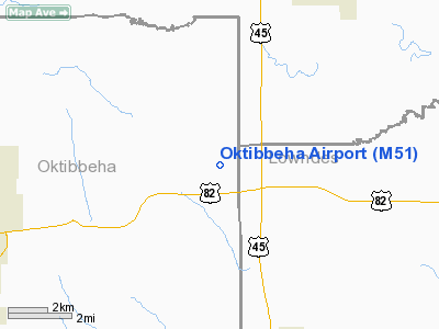
Location & QuickFacts
| FAA Information Effective: | 2008-09-25 |
| Airport Identifier: | M51 |
| Airport Status: | Operational |
| Longitude/Latitude: | 088-40-52.8030W/33-29-51.1530N
-88.681334/33.497543 (Estimated) |
| Elevation: | 250 ft / 76.20 m (Estimated) |
| Land: | 153 acres |
| From nearest city: | 7 nautical miles NE of Starkville, MS |
| Location: | Oktibbeha County, MS |
| Magnetic Variation: | 02E (1985) |
Owner & Manager
| Ownership: | Privately owned |
| Owner: | Terry M. Camp |
| Address: | 1620 Camp Airport Rd
Starkville, MS 39759 |
| Phone number: | 662-323-3515 |
| Manager: | Doug Camp |
| Address: | 1620 Camp Airport Rd
Starkville, MS 39759 |
| Phone number: | 662-323-3515 |
Airport Operations and Facilities
| Airport Use: | Open to public |
| Wind indicator: | Yes |
| Segmented Circle: | No |
| Control Tower: | No |
| Landing fee charge: | No |
| Sectional chart: | Memphis |
| Region: | ASO - Southern |
| Boundary ARTCC: | ZME - Memphis |
| Tie-in FSS: | GWO - Greenwood |
| FSS on Airport: | No |
| FSS Toll Free: | 1-800-WX-BRIEF |
| NOTAMs Facility: | GWO (NOTAM-d service avaliable) |
Airport Communications
| CTAF: | 122.800 |
| Unicom: | 122.800
UNICOM OTS INDEFLY. |
Airport Services
| Airframe Repair: | MAJOR |
| Power Plant Repair: | MAJOR |
| Bottled Oxygen: | NONE |
| Bulk Oxygen: | NONE |
Runway Information
Runway 13/31
| Dimension: | 2700 x 150 ft / 823.0 x 45.7 m |
| Surface: | TURF, Fair Condition |
| |
Runway 13 |
Runway 31 |
| Longitude: | 088-41-04.1770W | 088-40-42.6760W |
| Latitude: | 33-30-01.9340N | 33-29-41.9340N |
| Traffic Pattern: | Left | Left |
|
Runway 18/36
| Dimension: | 2200 x 150 ft / 670.6 x 45.7 m |
| Surface: | TURF, Fair Condition |
| |
Runway 18 |
Runway 36 |
| Longitude: | 088-40-51.1760W | 088-40-53.1760W |
| Latitude: | 33-30-00.9330N | 33-29-39.4340N |
| Traffic Pattern: | Left | Left |
| Obstruction: | 78 ft trees, 2400.0 ft from runway, 30:1 slope to clear | 16 ft trees, 400.0 ft from runway, 130 ft left of centerline, 25:1 slope to clear |
|
Radio Navigation Aids
| ID |
Type |
Name |
Ch |
Freq |
Var |
Dist |
| STF | NDB | Bryan | | 281.00 | 02E | 9.3 nm |
| LMS | NDB | Louisville | | 212.00 | 00E | 28.6 nm |
| AIV | NDB | Aliceville | | 254.00 | | 33.9 nm |
| FDF | NDB | Fayette | | 204.00 | 00E | 45.4 nm |
| MPE | NDB | Philadelphia | | 219.00 | 01E | 47.6 nm |
| OSX | NDB | Kosciusko | | 269.00 | 00W | 49.6 nm |
| NJW | TACAN | Joe Williams | 61Y | | 01E | 42.9 nm |
| OTB | VOR/DME | Tupelo | 035X | 109.80 | 04E | 44.0 nm |
| IGB | VORTAC | Bigbee | 109X | 116.20 | 04E | 8.4 nm |
| CBM | VORTAC | Caledonia | 099X | 115.20 | 00E | 14.9 nm |
Remarks
Images and information placed above are from
http://www.airport-data.com/airport/M51/
We thank them for the data!
| General Info
|
| Country |
United States
|
| State |
MISSISSIPPI
|
| FAA ID |
M51
|
| Latitude |
33-29-51.153N
|
| Longitude |
088-40-52.803W
|
| Elevation |
250 feet
|
| Near City |
STARKVILLE
|
We don't guarantee the information is fresh and accurate. The data may
be wrong or outdated.
For more up-to-date information please refer to other sources.
|
|


