 |
|
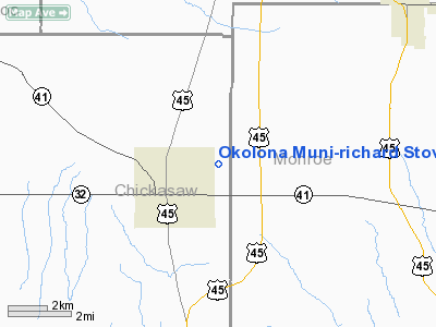
Okolona Muni - Richard Stovall Field Airport |
Location & QuickFacts
| FAA Information Effective: | 2008-09-25 |
| Airport Identifier: | 5A4 |
| Airport Status: | Operational |
| Longitude/Latitude: | 088-43-34.2820W/34-00-56.8990N
-88.726189/34.015805 (Estimated) |
| Elevation: | 335 ft / 102.11 m (Surveyed) |
| Land: | 60 acres |
| From nearest city: | 2 nautical miles NE of Okolona, MS |
| Location: | Chickasaw County, MS |
| Magnetic Variation: | 01E (1985) |
Owner & Manager
| Ownership: | Publicly owned |
| Owner: | City Of Okolona
JOHN HOLLOWAY, MAYOR OF OKOLONA CITY. |
| Address: | Po Box 111
Okolona, MS 38860 |
| Phone number: | 601-447-5461 |
| Manager: | City Of Okolona
JOHN HOLLOWAY, MAYOR OF OKOLONA CITY. |
| Address: | Po Box 111
Okolona, MS 38860 |
| Phone number: | 601-447-5461 |
Airport Operations and Facilities
| Airport Use: | Open to public |
| Wind indicator: | Yes |
| Segmented Circle: | Yes |
| Control Tower: | No |
| Lighting Schedule: | DUSK-DAWN
ACTVT MIRL RY 18/36 - CTAF. |
| Beacon Color: | Clear-Green (lighted land airport) |
| Landing fee charge: | No |
| Sectional chart: | Memphis |
| Region: | ASO - Southern |
| Boundary ARTCC: | ZME - Memphis |
| Tie-in FSS: | GWO - Greenwood |
| FSS on Airport: | No |
| FSS Toll Free: | 1-800-WX-BRIEF |
| NOTAMs Facility: | GWO (NOTAM-d service avaliable) |
| Federal Agreements: | NGY |
Airport Communications
Airport Services
| Airframe Repair: | NONE |
| Power Plant Repair: | NONE |
| Bottled Oxygen: | NONE |
| Bulk Oxygen: | NONE |
Runway Information
Runway 18/36
| Dimension: | 3200 x 60 ft / 975.4 x 18.3 m |
| Surface: | ASPH, Good Condition |
| Weight Limit: | Single wheel: 12500 lbs. |
| Edge Lights: | Medium |
| |
Runway 18 |
Runway 36 |
| Longitude: | 088-43-34.4490W | 088-43-34.1810W |
| Latitude: | 34-01-12.7450N | 34-00-41.0990N |
| Elevation: | 333.00 ft | 335.00 ft |
| Alignment: | 127 | 127 |
| Traffic Pattern: | Left | Left |
| Markings: | Basic, Poor Condition
RY MARKINGS FADED. | Basic, Poor Condition
RY MARKINGS FADED. |
| Obstruction: | 36 ft tree, 1554.0 ft from runway, 37:1 slope to clear | 46 ft trees, 1535.0 ft from runway, 29:1 slope to clear |
|
Radio Navigation Aids
| ID |
Type |
Name |
Ch |
Freq |
Var |
Dist |
| STF | NDB | Bryan | | 281.00 | 02E | 35.6 nm |
| FDF | NDB | Fayette | | 204.00 | 00E | 49.1 nm |
| OTB | VOR/DME | Tupelo | 035X | 109.80 | 04E | 13.0 nm |
| CBM | VORTAC | Caledonia | 099X | 115.20 | 00E | 26.7 nm |
| IGB | VORTAC | Bigbee | 109X | 116.20 | 04E | 33.6 nm |
| HAB | VORTAC | Hamilton | 041X | 110.40 | 02E | 37.1 nm |
Remarks
- RWY 18/36 TERRAIN DROPS OFF ABRUPTLY 200' FROM BOTH ENDS.
- PAEW ON & INVOF RY 18/36.
Images and information placed above are from
http://www.airport-data.com/airport/5A4/
We thank them for the data!
| General Info
|
| Country |
United States
|
| State |
MISSISSIPPI
|
| FAA ID |
5A4
|
| Latitude |
34-00-56.899N
|
| Longitude |
088-43-34.282W
|
| Elevation |
335 feet
|
| Near City |
OKOLONA
|
We don't guarantee the information is fresh and accurate. The data may
be wrong or outdated.
For more up-to-date information please refer to other sources.
|
|


