 |
|
Location & QuickFacts
| FAA Information Effective: | 2008-09-25 |
| Airport Identifier: | MS94 |
| Airport Status: | Operational |
| Longitude/Latitude: | 090-33-06.3530W/34-10-42.3920N
-90.551765/34.178442 (Estimated) |
| Elevation: | 168 ft / 51.21 m (Estimated) |
| Land: | 0 acres |
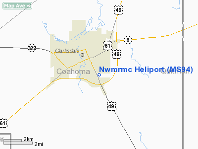
| From nearest city: | 2 nautical miles SE of Clarksdale, MS |
| Location: | Coahoma County, MS |
| Magnetic Variation: | 03E (1985) |
Owner & Manager
| Ownership: | Publicly owned |
| Owner: | Coahoma Co. Board Of Supvrs |
| Address: | Po Box 1218
Clarksdale, MS 38614 |
| Phone number: | 601-624-9411 |
| Manager: | Clifford L. Johnson, Jr. |
| Address: | Po Box 1218
Clarksdale, MS 38614 |
| Phone number: | 601-624-3401 |
Airport Operations and Facilities
| Airport Use: | Private |
| Wind indicator: | Yes
WND SOCK ON TOP OF BLDG APRXLY 40' FROM TOUCH DOWN PAD. |
| Segmented Circle: | No |
| Control Tower: | No |
| Lighting Schedule: | PHONE REQ
FOR PERIMETER LGTS CALL 601-627-3401. |
| Landing fee charge: | No |
| Sectional chart: | Memphis |
| Region: | ASO - Southern |
| Boundary ARTCC: | ZME - Memphis |
| Tie-in FSS: | GWO - Greenwood |
| FSS on Airport: | No |
| FSS Toll Free: | 1-800-WX-BRIEF |
Runway Information
Helipad H1
| Dimension: | 50 x 50 ft / 15.2 x 15.2 m |
| Surface: | CONC, |
| |
Runway H1 |
Runway |
| Traffic Pattern: | Left | Left |
|
Radio Navigation Aids
| ID |
Type |
Name |
Ch |
Freq |
Var |
Dist |
| CKM | NDB | Clarksdale | | 341.00 | 02E | 7.1 nm |
| HEE | NDB | Thompson-robbins | | 251.00 | 01E | 24.4 nm |
| RNV | NDB | Renova | | 272.00 | 04E | 24.7 nm |
| SBQ | NDB | Scobey | | 245.00 | 01E | 37.9 nm |
| IDL | NDB | Indianola | | 284.00 | 03E | 42.4 nm |
| FCY | NDB | Forrest City | | 332.00 | 01E | 47.1 nm |
| UJM | VOR/DME | Marvell | 033X | 109.60 | 01E | 24.6 nm |
| GLH | VOR/DME | Greenville | 039X | 110.20 | 04E | 44.9 nm |
| SQS | VORTAC | Sidon | 094X | 114.70 | 03E | 45.1 nm |
Remarks
- PRVDD PVT USE; EXISTING PAD CLSD WITH OPENING OF NEW PAD; APCH/DEP OPNS CODUCTED 070-120 CLKWS AND FROM 240-300 CLKWS; TAKEOFF/LANDING AREA IS MARKED; WIND INDICATOR IS MAINTAINED; SHRUBS REMOVED; PLINES TO THE NORTH ARE MARKED WITH SPHERICAL OBSTN MARKERS.
Images and information placed above are from
http://www.airport-data.com/airport/MS94/
We thank them for the data!
| General Info
|
| Country |
United States
|
| State |
MISSISSIPPI
|
| FAA ID |
MS94
|
| Latitude |
34-10-42.392N
|
| Longitude |
090-33-06.353W
|
| Elevation |
168 feet
|
| Near City |
CLARKSDALE
|
We don't guarantee the information is fresh and accurate. The data may
be wrong or outdated.
For more up-to-date information please refer to other sources.
|
|


