 |
|
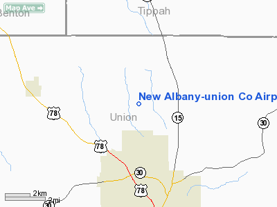
New Albany-union Co Airport |
Location & QuickFacts
| FAA Information Effective: | 2008-09-25 |
| Airport Identifier: | M72 |
| Airport Status: | Operational |
| Longitude/Latitude: | 089-01-27.9700W/34-32-56.4350N
-89.024436/34.549010 (Estimated) |
| Elevation: | 413 ft / 125.88 m (Surveyed) |
| Land: | 100 acres |
| From nearest city: | 3 nautical miles N of New Albany, MS |
| Location: | Union County, MS |
| Magnetic Variation: | 01W (2005) |
Owner & Manager
| Ownership: | Publicly owned |
| Owner: | New Albany City & Union County |
| Address: | P.o. Box 56
New Albany, MS 38652 |
| Phone number: | 662-534-1010 |
| Manager: | Charles Wright |
| Address: | 1476 County Road 101
New Albany, MS 38652 |
| Phone number: | 662-534-1050 |
Airport Operations and Facilities
| Airport Use: | Open to public |
| Wind indicator: | Yes |
| Segmented Circle: | No |
| Control Tower: | No |
| Lighting Schedule: | DUSK-DAWN
MIRL RY 18/36 OPR DUSK-2200. AFTER 2200 CTAF. |
| Beacon Color: | Clear-Green (lighted land airport) |
| Landing fee charge: | No |
| Sectional chart: | Memphis |
| Region: | ASO - Southern |
| Boundary ARTCC: | ZME - Memphis |
| Tie-in FSS: | GWO - Greenwood |
| FSS on Airport: | No |
| FSS Toll Free: | 1-800-WX-BRIEF |
| NOTAMs Facility: | GWO (NOTAM-d service avaliable) |
| Federal Agreements: | NGY |
Airport Communications
| CTAF: | 122.800 |
| Unicom: | 122.800 |
Airport Services
| Bottled Oxygen: | NONE |
| Bulk Oxygen: | NONE |
Runway Information
Runway 18/36
| Dimension: | 3903 x 75 ft / 1189.6 x 22.9 m |
| Surface: | ASPH, Good Condition
SURFACE IS ROUGH AND UNEVEN |
| Weight Limit: | Single wheel: 20000 lbs. |
| Edge Lights: | Medium |
| |
Runway 18 |
Runway 36 |
| Longitude: | 089-01-29.4000W | 089-01-26.5400W |
| Latitude: | 34-33-15.7000N | 34-32-37.1700N |
| Alignment: | 127 | 127 |
| Traffic Pattern: | Left | Left |
| Markings: | Basic, Good Condition | Basic, Good Condition |
| Obstruction: | 62 ft trees, 2000.0 ft from runway, 29:1 slope to clear | 66 ft trees, 1475.0 ft from runway, 19:1 slope to clear |
|
Radio Navigation Aids
| ID |
Type |
Name |
Ch |
Freq |
Var |
Dist |
| BAV | NDB | Hardeman | | 404.00 | 01E | 40.0 nm |
| FYE | NDB | Somerville | | 255.00 | 00E | 43.5 nm |
| OLV | NDB | Olive Branch | | 275.00 | 01E | 45.8 nm |
| SZY | NDB | Sibley | | 386.00 | 01E | 48.3 nm |
| OTB | VOR/DME | Tupelo | 035X | 109.80 | 04E | 22.6 nm |
| HLI | VORTAC | Holly Springs | 071X | 112.40 | 03E | 26.9 nm |
Images and information placed above are from
http://www.airport-data.com/airport/M72/
We thank them for the data!
| General Info
|
| Country |
United States
|
| State |
MISSISSIPPI
|
| FAA ID |
M72
|
| Latitude |
34-32-50.000N
|
| Longitude |
089-01-27.000W
|
| Elevation |
413 feet
|
| Near City |
NEW ALBANY
|
We don't guarantee the information is fresh and accurate. The data may
be wrong or outdated.
For more up-to-date information please refer to other sources.
|
|


