 |
|
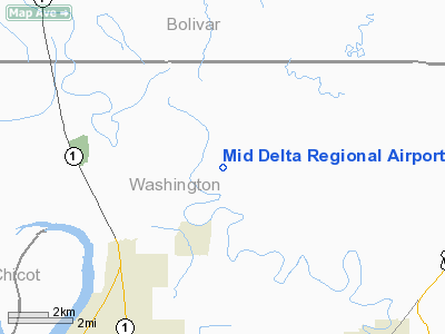
Mid Delta Regional Airport |
| Mid-Delta Regional Airport |
 |
| USGS aerial image, 1996 |
| IATA: GLH – ICAO: KGLH – FAA LID: GLH |
| Summary |
| Airport type |
Public |
| Owner |
City of Greenville |
| Serves |
Greenville, Mississippi |
| Elevation AMSL |
131 ft / 40 m |
| Coordinates |
33°28′58″N 090°59′08″W / 33.48278°N 90.98556°W / 33.48278; -90.98556 |
| Website |
www.greenville.ms.us/... |
| Runways |
| Direction |
Length |
Surface |
| ft |
m |
| 18L/36R |
8,001 |
2,439 |
Asphalt |
| 18R/36L |
7,019 |
2,139 |
Asphalt/Concrete |
| Statistics (2009) |
| Aircraft operations |
37,295 |
| Based aircraft |
17 |
| Source: Federal Aviation Administration |
Mid-Delta Regional Airport (IATA: GLH, ICAO: KGLH, FAA LID: GLH) is a city-owned public-use airport located five nautical miles (9 km) northeast of the central business district of Greenville, a city in Washington County, Mississippi, United States. This airport is included in the FAA's National Plan of Integrated Airport Systems for 2009–2013, which categorized it as commercial service - non-primary. It is served by one commercial airline which is subsidized by the Essential Air Service program. History
In February 1940, a United States Army Air Corps site selection board picked Greenville, Mississippi, as the location of a training center for the Second Aviation Initiative. By mid-June construction at the 2,000 acre, 140 building site was in full progress. The Air Corps activated Greenville Army Airfield in August 1940, only two months after construction commenced. The first planes arrived on 5 November, and the training of pilots began.
The Army Air Forces Pilot Training School (Basic) conducted contract flying training until inactivated in March 1945. The airfield was reactivated on 5 June 1945 and was transferred to Air Technical Service Command, becoming a sub-base of Brookley Army Airfield, Alabama. ATSC used Greenville as a storage depot for returning Eighth and Fifteenth Air Force B-24 Liberators. During the summer, C-47s returning from Europe were also sent to Greenville for storage. Aircraft operations at the base consisted mostly of test flights, and flying stored aircraft to reclamation facilities. Storage of other types of aircraft began after the end of the war in September, with all the stored aircraft moved out by the end of June 1946. Greenville Army Airfield was inactivated on 22 July 1946 and turned over to the War Assets Administration for disposal.
The airfield was operated as a civilian airport in the late 1940s, however to handle increased pilot requirements for the Korean War, the United States Air Force Air Training Command activated the former World War II airfield as Greenville Air Base, on 1 December 1950 to be used as stations for contract flying schools. However, contract flying squadrons were not established until 1951 when the 3300th Flying Training Squadron was activated.
 | |
Emblem of the 3505th Pilot Training Wing (ATC) |
ATC activated Graham Air Base Florida in January 1953 to replace Greenville Air Base as a contract pirmary pilot training School. Greenville was redesignated as Greenville Air Force Base and became a full, Air Training Command basic single-engine pilot training school, with the 3505th Pilot Training Wing (Basic, Single-Engine) as its operational training unit. Instruction was begun in April 1953 flying T-28 Trojans. The wing was upgraded to jet trainers in 1955 when T-33 Shooting Stars arrived.
On 1 December 1960, pilot training at Greenville AFB was discontinued and the 3505th Pilot Training Wing was inactivated. The T-33s were sent to the new Consolidated Pilot Training school at Craig AFB, Alabama. Air Training Command initially wanted to close the base, however, owing to political pressure, several technical training courses were transferred to the base and the facility became a Technical Training Center for ATC. Between November 1960 and mid-1961, Greenville received six personnel courses from Lackland AFB, Texas and two fire protection courses from Lowry AFB, Colorado under the new 3505th Technical Training Wing. In 1962, several medical courses were also reassigned to Greenville from Lowry.
In December 1963, Secretary of Defense Robert MacNamara announced that Greenville AFB would be closed in 1965 as part of budgetary reductions. During 1964, activities at Greenville AFB began to be phased down, initially by downgrading the 3505th to group status and moving medical courses to Gunter AFS, Alabama; personnel courses moved to Amarillo AFB, Texas and firefighting courses to Chanute AFB, Illinois. On 1 April 1964, the 3505th TTG was inactivated. Greenville AFB was placed in caretaker status, being assigned as a sub-base to Keesler AFB. De-militarization activities were commenced and the military part of the airport was returned to full civilian control on 27 December 1966.
Facilities and aircraft
Mid-Delta Regional Airport is the only commercial airport located in the Delta. Located approximately three miles north of Greenville, MDRA is situated on 2,000 acres (809 ha) of land, with a sizable portion in the Mid-Delta Empowerment Zone. A controlled airfield, MDRA has a control tower which is manned from 7:00 a.m. to 7:00 p.m., seven days a week.
The facility has two runways, the primary being 18L/36R which is composed of an asphalt surface 150 feet (46 m) wide by 8,001 feet (2,439 m) long. Runway 18L/36R is a precision approach runway with an Instrument landing System (ILS), medium approach lighting system with rails, (MALSR) approach lights and High Intensity Runway Lights (HIRLs). A parallel runway, 18R/36L, has an asphalt and concrete surface with a width of 150 feet (46 m) and length of 7,019 feet (2,139 m). Runway 18R/36L is a non-precision runway with Medium Intensity Runway Lights, (MIRL). The runways are connected by six taxiways. Ramp space is abundant, with 2,660,000 square feet (247,000 m) of concrete ramp area.
For the 12-month period ending December 31, 2009, the airport had 37,295 aircraft operations, an average of 102 per day: 47% military, 30% air taxi, 23% general aviation, and <1% scheduled commercial. At that time there were 17 aircraft based at this airport: 88.2% single-engine and 11.8% jet.
Airline and destination
| Airlines |
Destinations |
| Delta Connection operated by Mesaba Airlines |
Memphis |
The above content comes from Wikipedia and is published under free licenses – click here to read more.
Location & QuickFacts
| FAA Information Effective: | 2008-09-25 |
| Airport Identifier: | GLH |
| Airport Status: | Operational |
| Longitude/Latitude: | 090-59-08.2100W/33-28-58.3720N
-90.985614/33.482881 (Estimated) |
| Elevation: | 131 ft / 39.93 m (Surveyed) |
| Land: | 2000 acres |
| From nearest city: | 5 nautical miles NE of Greenville, MS |
| Location: | Washington County, MS |
| Magnetic Variation: | 03E (1990) |
Owner & Manager
| Ownership: | Publicly owned |
| Owner: | City Of Greenville |
| Address: | 340 Main Street
Greenville, MS 38701 |
| Manager: | Lane Rodgers |
| Address: | 166 Fifth Ave Suite 300
Greenville, MS 38703 |
| Phone number: | 662-334-3121 |
Airport Operations and Facilities
| Airport Use: | Open to public |
| Wind indicator: | Yes |
| Segmented Circle: | Yes |
| Control Tower: | Yes |
| Lighting Schedule: | DUSK-DAWN
WHEN ATCT CLSD HIRL RY 18L/36R PRESET MED INTST; TO INCR INTST & ACTVT MALSR RY 18L - CTAF. VASI RY 36R OPER CONT. |
| Beacon Color: | Clear-Green (lighted land airport) |
| Landing fee charge: | No |
| Sectional chart: | Memphis |
| Region: | ASO - Southern |
| Boundary ARTCC: | ZME - Memphis |
| Tie-in FSS: | GWO - Greenwood |
| FSS on Airport: | No |
| FSS Toll Free: | 1-800-WX-BRIEF |
| NOTAMs Facility: | GLH (NOTAM-d service avaliable) |
| Certification type/date: | I A S 06/1989 |
| Federal Agreements: | NGPY3 |
Airport Communications
| CTAF: | 119.000 |
| Unicom: | 122.950 |
Airport Services
| Fuel available: | 100LLA |
| Airframe Repair: | MAJOR |
| Power Plant Repair: | MAJOR |
| Bottled Oxygen: | NONE |
| Bulk Oxygen: | NONE |
Runway Information
Runway 18L/36R
| Dimension: | 8001 x 150 ft / 2438.7 x 45.7 m |
| Surface: | ASPH, Good Condition
SURFACE IS ROUGH AND HAS SEVERAL LARGE BUMPS, OR HEAVES. |
| Surface Treatment: | Saw-cut or plastic Grooved |
| Weight Limit: | Single wheel: 75000 lbs.
Dual wheel: 112000 lbs.
Dual tandem wheel: 182000 lbs.
Dual dual tandem wheel: 540000 lbs. |
| Edge Lights: | High
RY 18R/36L MIRL OTS INDEFLY. |
| |
Runway 18L |
Runway 36R |
| Longitude: | 090-58-55.5190W | 090-58-55.5200W |
| Latitude: | 33-29-48.7410N | 33-28-29.5870N |
| Elevation: | 129.00 ft | 129.00 ft |
| Alignment: | 127 | 0 |
| ILS Type: | ILS
| |
| Traffic Pattern: | Left | Right |
| Markings: | Precision instrument, Good Condition | Precision instrument, Good Condition |
| Arresting: | BAK12 | BAK12 |
| Crossing Height: | 0.00 ft | 51.00 ft |
| VASI: | | 4-box on left side |
| Visual Glide Angle: | 0.00° | 3.00° |
| Approach lights: | MALSR | |
| Runway End Identifier: | No | Yes |
| Obstruction: | , 50:1 slope to clear | 84 ft tree, 3691.0 ft from runway, 478 ft left of centerline, 41:1 slope to clear |
|
Runway 18R/36L
| Dimension: | 7019 x 150 ft / 2139.4 x 45.7 m |
| Surface: | ASPH-CONC, Poor Condition
SURFACE IS ROUGH AND HAS SEVERAL LARGE BUMPS, OR HEAVES. |
| Weight Limit: | Single wheel: 29000 lbs.
Dual wheel: 47000 lbs.
Dual tandem wheel: 78000 lbs. |
| Edge Lights: | Medium
RY 18R/36L MIRL OTS INDEFLY. |
| |
Runway 18R |
Runway 36L |
| Longitude: | 090-59-13.9980W | 090-59-13.9750W |
| Latitude: | 33-29-39.0260N | 33-28-29.5860N |
| Elevation: | 128.00 ft | 130.00 ft |
| Alignment: | 127 | 127 |
| Traffic Pattern: | Right | Left |
| Markings: | Non-precision instrument, Good Condition | Non-precision instrument, Good Condition |
| Crossing Height: | 52.00 ft | 40.00 ft |
| VASI: | 4-box on left side | 4-box on left side |
| Visual Glide Angle: | 3.00° | 3.00° |
| Centerline Lights: | | No |
| Obstruction: | , 50:1 slope to clear | 56 ft trees, 1400.0 ft from runway, 425 ft left of centerline, 21:1 slope to clear |
|
Radio Navigation Aids
| ID |
Type |
Name |
Ch |
Freq |
Var |
Dist |
| MTQ | NDB | Metcalf | | 359.00 | 03E | 3.5 nm |
| IDL | NDB | Indianola | | 284.00 | 03E | 15.5 nm |
| RNV | NDB | Renova | | 272.00 | 04E | 22.5 nm |
| BLE | NDB | Lake Providence | | 278.00 | 03E | 40.5 nm |
| GLH | VOR/DME | Greenville | 039X | 110.20 | 04E | 2.4 nm |
| MON | VOR/DME | Monticello | 053X | 111.60 | 04E | 36.9 nm |
| SQS | VORTAC | Sidon | 094X | 114.70 | 03E | 35.5 nm |
Images and information placed above are from
http://www.airport-data.com/airport/GLH/
We thank them for the data!
| General Info
|
| Country |
United States
|
| State |
MISSISSIPPI
|
| FAA ID |
GLH
|
| Latitude |
33-28-58.372N
|
| Longitude |
090-59-08.210W
|
| Elevation |
131 feet
|
| Near City |
GREENVILLE
|
We don't guarantee the information is fresh and accurate. The data may
be wrong or outdated.
For more up-to-date information please refer to other sources.
|
|


