 |
|
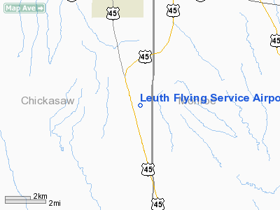
Leuth Flying Service Airport |
Location & QuickFacts
| FAA Information Effective: | 2008-09-25 |
| Airport Identifier: | MS52 |
| Airport Status: | Operational |
| Longitude/Latitude: | 088-43-50.1810W/33-55-25.4060N
-88.730606/33.923724 (Estimated) |
| Elevation: | 310 ft / 94.49 m (Estimated) |
| Land: | 15 acres |
| From nearest city: | 4 nautical miles S of Okolona, MS |
| Location: | Chickasaw County, MS |
| Magnetic Variation: | 02E (1985) |
Owner & Manager
| Ownership: | Privately owned |
| Owner: | Stewart Kimmel |
| Address: | Route 1 Box 482
Greenwood, MS 38930 |
| Phone number: | 662-455-3070 |
| Manager: | Stewart Kimmel |
| Address: | Route 1 Box 482
Greenwood, MS 38930 |
| Phone number: | 662-455-3000 |
Airport Operations and Facilities
| Airport Use: | Private |
| Segmented Circle: | No |
| Control Tower: | No |
| Landing fee charge: | No |
| Sectional chart: | Memphis |
| Region: | ASO - Southern |
| Boundary ARTCC: | ZME - Memphis |
| Tie-in FSS: | GWO - Greenwood |
| FSS on Airport: | No |
| FSS Toll Free: | 1-800-WX-BRIEF |
Airport Services
| Airframe Repair: | NONE |
| Power Plant Repair: | NONE |
| Bottled Oxygen: | NONE |
| Bulk Oxygen: | NONE |
Runway Information
Runway 09/27
| Dimension: | 3300 x 40 ft / 1005.8 x 12.2 m |
| Surface: | TURF,
RWY 9 HAS 800 X 12 ASPH SECTION JOINING 10 FT WIDE GRAVEL SECTION. |
| |
Runway 09 |
Runway 27 |
| Traffic Pattern: | Left | Left |
| Markings: | None, | None, |
| Runway End Identifier: | No | No |
| Centerline Lights: | No | No |
| Touchdown Lights: | No | No |
| Obstruction: | 25 ft pline, 100.0 ft from runway, 4:1 slope to clear
HIGHWAY AT 20 FT & 30 FT P-LINE AT 100 FT | 30 ft trees, 10.0 ft from runway, 2:1 slope to clear
PR 5' AT 50' & 30' PLINE AT 80' & TREES AT 15'. |
|
Radio Navigation Aids
| ID |
Type |
Name |
Ch |
Freq |
Var |
Dist |
| STF | NDB | Bryan | | 281.00 | 02E | 30.2 nm |
| FDF | NDB | Fayette | | 204.00 | 00E | 47.5 nm |
| LMS | NDB | Louisville | | 212.00 | 00E | 49.7 nm |
| OTB | VOR/DME | Tupelo | 035X | 109.80 | 04E | 18.3 nm |
| CBM | VORTAC | Caledonia | 099X | 115.20 | 00E | 22.4 nm |
| IGB | VORTAC | Bigbee | 109X | 116.20 | 04E | 28.5 nm |
| HAB | VORTAC | Hamilton | 041X | 110.40 | 02E | 39.3 nm |
Remarks
- RWY 9/27 FAIR IN DRY SEASON, DANGEROUS IN WET SEASON; CAUTION-NARROW CULVERT ACROSS RWY.
- CULVERT ACROSS E END OF RWY.
Images and information placed above are from
http://www.airport-data.com/airport/MS52/
We thank them for the data!
| General Info
|
| Country |
United States
|
| State |
MISSISSIPPI
|
| FAA ID |
MS52
|
| Latitude |
33-55-25.406N
|
| Longitude |
088-43-50.181W
|
| Elevation |
310 feet
|
| Near City |
OKOLONA
|
We don't guarantee the information is fresh and accurate. The data may
be wrong or outdated.
For more up-to-date information please refer to other sources.
|
|


