|
 |
|
||||
|
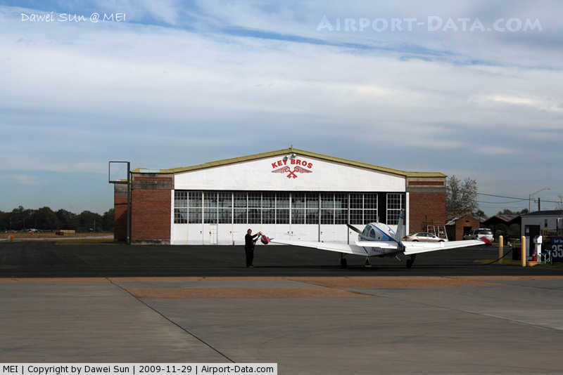
HistoryMeridian Regional Airport was established in 1928 and opened in November 1930 with the completion of the terminal, hangar, powerhouse and a graded and packed dirt runway. Meridian city officials asked Al and Fred Key, who operated the Key Brothers' Flying School at Bonita, to co-manage the new facility. The brothers maintained their flying school at the new field as well as their other duties, such as selling commercial airline tickets, operating the terminal and hangar, and handling airmail delivery schedules. With the onset of the Great Depression, the City of Meridian considered abandoning the airport because of the cost of maintenance. Airmail deliveries tapered off, and few people could afford to take commercial flights or pay for flying lessons. The Key Brothers, however, devised a scheme to keep the airport operating. They hoped that by breaking the standing flight endurance record of 23 days they would focus worldwide attention on Meridian and its airport. From June 4 until July 1, 1935, the brothers flew over Meridian; a total flight time of over 27 days. Key Field is named in their honor. The hangar and offices used by the Key brothers preceding and following the flight are still in use today and are listed in the National Register of Historic Places. Alarmed by the fall of France in 1940, Congress funded an increase in the strength of the United States Army Air Corps (USAAC) from 29 to 54 combat groups. The quickest way for the United States Army Air Corps to obtain additional bases was to utilize existing civil airports. The Air Corps signed an agreement to lease Key Field. The 153rd Observation Squadron (Mississippi National Guard) was federalized and activated at the airfield on 15 October 1940. Key Field was placed under the command of Third Air Force, and in 1941, the USAAC became the US Army Air Forces (USAAF). Once under USAAF control, a large construction program was needed to turn the civil airport into a military airfield. Construction involved runways and airplane hangars, with three concrete runways, several taxiways and a large parking apron and a control tower. Several large hangars were also constructed. Buildings were ultimately utilitarian and quickly assembled. Most base buildings, not meant for long-term use, were constructed of temporary or semi-permanent materials. Although some hangars had steel frames and the occasional brick or tile brick building could be seen, most support buildings sat on concrete foundations but were of frame construction clad in little more than plywood and tarpaper. The initial mission of Key Field was the training of operational units for overseas combat duty. The first training unit assigned was the 50th Pursuit(later Fighter) Group, equipped with Curtiss P-40s. Arriving on 3 October 1941, the group was assigned to III Fighter Command School with a mission to test equipment and conduct training in air defense operations. The group also trained fighter pilots and furnished cadres to night fighter units being developed at the Army Air Force School of Applied Tactics, being organized in Florida. On 22 March 1943, the group was reassigned to AAFSAT and moved to Orlando AAF. The 50th FG was supplemented by the 76th Reconnaissance Group, in March 1942, which was equipped with P-39 Aircobras, P-40s and also A-20 Havoc light bombers. The 76th RG performed similar training as the 50th did, and also taught dive-bombing techniques with the A-20s. The 76th RG also assisted the Second Army with training maneuvers. With the departure of the 76th RG, Key Field became a training center for B-25 Mitchell medium bombardment units. The following medium bomb groups were equipped and trained at the airfield:
Medium bomber training was moved to Columbia AAB, South Carolina in June 1942. Key Field then switched to attack and dive bombing training of the following units:
The 86th Bombardment Group arrived on 7 August 1942 and remained until 19 March 1943. Training was shifted from training operational units to that of replacement personnel training, with the 86th being the host Training Unit. The 86th then itself deployed to Europe in March 1943. Key Field was reassigned to III Reconnaissance Command in the summer of 1943, with an additional mission to train aerial reconnaissance units.
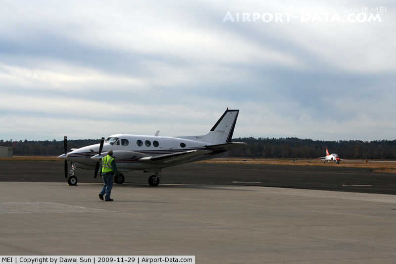
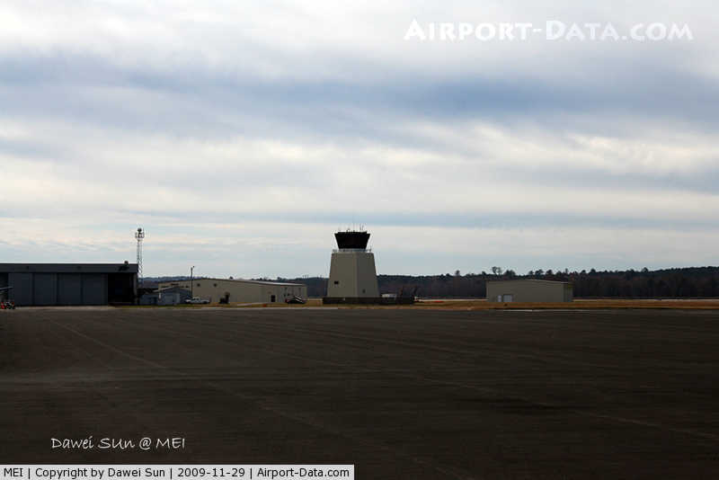
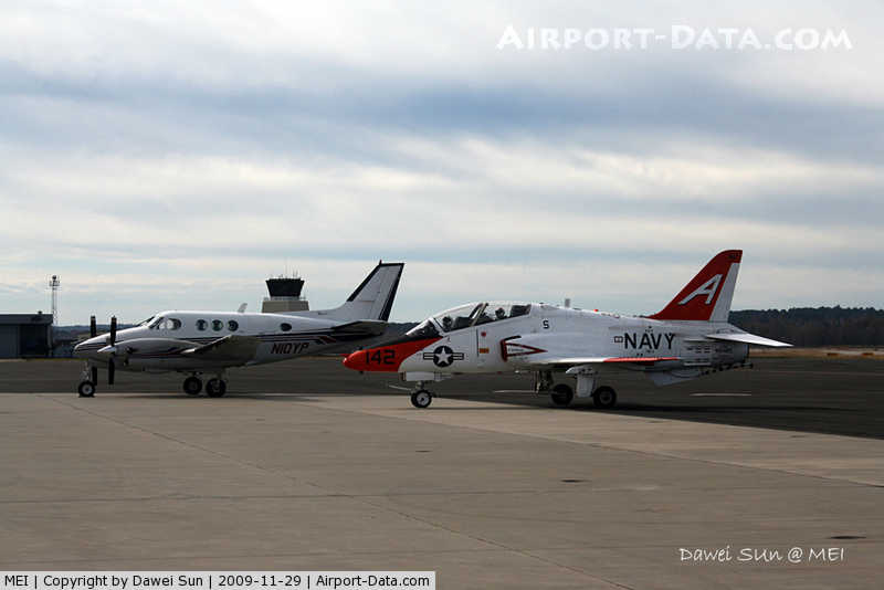
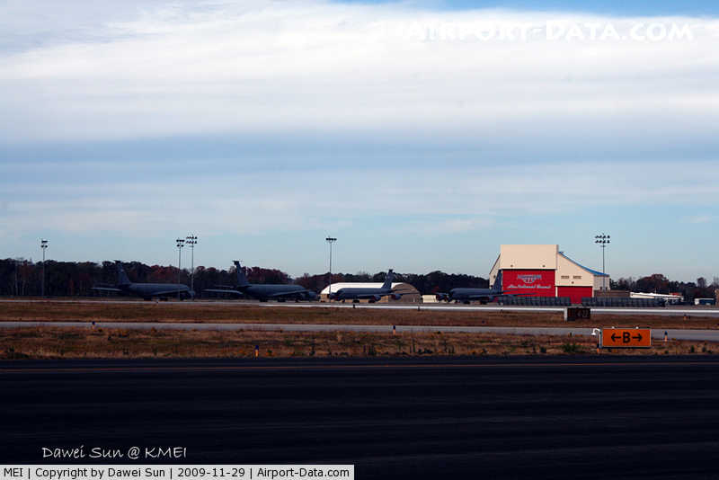
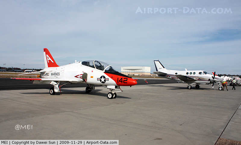
With the end of the war in September 1945, activities at Key Field were diminished. The airfield was returned to civil control in 1946, and allocated to the reconstituted Mississippi Air National Guard. Air National Guard useKey Field is currently home to the Mississippi Air National Guard's 186th Air Refueling Wing (186 ARW). Operationally gained by the Air Mobility Command (AMC), the 186 ARW operates a fleet of KC-135R Stratotanker aerial refueling and cargo aircraft. Key Field is also home to the Mississippi Army National Guard's 185th Army Aviation Support Facility, Company G. The 185th operates a fleet of CH-47 Chinook helicopters, a multi-purpose transport/cargo helicopter capable of carrying 55 troops and gear or can also sling-load up to 25,000 pounds. Navy T-45 Goshawk aircraft from nearby NAS Meridian and Air Force T-6A, T-1A and T-38C aircraft from Columbus AFB also frequently practice approaches and other procedures over Key Field. Aircraft Rescue and Firefighting (ARFF) capabilities are provided by the Air National Guard. Due to their mission as an air refueling wing, the ANG ARFF assets provide the entire airport with firefighting capabilities that will rival any airport in the Southeastern United States. In 2008, the 186 ARW entered into an arrangement with the active Air Force, hosting an operational training detachment for USAF-operated MC-12W aircraft under a program known as Project Liberty. The MC-12W is a USAF intelligence, surveillance and reconnaissance (ISR) platform and Air Combat Command (ACC) asset, which was fielded under an ambitious timeline in 2008 and 2009 to meet ground support ISR requirements in the U.S. Central Command (USCENTCOM) Area of Responsibility for Operations Enduring Freedom (OEF) and Iraqi Freedom (OIF). A derivative of the C-12 Huron, the MC-12W Liberty platform was created in response to Defense Secretary Robert Gates' initiative to better support warfighters on the ground with increased ISR in theater. USAF plans to procure 38 MC-12W aircraft. Mission qualification training in the MC-12W is currently conducted by a combined active Air Force and Air National Guard detachment embedded with the 186 ARW at Key Field. According to the 2005 BRAC Report, the 186 ARW is to be reassigned per recommendation #97, distributing its KC-135R aircraft between the Air National Guard's 101 ARW, 128 ARW, and 134 ARW, in Maine, Wisconsin, and Tennessee, respectively. The BRAC Report also states that the 186 ARW's aircraft rescue and firefighting (ARFF) positions are to be reassigned to the Mississippi Air National Guard's 172nd Airlift Wing (172 AW), an AMC-gained C-17 Globemaster III unit at Jackson International Airport. These transfers are to take place in 2010 and 2011, although the recent addition of the MC-12W Project Liberty program at Key Field may delay or eliminate the ARFF reassignment. In 2011, the same year that the 2005 BRAC realignments are to be completed, the 186th ARW is expecting to receive two new missions. According to Mississippi Governor Haley Barbour and State Adjutant General Harold Cross, these missions are to be a new Joint Cargo Aircraft mission and an Air Force War Fighting Headquarters. According to Tom Williams, CEO of Meridian Airport Authority, this will result in an increase in local jobs at Meridian's Air National Guard facility. Facilities and aircraftKey Field covers an area of 863 acres (349 ha) at an elevation of 297 feet (91 m) above mean sea level. It has two runways: 1/19 is 10,003 by 150 feet (3,049 x 46 m) with an asphalt/concrete surface and 4/22 is 4,599 by 150 feet (1,402 x 46 m) with an asphalt surface. The majority of the site is paved in asphalt, with a large parking area in front of the terminal. Only small areas around the buildings are unpaved, and landscaping is limited to the terminal, which has shrubbery and an ornamental tree. The old terminal building, hangar, and powerhouse at Key Field together form the earliest surviving airport complex in the state of Mississippi and were listed on the National Register of Historic Places in 2003. After being listed, the buildings were rehabilitated for use as a Cessna flight training school and repair shop. The old terminal building is a two-story brick building crowned with a gabled roof and parapeted end walls. Facing east toward Highway 11, the building is supported by a concrete foundation. The side wings and front pavilion of the terminal have flat parapeted roofs as well, and a gable-roofed porte-cochère extends from the front pavilion and terminates at a taller brick wall, in which is a large arched opening. The front pavilion has another arched opening that leads to a recessed entrance. A one-story polygonal porch dominates the rear facade, facing the airfield. Flanking the porch, there are arched openings in the side wings as well. The second floor has a central door that opens onto the porch roof, forming an observation deck overlooking the airfield. The interior of the building contains a waiting room with the former manager's office to the north and the baggage and mailroom to the south. All the walls in the building are plastered, and the floors are vinyl tile. A staircase leads to the second floor, which is a single room that originally housed the weather bureau. The rectangular hangar accommodates 10 planes, and is still in use today. The building is made of brick and has a concrete foundation. The roof is gabled, and the walls are parapeted. The end walls are capped by pent roofs and decorative brick panels framed by stucco. The north and south ends contain eight large sliding metal doors, which open to allow planes to roll in. The interior has a concrete floor, unfinished brick walls, and an unfinished ceiling with exposed steel trusses. There is a small office and washroom on the east end, and a staircase leads to a narrow second floor room that overlooks the workroom and hangar storage area. Located on the east side of the hangar, the Powerhouse is a one-story, one-by-one bay building with another gabled roof and parapeted walls. Entrance is gained through a door on the south side of the building, and the only other openings are a metal window on the east side, and a small vent on the west side. For the 12-month period ending December 31, 2009, the airport had 93,766 aircraft operations, an average of 256 per day: 67% military, 31% general aviation, 2% air taxi, and <1% scheduled commercial. At that time there were 75 aircraft based at this airport: 47% single-engine, 13% multi-engine, 5% jet, 12% helicopter and 23% military. Meridian Regional Airport Authority operates Meridian Aviation, a full service FBO on the airport. Airline and destinationService is subsidized by the Essential Air Service program.
The above content comes from Wikipedia and is published under free licenses – click here to read more.
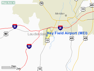
Location & QuickFacts
Owner & Manager
Airport Operations and Facilities
Airport Communications
Airport Services
Runway InformationRunway 01/19
Runway 04/22
Radio Navigation Aids
Remarks
Images and information placed above are from We thank them for the data!
We don't guarantee the information is fresh and accurate. The data may
be wrong or outdated.
|
|||||||||||||||||||||||||||||||||||||||||||||||||||||||||||||||||||||||||||||||||||||||||||||||||||||||||||||||||||||||||||||||||||||||||||||||||||||||||||||||||||||||||||||||||||||||||||||||||||||||||||||||||||||||||||||||||||||||||||||||||||||||||||||||||||||||||||||||||||||||||||||||||||||||||||||||||||||||||||||||||||||||||||||||||||||

 |
|
Copyright 2004-2024 © by Airports-Worldwide.com, Vyshenskoho st. 36, Lviv 79010, Ukraine Legal Disclaimer |