 |
|
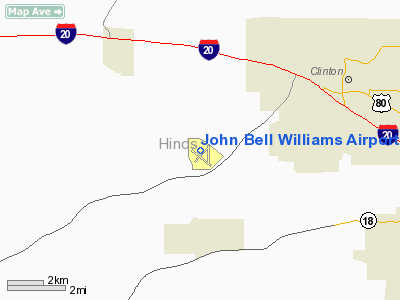
John Bell Williams Airport |
Location & QuickFacts
| FAA Information Effective: | 2008-09-25 |
| Airport Identifier: | M16 |
| Airport Status: | Operational |
| Longitude/Latitude: | 090-24-37.9000W/32-18-16.1000N
-90.410528/32.304472 (Estimated) |
| Elevation: | 247 ft / 75.29 m (Surveyed) |
| Land: | 284 acres |
| From nearest city: | 3 nautical miles NE of Raymond, MS |
| Location: | Hinds County, MS |
| Magnetic Variation: | 03E (1985) |
Owner & Manager
| Ownership: | Publicly owned |
| Owner: | Hinds Community College
DR. CLYDE MUSE PRES HINDS COMMUNITY COLLEGE; RAYMOND MS 39145. |
| Address: | Po Box 1265 Hcc
Raymond, MS 39154 |
| Phone number: | 601-857-3367 |
| Manager: | Michele Jackson |
| Address: | Hinds Community College, P.o. Box 1100
Raymond, MS 39154 |
| Phone number: | 601-857-3884
PHONE IN TERMINAL BLDG AT RAYMOND 601-857-3884. |
Airport Operations and Facilities
| Airport Use: | Open to public |
| Wind indicator: | Yes |
| Segmented Circle: | Yes |
| Control Tower: | No |
| Lighting Schedule: | DUSK-DAWN
ACTVT MIRL RY 12/30 - CTAF. PAPI RYS 12 & 30 OPER 24 HRS. |
| Beacon Color: | Clear-Green (lighted land airport) |
| Landing fee charge: | No |
| Sectional chart: | Memphis |
| Region: | ASO - Southern |
| Boundary ARTCC: | ZME - Memphis |
| Tie-in FSS: | GWO - Greenwood |
| FSS on Airport: | No |
| FSS Toll Free: | 1-800-WX-BRIEF |
| NOTAMs Facility: | GWO (NOTAM-d service avaliable) |
| Federal Agreements: | NGY |
Airport Communications
| CTAF: | 122.800 |
| Unicom: | 122.800 |
Airport Services
| Fuel available: | 100LLA
FUEL AVAILABLE 24 HRS WITH CARD. |
| Airframe Repair: | MAJOR |
| Power Plant Repair: | MINOR |
| Bottled Oxygen: | NONE |
| Bulk Oxygen: | NONE |
Runway Information
Runway 12/30
| Dimension: | 5499 x 100 ft / 1676.1 x 30.5 m |
| Surface: | ASPH, Good Condition |
| Surface Treatment: | Rubberized Friction Seal Coat |
| Weight Limit: | Single wheel: 60000 lbs.
Dual wheel: 75000 lbs. |
| Edge Lights: | Medium |
| |
Runway 12 |
Runway 30 |
| Longitude: | 090-25-04.5725W | 090-24-11.1522W |
| Latitude: | 32-18-31.1290N | 32-18-01.0981N |
| Elevation: | 240.00 ft | 247.00 ft |
| Alignment: | 123 | 127 |
| Traffic Pattern: | Left | Left |
| Markings: | Non-precision instrument, Good Condition | Non-precision instrument, Good Condition |
| Crossing Height: | 38.00 ft | 39.00 ft |
| VASI: | 2-light PAPI on left side | 2-light PAPI on left side |
| Visual Glide Angle: | 3.00° | 3.00° |
| Obstruction: | 41 ft trees, 1364.0 ft from runway, 28:1 slope to clear | 85 ft trees, 1470.0 ft from runway, 70L/ ft right of centerline, 14:1 slope to clear |
|
Radio Navigation Aids
| ID |
Type |
Name |
Ch |
Freq |
Var |
Dist |
| RYB | NDB | Raymond | | 375.00 | 03E | 0.2 nm |
| JH | NDB | Brenz | | 260.00 | 02E | 10.0 nm |
| VKS | NDB | Vicksburg | | 382.00 | 03E | 26.6 nm |
| TV | NDB | Savry | | 344.00 | 02E | 31.5 nm |
| BVV | NDB | Brookhaven | | 407.00 | 03E | 41.9 nm |
| JAN | VORTAC | Jackson | 073X | 112.60 | 05E | 17.3 nm |
| JAN | VOT | Jackson | | 111.00 | | 17.5 nm |
Remarks
Images and information placed above are from
http://www.airport-data.com/airport/M16/
We thank them for the data!
| General Info
|
| Country |
United States
|
| State |
MISSISSIPPI
|
| FAA ID |
M16
|
| Latitude |
32-18-12.028N
|
| Longitude |
090-24-30.540W
|
| Elevation |
246 feet
|
| Near City |
RAYMOND
|
We don't guarantee the information is fresh and accurate. The data may
be wrong or outdated.
For more up-to-date information please refer to other sources.
|
|


