 |
|
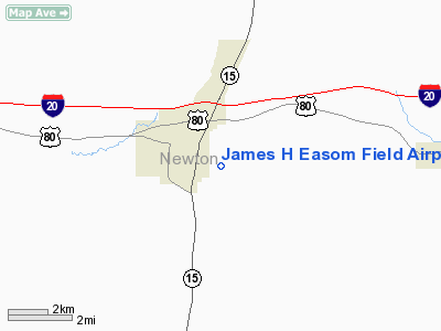
James H Easom Field Airport |
Location & QuickFacts
| FAA Information Effective: | 2008-09-25 |
| Airport Identifier: | M23 |
| Airport Status: | Operational |
| Longitude/Latitude: | 089-08-09.2110W/32-18-42.5200N
-89.135892/32.311811 (Estimated) |
| Elevation: | 369 ft / 112.47 m (Estimated) |
| Land: | 122 acres |
| From nearest city: | 1 nautical miles SE of Newton, MS |
| Location: | Newton County, MS |
| Magnetic Variation: | 02E (1985) |
Owner & Manager
| Ownership: | Publicly owned |
| Owner: | Town Of Newton
THE HONORABLE MICHAEL PICKENS, MAYOR OF NEWTON |
| Address: | Po Box 300
Newton, MS 39345 |
| Phone number: | 601-683-6181 |
| Manager: | Ron Davis |
| Address: | P.o. Box 300
Newton, MS 39345 |
| Phone number: | 601-683-2870
CELL 601-282-0828. |
Airport Operations and Facilities
| Airport Use: | Open to public |
| Wind indicator: | Yes |
| Segmented Circle: | Yes |
| Control Tower: | No |
| Lighting Schedule: | DUSK-DAWN
ACVT MIRL RY 13/31 - 122.8. |
| Beacon Color: | Clear-Green (lighted land airport) |
| Landing fee charge: | No |
| Sectional chart: | Memphis |
| Region: | ASO - Southern |
| Boundary ARTCC: | ZME - Memphis |
| Tie-in FSS: | GWO - Greenwood |
| FSS on Airport: | No |
| FSS Toll Free: | 1-800-WX-BRIEF |
| NOTAMs Facility: | GWO (NOTAM-d service avaliable) |
| Federal Agreements: | N1 |
Airport Communications
| CTAF: | 122.800 |
| Unicom: | 122.800 |
Airport Services
| Fuel available: | 100LL
24 HR FUEL AVAILABLE WITH CC |
| Airframe Repair: | MAJOR |
| Power Plant Repair: | MAJOR |
| Bottled Oxygen: | NONE |
| Bulk Oxygen: | NONE |
Runway Information
Runway 13/31
| Dimension: | 3000 x 75 ft / 914.4 x 22.9 m |
| Surface: | ASPH, Good Condition |
| Weight Limit: | Single wheel: 21000 lbs. |
| Edge Lights: | Medium |
| |
Runway 13 |
Runway 31 |
| Traffic Pattern: | Left | Left |
| Markings: | Basic, Good Condition | Basic, Good Condition |
| Crossing Height: | 0.00 ft | 26.00 ft |
| VASI: | | pulsating/steady burning on left side |
| Visual Glide Angle: | 0.00° | 7.00° |
| Obstruction: | 71 ft tree, 710.0 ft from runway, 150 ft left of centerline, 7:1 slope to clear | 104 ft trees, 2600.0 ft from runway, 23:1 slope to clear |
|
Radio Navigation Aids
| ID |
Type |
Name |
Ch |
Freq |
Var |
Dist |
| ME | NDB | Savoy | | 356.00 | 01E | 18.9 nm |
| MPE | NDB | Philadelphia | | 219.00 | 01E | 29.3 nm |
| THJ | NDB | Tallahala | | 346.00 | 00E | 37.6 nm |
| NJW | TACAN | Joe Williams | 61Y | | 01E | 32.8 nm |
| NMM | TACAN | Meridian | 056X | | 01E | 34.0 nm |
| MEI | VORTAC | Meridian | 117X | 117.00 | 05E | 17.3 nm |
| EWA | VORTAC | Kewanee | 085X | 113.80 | 04E | 34.6 nm |
| JAN | VOT | Jackson | | 111.00 | | 47.2 nm |
Remarks
- PUB FONE AVBL 601-683-2664.
Images and information placed above are from
http://www.airport-data.com/airport/M23/
We thank them for the data!
| General Info
|
| Country |
United States
|
| State |
MISSISSIPPI
|
| FAA ID |
M23
|
| Latitude |
32-18-42.520N
|
| Longitude |
089-08-09.211W
|
| Elevation |
369 feet
|
| Near City |
NEWTON
|
We don't guarantee the information is fresh and accurate. The data may
be wrong or outdated.
For more up-to-date information please refer to other sources.
|
|


