 |
|
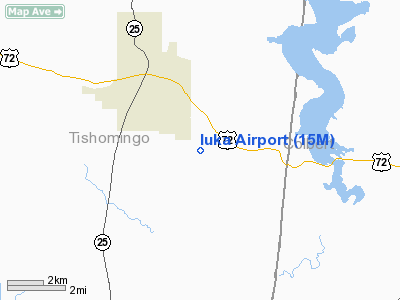
Location & QuickFacts
| FAA Information Effective: | 2008-09-25 |
| Airport Identifier: | 15M |
| Airport Status: | Operational |
| Longitude/Latitude: | 088-09-57.1480W/34-46-20.3250N
-88.165874/34.772312 (Estimated) |
| Elevation: | 630 ft / 192.02 m (Estimated) |
| Land: | 57 acres |
| From nearest city: | 3 nautical miles SE of Iuka, MS |
| Location: | Tishomingo County, MS |
| Magnetic Variation: | 01E (1985) |
Owner & Manager
| Ownership: | Publicly owned |
| Owner: | Tishomingo Dist 1 2 & 3
DANNY RYAN, PRESIDENT, TISHOMINGO COUNTY BOARD OF SUPERVISORS. |
| Address: | P.o. Box 1008
Iuka, MS 38852 |
| Phone number: | 662-423-7032 |
| Manager: | Dale Edmondson |
| Address: | 39 County Road 187
Iuka, MS 38852 |
| Phone number: | 662-423-6699 |
Airport Operations and Facilities
| Airport Use: | Open to public |
| Wind indicator: | Yes |
| Segmented Circle: | Yes |
| Control Tower: | No |
| Lighting Schedule: | DUSK-DAWN
ACTVT MIRL RY 18/36 - CTAF. RY LGT INTENSITY CANNOT BE CHGD. |
| Beacon Color: | Clear-Green (lighted land airport) |
| Landing fee charge: | No |
| Sectional chart: | Memphis |
| Region: | ASO - Southern |
| Boundary ARTCC: | ZME - Memphis |
| Tie-in FSS: | GWO - Greenwood |
| FSS on Airport: | No |
| FSS Toll Free: | 1-800-WX-BRIEF |
| NOTAMs Facility: | GWO (NOTAM-d service avaliable) |
| Federal Agreements: | NY1 |
Airport Communications
Airport Services
| Bottled Oxygen: | NONE |
| Bulk Oxygen: | NONE |
Runway Information
Runway 18/36
| Dimension: | 4000 x 75 ft / 1219.2 x 22.9 m |
| Surface: | ASPH, Good Condition |
| Surface Treatment: | Saw-cut or plastic Grooved |
| Weight Limit: | Single wheel: 30000 lbs. |
| Edge Lights: | Medium |
| |
Runway 18 |
Runway 36 |
| Longitude: | 088-09-56.4442W | 088-09-59.4122W |
| Latitude: | 34-46-43.7728N | 34-46-04.2853N |
| Elevation: | 625.00 ft | 620.00 ft |
| Traffic Pattern: | Left | Left |
| Markings: | Basic, Good Condition | Basic, Good Condition |
| Obstruction: | 93 ft trees, 2250.0 ft from runway, 22:1 slope to clear | 68 ft trees, 1300.0 ft from runway, 200 ft right of centerline, 16:1 slope to clear
RY 36 +8 FT FENCE 200 FT FROM THLD 100 FT L. |
|
Radio Navigation Aids
| ID |
Type |
Name |
Ch |
Freq |
Var |
Dist |
| HHY | NDB | Pinhook | | 346.00 | 01W | 29.0 nm |
| SZY | NDB | Sibley | | 386.00 | 01E | 32.8 nm |
| JHG | NDB | Hohenwald | | 257.00 | 01W | 49.1 nm |
| OTB | VOR/DME | Tupelo | 035X | 109.80 | 04E | 45.4 nm |
| MSL | VORTAC | Muscle Shoals | 112X | 116.50 | 01E | 33.5 nm |
| HAB | VORTAC | Hamilton | 041X | 110.40 | 02E | 35.5 nm |
Images and information placed above are from
http://www.airport-data.com/airport/15M/
We thank them for the data!
| General Info
|
| Country |
United States
|
| State |
MISSISSIPPI
|
| FAA ID |
15M
|
| Latitude |
34-46-20.325N
|
| Longitude |
088-09-57.148W
|
| Elevation |
630 feet
|
| Near City |
IUKA
|
We don't guarantee the information is fresh and accurate. The data may
be wrong or outdated.
For more up-to-date information please refer to other sources.
|
|


