 |
|
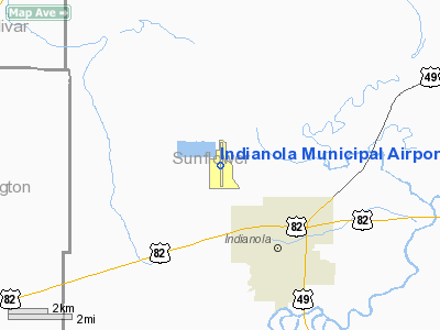
Indianola Municipal Airport |
Location & QuickFacts
| FAA Information Effective: | 2008-09-25 |
| Airport Identifier: | IDL |
| Airport Status: | Operational |
| Longitude/Latitude: | 090-40-44.0000W/33-29-08.6000N
-90.678889/33.485722 (Estimated) |
| Elevation: | 126 ft / 38.40 m (Surveyed) |
| Land: | 600 acres |
| From nearest city: | 2 nautical miles NW of Indianola, MS |
| Location: | Sunflower County, MS |
| Magnetic Variation: | 03E (1985) |
Owner & Manager
| Ownership: | Publicly owned |
| Owner: | City Of Indianola |
| Address: | Po Box 269
Indianola, MS 38751 |
| Phone number: | 662-887-3101 |
| Manager: | Gerald Jones |
| Address: | Box 662
Indianola, MS 38751 |
| Phone number: | 662-887-2861 |
Airport Operations and Facilities
| Airport Use: | Open to public |
| Wind indicator: | Yes |
| Segmented Circle: | Yes
3 PANELS ARE BROKEN AND ALL PANELS NEED RE-PAINTING. |
| Control Tower: | No |
| Lighting Schedule: | DUSK-DAWN
ACTVT MIRL RY 17/35 - CTAF. |
| Beacon Color: | Clear-Green (lighted land airport) |
| Landing fee charge: | No |
| Sectional chart: | Memphis |
| Region: | ASO - Southern |
| Boundary ARTCC: | ZME - Memphis |
| Tie-in FSS: | GWO - Greenwood |
| FSS on Airport: | No |
| FSS Toll Free: | 1-800-WX-BRIEF |
| NOTAMs Facility: | GWO (NOTAM-d service avaliable) |
| Federal Agreements: | NGPY |
Airport Communications
| CTAF: | 122.800 |
| Unicom: | 122.800 |
Airport Services
| Fuel available: | 100LL |
| Airframe Repair: | MAJOR |
| Power Plant Repair: | MAJOR |
| Bottled Oxygen: | NONE |
| Bulk Oxygen: | NONE |
Runway Information
Runway 17/35
| Dimension: | 7004 x 150 ft / 2134.8 x 45.7 m |
| Surface: | CONC, Good Condition |
| Weight Limit: | Single wheel: 20000 lbs. |
| Edge Lights: | Medium |
| |
Runway 17 |
Runway 35 |
| Longitude: | 090-40-44.0967W | 090-40-43.8168W |
| Latitude: | 33-29-43.2581N | 33-28-33.9704N |
| Elevation: | 126.00 ft | 120.00 ft |
| Alignment: | 127 | 127 |
| Traffic Pattern: | Left | Left |
| Markings: | Basic, Good Condition | Basic, Good Condition |
| Obstruction: | 58 ft trees, 750.0 ft from runway, 300 ft right of centerline, 9:1 slope to clear | , 50:1 slope to clear |
|
Radio Navigation Aids
| ID |
Type |
Name |
Ch |
Freq |
Var |
Dist |
| IDL | NDB | Indianola | | 284.00 | 03E | 0.4 nm |
| MTQ | NDB | Metcalf | | 359.00 | 03E | 15.6 nm |
| RNV | NDB | Renova | | 272.00 | 04E | 19.8 nm |
| BLE | NDB | Lake Providence | | 278.00 | 03E | 47.0 nm |
| SBQ | NDB | Scobey | | 245.00 | 01E | 47.0 nm |
| CKM | NDB | Clarksdale | | 341.00 | 02E | 49.2 nm |
| GLH | VOR/DME | Greenville | 039X | 110.20 | 04E | 15.4 nm |
| SQS | VORTAC | Sidon | 094X | 114.70 | 03E | 20.2 nm |
Remarks
- FOR SERVICE AFTER HRS CALL 662-887-2580.
Images and information placed above are from
http://www.airport-data.com/airport/IDL/
We thank them for the data!
| General Info
|
| Country |
United States
|
| State |
MISSISSIPPI
|
| FAA ID |
IDL
|
| Latitude |
33-29-08.686N
|
| Longitude |
090-40-43.954W
|
| Elevation |
126 feet
|
| Near City |
INDIANOLA
|
We don't guarantee the information is fresh and accurate. The data may
be wrong or outdated.
For more up-to-date information please refer to other sources.
|
|


