 |
|
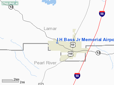
I H Bass Jr Memorial Airport |
Location & QuickFacts
| FAA Information Effective: | 2008-09-25 |
| Airport Identifier: | 4R1 |
| Airport Status: | Operational |
| Longitude/Latitude: | 089-28-57.2360W/31-00-55.6570N
-89.482566/31.015460 (Estimated) |
| Elevation: | 310 ft / 94.49 m (Surveyed) |
| Land: | 47 acres |
| From nearest city: | 2 nautical miles NW of Lumberton, MS |
| Location: | Lamar County, MS |
| Magnetic Variation: | 02E (1985) |
Owner & Manager
| Ownership: | Publicly owned |
| Owner: | City Of Lumberton |
| Address: | P.o.box 211
Lumberton, MS 39455 |
| Phone number: | 601-796-8341 |
| Manager: | Al Young
DORMAN A. DAVIS JR., MAYOR. |
| Address: | 277 Lower Airport Rd
Lumberton, MS 39455 |
| Phone number: | 601-543-5683 |
Airport Operations and Facilities
| Airport Use: | Open to public |
| Wind indicator: | Yes |
| Segmented Circle: | Yes |
| Control Tower: | No |
| Lighting Schedule: | DUSK-DAWN
MIRL RY 14/32 & PAPI RYS 14 & 32 OPER DUSK-2200; AFTER 2200 ACTVT - 122.8. |
| Beacon Color: | Clear-Green (lighted land airport) |
| Landing fee charge: | No |
| Sectional chart: | New Orleans |
| Region: | ASO - Southern |
| Boundary ARTCC: | ZHU - Houston |
| Tie-in FSS: | GWO - Greenwood |
| FSS on Airport: | No |
| FSS Toll Free: | 1-800-WX-BRIEF |
| NOTAMs Facility: | GWO (NOTAM-d service avaliable) |
| Federal Agreements: | NGY |
Airport Communications
| CTAF: | 122.800 |
| Unicom: | 122.800 |
Airport Services
| Airframe Repair: | NONE |
| Power Plant Repair: | NONE |
| Bottled Oxygen: | NONE |
| Bulk Oxygen: | NONE |
Runway Information
Runway 14/32
| Dimension: | 3000 x 75 ft / 914.4 x 22.9 m |
| Surface: | ASPH, Good Condition |
| Weight Limit: | Single wheel: 22000 lbs. |
| Edge Lights: | Medium |
| |
Runway 14 |
Runway 32 |
| Traffic Pattern: | Left | Left |
| Markings: | Basic, Good Condition
RY 14/32 MKG FADED. | Basic, Good Condition |
| VASI: | 2-light PAPI on left side | 2-light PAPI on left side |
| Obstruction: | 54 ft trees, 1350.0 ft from runway, 21:1 slope to clear
4 FT FENCE 100 FT OFF END OF RY 14 | 36 ft trees, 950.0 ft from runway, 75 ft left of centerline, 20:1 slope to clear |
|
Radio Navigation Aids
| ID |
Type |
Name |
Ch |
Freq |
Var |
Dist |
| BX | NDB | Carma | | 353.00 | 02E | 21.2 nm |
| FOH | NDB | Foxworth | | 331.00 | 05E | 24.2 nm |
| MJD | NDB | Picayune | | 276.00 | 01E | 32.5 nm |
| HS | NDB | Hanco | | 221.00 | 01E | 34.0 nm |
| AYI | NDB | Hanco | | 221.00 | 03E | 34.0 nm |
| FNA | NDB | Florenville | | 371.00 | 03E | 40.1 nm |
| THJ | NDB | Tallahala | | 346.00 | 00E | 43.1 nm |
| DEF | NDB | Slidell | | 256.00 | 03E | 46.9 nm |
| BIX | TACAN | Keesler | 055X | | 01E | 46.4 nm |
| PCU | VOR/DME | Picayune | 059X | 112.20 | 05E | 30.2 nm |
| GPT | VOR/DME | Gulfport | 27X | 109.00 | 02E | 42.3 nm |
| LBY | VORTAC | Eaton | 043X | 110.60 | 05E | 25.4 nm |
| MCB | VORTAC | Mc Comb | 114X | 116.70 | 03E | 43.5 nm |
Remarks
- HIGH VOLUME OF RADIO CONTROLLED AIRPLANES INVOF ARPT.
- SKYDIVING ACTIVITY ON WKEND.
Images and information placed above are from
http://www.airport-data.com/airport/4R1/
We thank them for the data!
| General Info
|
| Country |
United States
|
| State |
MISSISSIPPI
|
| FAA ID |
4R1
|
| Latitude |
31-00-55.657N
|
| Longitude |
089-28-57.236W
|
| Elevation |
310 feet
|
| Near City |
LUMBERTON
|
We don't guarantee the information is fresh and accurate. The data may
be wrong or outdated.
For more up-to-date information please refer to other sources.
|
|


