 |
|
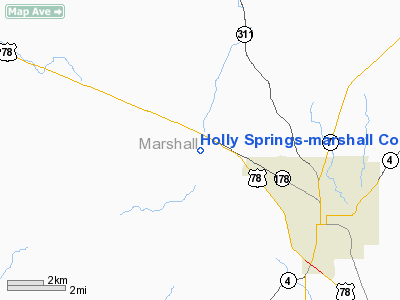
Holly Springs - Marshall County Airport |
Location & QuickFacts
| FAA Information Effective: | 2008-09-25 |
| Airport Identifier: | M41 |
| Airport Status: | Operational |
| Longitude/Latitude: | 089-31-15.9870W/34-48-15.6460N
-89.521107/34.804346 (Estimated) |
| Elevation: | 553 ft / 168.55 m (Surveyed) |
| Land: | 94 acres |
| From nearest city: | 4 nautical miles W of Holly Springs, MS |
| Location: | Marshall County, MS |
| Magnetic Variation: | 02E (1985) |
Owner & Manager
| Ownership: | Publicly owned |
| Owner: | City Of Holly Springs
AND MARSHALL COUNTY. |
| Address: | Box 670
Holly Springs, MS 38635 |
| Phone number: | 662-252-4652 |
| Manager: | Justin Hall |
| Address: | 520 J. M. Ash Drive, Po Box 128
Holly Springs, MS 38635 |
| Phone number: | 662-252-3916 |
Airport Operations and Facilities
| Airport Use: | Open to public |
| Wind indicator: | Yes |
| Segmented Circle: | Yes |
| Control Tower: | No |
| Lighting Schedule: | DUSK-DAWN |
| Beacon Color: | Clear-Green (lighted land airport) |
| Landing fee charge: | No |
| Sectional chart: | Memphis |
| Region: | ASO - Southern |
| Boundary ARTCC: | ZME - Memphis |
| Tie-in FSS: | GWO - Greenwood |
| FSS on Airport: | No |
| FSS Toll Free: | 1-800-WX-BRIEF |
| NOTAMs Facility: | GWO (NOTAM-d service avaliable) |
| Federal Agreements: | NGY |
Airport Communications
| CTAF: | 122.800 |
| Unicom: | 122.800 |
Airport Services
| Fuel available: | 100LL
24 HR SELF-SVC WITH CARD. |
| Airframe Repair: | MAJOR |
| Power Plant Repair: | MAJOR |
| Bottled Oxygen: | NONE |
| Bulk Oxygen: | NONE |
Runway Information
Runway 18/36
| Dimension: | 3201 x 60 ft / 975.7 x 18.3 m |
| Surface: | ASPH, Good Condition |
| Weight Limit: | Single wheel: 15000 lbs. |
| Edge Lights: | Medium
RY 18/36 MIRL OTS INDEFLY. |
| |
Runway 18 |
Runway 36 |
| Longitude: | 089-31-16.3150W | 089-31-15.6920W |
| Latitude: | 34-48-31.4960N | 34-47-59.8430N |
| Elevation: | 518.00 ft | 553.00 ft |
| Alignment: | 127 | 127 |
| Traffic Pattern: | Left | Left |
| Markings: | Basic, Good Condition | Basic, Good Condition |
| Crossing Height: | 86.00 ft | 65.00 ft |
| VASI: | 2-light PAPI on left side
PAPI OTS INDEFLY. | 2-light PAPI on left side
PAPI OTS INDEFLY. |
| Visual Glide Angle: | 2.75° | 3.25° |
| Obstruction: | 62 ft trees, 2000.0 ft from runway, 29:1 slope to clear | 53 ft tree, 1900.0 ft from runway, 32:1 slope to clear |
|
Radio Navigation Aids
| ID |
Type |
Name |
Ch |
Freq |
Var |
Dist |
| OLV | NDB | Olive Branch | | 275.00 | 01E | 16.9 nm |
| FYE | NDB | Somerville | | 255.00 | 00E | 25.0 nm |
| ME | NDB | Elvis | | 287.00 | 01E | 31.2 nm |
| BAV | NDB | Hardeman | | 404.00 | 01E | 34.1 nm |
| MIG | NDB | Millington | | 232.00 | 04E | 35.0 nm |
| SPQ | NDB | Spain | | 414.00 | 04E | 35.4 nm |
| AWM | NDB | West Memphis | | 362.00 | 01E | 40.4 nm |
| COO | NDB | Covington | | 326.00 | 02E | 47.3 nm |
| HLI | VORTAC | Holly Springs | 071X | 112.40 | 03E | 2.4 nm |
| MEM | VORTAC | Memphis | 122X | 117.50 | 01E | 26.1 nm |
| MEM | VOT | Memphis Metropolitn | | 111.00 | | 27.0 nm |
Images and information placed above are from
http://www.airport-data.com/airport/M41/
We thank them for the data!
| General Info
|
| Country |
United States
|
| State |
MISSISSIPPI
|
| FAA ID |
M41
|
| Latitude |
34-48-15.646N
|
| Longitude |
089-31-15.987W
|
| Elevation |
553 feet
|
| Near City |
HOLLY SPRINGS
|
We don't guarantee the information is fresh and accurate. The data may
be wrong or outdated.
For more up-to-date information please refer to other sources.
|
|


