|
 |
|
||||
|
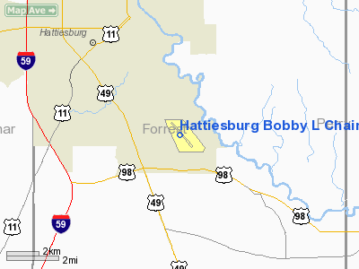
Hattiesburg Bobby L. Chain Municipal Airport (IATA: HBG, ICAO: KHBG, FAA LID: HBG) is a city-owned public-use airport located four nautical miles (7 km) southeast of the central business district of Hattiesburg, a city in Forrest County, Mississippi, United States. The airport serves the general aviation community, with no scheduled commercial airline service. HistorySince 1930, the Hattiesburg-Bobby L. Chain Municipal Airport has provided air service to the greater Hattiesburg area. It provided commercial airline service to the area beginning in the mid 1930s. However, alarmed by the fall of France in 1940, Congress funded an increase in the strength of the United States Army Air Corps from 29 to 54 combat groups. The quickest way for the Air Corps to obtain additional bases was to utilize existing civil airports. The Air Corps signed an agreement to lease Hattiesburg Airport, but because of technicalities in the land transfer, construction did not begin until March 1941. Once begun, a large construction program was needed to turn the civil airport into a military airfield. Construction involved runways and airplane hangars, with three concrete runways, several taxiways and a large parking apron and a control tower. Several large hangars were also constructed. Buildings were ultimately utilitarian and quickly assembled. Most base buildings, not meant for long-term use, were constructed of temporary or semi-permanent materials. Although some hangars had steel frames and the occasional brick or tile brick building could be seen, most support buildings sat on concrete foundations but were of frame construction clad in little more than plywood and tarpaper. On 8 December 1941, Hattiesburg Army Airfield was opened and assigned to the Third Air Force. The first mission of the new airfield was antisubmarine patrols along the Gulf of Mexico coastline. in early June 1942, the 21st Bombardment Group, based at Jackson AAB, dispatched the 313th Bombardment Squadron flying B-25 Mitchells from the airfield. They was replaced in late June by the 113th Observation Squadron which flew light observation planes (O-49 Vigilants and O-52 Owls) until the end of July. The 27th Bombardment Group (Light), flying A-20 Havocs arrived at Hattiesburg in mid-August. The 27th was forming in the Philippines at the time of the Attack on Pearl Harbor and without any aircraft (they were diverted to Australia), the unit's ground echelon were pressed into infantry duty and were either killed or surrendered after the Battle of Bataan. It's pilots reformed the unit in Australia, but its A-24 Dauntlesses were badly mauled during the battle of the Dutch East Indies and in New Guinea. The entire unit was withdrawn from the Southwest Pacific and reformed and reequipped in the United States. The reconstituted group trained at Hattiesburg until the end of October then were moved for final training before joining Twelfth Air Force in North Africa. The 27th Bomb Group was the last combat unit to be stationed at Hattiesburg, as by early 1943, purpose-built Army Airfields designed for training large units had been built in the southeast and Hattiesburg AAF was reassigned to Air Technical Service Command to become a support airfield, performing maintenance on transient aircraft and also to support the Army training units at Camp Shelby. In early 1945, military activities were phased down, and the Air Force put Hattiesburg on standby inactive status. Return to full civil control was made in April 1946. In 1974, airline service was moved ot the new Hattiesburg-Laurel Regional Airport. Though commercial air service is no longer conducted at the municipal airport, the facility maintains a vital role in the transportation infrastructure of the metropolitan Hattiesburg area, serving as the preferred business airport for Forrest, Lamar and Perry Counties, as well as parts of Pearl River, Stone and Greene counties. Facilities and aircraftHattiesburg Bobby L. Chain Municipal Airport covers an area of 420 acres (170 ha) at an elevation of 151 feet (46 m) above mean sea level. It has one asphalt paved runway designated 13/31 which measures 6,094 by 150 feet (1,857 x 46 m). For the 12-month period ending June 4, 2008, the airport had 39,672 aircraft operations, an average of 108 per day:88% general aviation, 8% military, 3% scheduled commercial and 1% air taxi. At that time there were 61 aircraft based at this airport: 75% single-engine, 15% multi-engine, 2% jet and 8% helicopter. The above content comes from Wikipedia and is published under free licenses – click here to read more.
Location & QuickFacts
Owner & Manager
Airport Operations and Facilities
Airport Communications
Airport Services
Runway InformationRunway 13/31
Radio Navigation Aids
Images and information placed above are from We thank them for the data!
We don't guarantee the information is fresh and accurate. The data may
be wrong or outdated.
|
||||||||||||||||||||||||||||||||||||||||||||||||||||||||||||||||||||||||||||||||||||||||||||||||||||||||||||||||||||||||||||||||||||||||||||||||||||||||||||||||||||||||||||||||||||||||||||||||||||||||||||||||||||||||||||||||||||||||||||||||||||||||||||||||||||||||||||||||||||||||||||||||||||||||

 |
|
Copyright 2004-2024 © by Airports-Worldwide.com, Vyshenskoho st. 36, Lviv 79010, Ukraine Legal Disclaimer |