 |
|
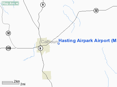
Location & QuickFacts
| FAA Information Effective: | 2008-09-25 |
| Airport Identifier: | MS80 |
| Airport Status: | Operational |
| Longitude/Latitude: | 089-18-45.2660W/33-59-40.3970N
-89.312574/33.994555 (Estimated) |
| Elevation: | 275 ft / 83.82 m (Surveyed) |
| Land: | 15 acres |
| From nearest city: | 2 nautical miles E of Bruce, MS |
| Location: | Calhoun County, MS |
| Magnetic Variation: | 02E (1985) |
Owner & Manager
| Ownership: | Privately owned |
| Owner: | Zack R. Hasting, Jr. |
| Address: | Po Box 113
Bruce, MS 38915 |
| Phone number: | 601-983-4475 |
| Manager: | David Tedford |
| Address: | Box 165
Bruce, MS 38915 |
| Phone number: | 601-983-4475 |
Airport Operations and Facilities
| Airport Use: | Private |
| Wind indicator: | Yes |
| Segmented Circle: | No |
| Control Tower: | No |
| Lighting Schedule: | PHONE REQ
FOR LIRL RWY 18/36 CALL 601-983-2275/4475. |
| Sectional chart: | Memphis |
| Region: | ASO - Southern |
| Boundary ARTCC: | ZME - Memphis |
| Tie-in FSS: | GWO - Greenwood |
| FSS on Airport: | No |
| FSS Toll Free: | 1-800-WX-BRIEF |
Airport Services
| Airframe Repair: | NONE |
| Power Plant Repair: | NONE |
| Bottled Oxygen: | NONE |
| Bulk Oxygen: | NONE |
Runway Information
Runway 18/36
| Dimension: | 3200 x 80 ft / 975.4 x 24.4 m |
| Surface: | TURF, Good Condition
TURF RY VERY SOFT WHEN WET. |
| Edge Lights: | Low
LIRL OTS INDEFLY |
| |
Runway 18 |
Runway 36 |
| Traffic Pattern: | Left | Left |
| Displaced threshold: | 450.00 ft
DSPLCD THR MARKED WITH TIRES PAINTED WHITE. | 0.00 ft |
| Obstruction: | 84 ft trees, 250.0 ft from runway, 50 ft left of centerline, 2:1 slope to clear
APCH RATIO 8:1 TO DSPLCD THR. | 24 ft trees, 0.0 ft from runway, 100L/ ft right of centerline
4 FT FENCE & SMALL BRUSH GROWING ON FENCE FROM +5 FT TO +6 FT TALL AT THR. |
|
Radio Navigation Aids
| ID |
Type |
Name |
Ch |
Freq |
Var |
Dist |
| SBQ | NDB | Scobey | | 245.00 | 01E | 28.7 nm |
| STF | NDB | Bryan | | 281.00 | 02E | 41.0 nm |
| OTB | VOR/DME | Tupelo | 035X | 109.80 | 04E | 29.1 nm |
| HLI | VORTAC | Holly Springs | 071X | 112.40 | 03E | 47.5 nm |
| CBM | VORTAC | Caledonia | 099X | 115.20 | 00E | 48.5 nm |
Images and information placed above are from
http://www.airport-data.com/airport/MS80/
We thank them for the data!
| General Info
|
| Country |
United States
|
| State |
MISSISSIPPI
|
| FAA ID |
MS80
|
| Latitude |
33-59-40.397N
|
| Longitude |
089-18-45.266W
|
| Elevation |
275 feet
|
| Near City |
BRUCE
|
We don't guarantee the information is fresh and accurate. The data may
be wrong or outdated.
For more up-to-date information please refer to other sources.
|
|


