 |
|
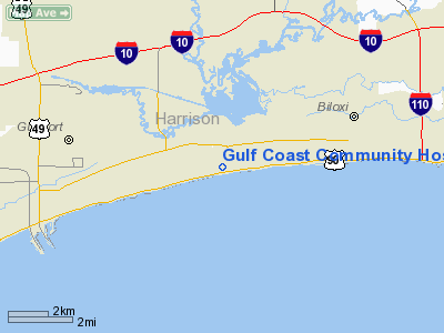
Gulf Coast Community Hosp-emerg Heliport |
Location & QuickFacts
| FAA Information Effective: | 2008-09-25 |
| Airport Identifier: | MS67 |
| Airport Status: | Operational |
| Longitude/Latitude: | 088-59-51.1220W/30-23-26.7130N
-88.997534/30.390754 (Estimated) |
| Elevation: | 18 ft / 5.49 m (Estimated) |
| Land: | 0 acres |
| From nearest city: | 3 nautical miles E of Biloxi, MS |
| Location: | Harrison County, MS |
| Magnetic Variation: | 02E (1985) |
Owner & Manager
| Ownership: | Privately owned |
| Owner: | Gulf Coast Community Hosp |
| Address: | 180-a Debuys Road
Biloxi, MS 39531 |
| Phone number: | 601-388-6711 |
| Manager: | C. L. Smith |
| Address: | 180-a Debuys Road
Biloxi, MS 39531 |
| Phone number: | 601-388-6711 |
Airport Operations and Facilities
| Airport Use: | Private
MEDICAL. |
| Wind indicator: | Yes |
| Segmented Circle: | Yes |
| Control Tower: | No |
| Lighting Schedule: | DUSK-DAWN |
| Landing fee charge: | No |
| Sectional chart: | New Orleans |
| Region: | ASO - Southern |
| Boundary ARTCC: | ZHU - Houston |
| Tie-in FSS: | GWO - Greenwood |
| FSS on Airport: | No |
| FSS Toll Free: | 1-800-WX-BRIEF |
Runway Information
Helipad H1
| Dimension: | 30 x 30 ft / 9.1 x 9.1 m |
| Surface: | CONC, |
| |
Runway H1 |
Runway |
| Traffic Pattern: | Left | Left |
|
Radio Navigation Aids
| ID |
Type |
Name |
Ch |
Freq |
Var |
Dist |
| HS | NDB | Hanco | | 221.00 | 01E | 24.0 nm |
| AYI | NDB | Hanco | | 221.00 | 03E | 24.0 nm |
| MJD | NDB | Picayune | | 276.00 | 01E | 34.5 nm |
| MO | NDB | Wisle | | 248.00 | 02E | 42.3 nm |
| FNA | NDB | Florenville | | 371.00 | 03E | 42.7 nm |
| DEF | NDB | Slidell | | 256.00 | 03E | 43.8 nm |
| BIX | TACAN | Keesler | 055X | | 01E | 3.7 nm |
| GPT | VOR/DME | Gulfport | 27X | 109.00 | 02E | 4.1 nm |
| PCU | VOR/DME | Picayune | 059X | 112.20 | 05E | 39.3 nm |
| SJI | VORTAC | Semmes | 100X | 115.30 | 05E | 38.7 nm |
Remarks
- LGTD RADIO TOWER 135' AGL ATOP HOSP BLDG.
- VFR/PVT USE. COORD USE HELI WITH JAX GADO; 2 WAY RDO COM WITH GPT ATCT PRIOR TO ENTERING OR OPERG IN THE ARPT CTLZ/ARPT TFC AREA AND THEIR APVL IS OBTAINED.
Images and information placed above are from
http://www.airport-data.com/airport/MS67/
We thank them for the data!
| General Info
|
| Country |
United States
|
| State |
MISSISSIPPI
|
| FAA ID |
MS67
|
| Latitude |
30-23-26.713N
|
| Longitude |
088-59-51.122W
|
| Elevation |
18 feet
|
| Near City |
BILOXI
|
We don't guarantee the information is fresh and accurate. The data may
be wrong or outdated.
For more up-to-date information please refer to other sources.
|
|


