 |
|
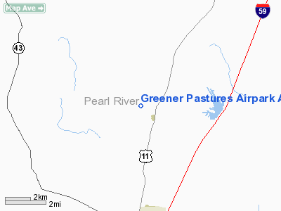
Greener Pastures Airpark Airport |
Location & QuickFacts
| FAA Information Effective: | 2008-09-25 |
| Airport Identifier: | 13MS |
| Airport Status: | Operational |
| Longitude/Latitude: | 089-39-50.0000W/30-38-00.0000N
-89.663889/30.633333 (Estimated) |
| Elevation: | 180 ft / 54.86 m (Estimated) |
| Land: | 15 acres |
| From nearest city: | 1 nautical miles NW of Carriere, MS |
| Location: | Pearl River County, MS |
| Magnetic Variation: | 01E (2000) |
Owner & Manager
| Ownership: | Privately owned |
| Owner: | Karl Jay Scott |
| Address: | Po Box 235
Carriere, MS 39426 |
| Phone number: | 601-798-3489 |
| Manager: | Karl Jay Scott |
| Address: | Po Box 235
Carriere, MS 39426 |
| Phone number: | 601-798-3489 |
Airport Operations and Facilities
| Airport Use: | Private |
| Wind indicator: | Yes |
| Segmented Circle: | No |
| Control Tower: | No |
| Sectional chart: | New Orleans |
| Region: | ASO - Southern |
| Boundary ARTCC: | ZHU - Houston |
| Tie-in FSS: | GWO - Greenwood |
| FSS Toll Free: | 1-800-WX-BRIEF |
Runway Information
Runway 18/36
| Dimension: | 3000 x 100 ft / 914.4 x 30.5 m |
| Surface: | TURF, |
| |
Runway 18 |
Runway 36 |
| Traffic Pattern: | Right | Left |
| Obstruction: | 55 ft trees, 1000.0 ft from runway
50 FT TREES 300 FT EAST OF RY AND 40 FT TREES WEST OF RY. | |
|
Radio Navigation Aids
| ID |
Type |
Name |
Ch |
Freq |
Var |
Dist |
| MJD | NDB | Picayune | | 276.00 | 01E | 8.4 nm |
| FNA | NDB | Florenville | | 371.00 | 03E | 15.4 nm |
| HS | NDB | Hanco | | 221.00 | 01E | 15.4 nm |
| AYI | NDB | Hanco | | 221.00 | 03E | 15.4 nm |
| BX | NDB | Carma | | 353.00 | 02E | 18.1 nm |
| DEF | NDB | Slidell | | 256.00 | 03E | 22.1 nm |
| FOH | NDB | Foxworth | | 331.00 | 05E | 40.6 nm |
| BIX | TACAN | Keesler | 055X | | 01E | 40.4 nm |
| HMU | VOR | Hammond | | 109.60 | 03E | 39.6 nm |
| PCU | VOR/DME | Picayune | 059X | 112.20 | 05E | 5.5 nm |
| GPT | VOR/DME | Gulfport | 27X | 109.00 | 02E | 33.4 nm |
| NEW | VOT | New Orleans Lakefront | | 111.00 | | 40.3 nm |
Remarks
- PROVIDED VFR OPNS; PVT USE; LTR OF AGREEMENT WITH GEORGE FORD AIRPORT REGARDING RESOLUTION OF CONFLICTING TRAFFIC PATTERNS; ESTABLISH RIGHT TRAFFIC RY 18.
Images and information placed above are from
http://www.airport-data.com/airport/13MS/
We thank them for the data!
| General Info
|
| Country |
United States
|
| State |
MISSISSIPPI
|
| FAA ID |
13MS
|
| Latitude |
30-38-00.000N
|
| Longitude |
089-39-50.000W
|
| Elevation |
180 feet
|
| Near City |
CARRIERE
|
We don't guarantee the information is fresh and accurate. The data may
be wrong or outdated.
For more up-to-date information please refer to other sources.
|
|


