 |
|
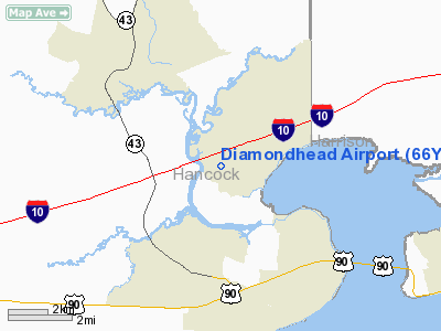
Location & QuickFacts
| FAA Information Effective: | 2008-09-25 |
| Airport Identifier: | 66Y |
| Airport Status: | Operational |
| Longitude/Latitude: | 089-23-15.5550W/30-21-46.7260N
-89.387654/30.362979 (Estimated) |
| Elevation: | 14 ft / 4.27 m (Surveyed) |
| Land: | 72 acres |
| From nearest city: | 0 nautical miles SW of Diamondhead, MS |
| Location: | Hancock County, MS |
| Magnetic Variation: | 02E (1985) |
Owner & Manager
| Ownership: | Privately owned |
| Owner: | Diamondhead Property
DIAMONDHEAD COUNTRY CLUB & PROPERTY OWNERS ASSOCIATION |
| Address: | 5300 Diamondhead Circle
Diamondhead, MS 39525 |
| Phone number: | 228-255-1900 |
| Manager: | John Bannen |
| Address: | 5300 Diamondhead Circle
Diamondhead, MS 39525 |
| Phone number: | 228-255-1900 |
Airport Operations and Facilities
| Airport Use: | Open to public |
| Wind indicator: | Yes |
| Segmented Circle: | No |
| Control Tower: | No |
| Lighting Schedule: | RDO-CTL
ACTIVATE LIRL RWY 18/36 - CTAF. |
| Landing fee charge: | No |
| Sectional chart: | New Orleans |
| Region: | ASO - Southern |
| Boundary ARTCC: | ZHU - Houston |
| Tie-in FSS: | GWO - Greenwood |
| FSS Toll Free: | 1-800-WX-BRIEF |
| NOTAMs Facility: | GWO (NOTAM-d service avaliable) |
Airport Communications
| CTAF: | 123.000 |
| Unicom: | 123.000 |
Airport Services
| Fuel available: | 100LL
FUEL AVBL 24 HRS WITH CREDIT CARD. |
| Airframe Repair: | NONE |
| Power Plant Repair: | NONE |
| Bottled Oxygen: | NONE |
| Bulk Oxygen: | NONE |
Runway Information
Runway 18/36
| Dimension: | 3800 x 75 ft / 1158.2 x 22.9 m |
| Surface: | ASPH, Good Condition |
| Weight Limit: | Single wheel: 12000 lbs. |
| Edge Lights: | Low
OTS INDEFLY. |
| |
Runway 18 |
Runway 36 |
| Longitude: | 089-23-15.5600W | 089-23-15.5500W |
| Latitude: | 30-22-05.5320N | 30-21-27.9200N |
| Traffic Pattern: | Left | Left |
| Displaced threshold: | 613.00 ft | 0.00 ft |
| Obstruction: | 59 ft trees, 570.0 ft from runway, 6:1 slope to clear
APCH RATIO 20:1 TO DSPLCD THLD.
SAND PERIMETER ROAD AT 88' FROM RWY END & OBSTR LTD +2' FENCE AT 123' FROM RWY END. | , 50:1 slope to clear |
|
Radio Navigation Aids
| ID |
Type |
Name |
Ch |
Freq |
Var |
Dist |
| AYI | NDB | Hanco | | 221.00 | 03E | 6.3 nm |
| HS | NDB | Hanco | | 221.00 | 01E | 6.3 nm |
| MJD | NDB | Picayune | | 276.00 | 01E | 15.9 nm |
| FNA | NDB | Florenville | | 371.00 | 03E | 22.6 nm |
| DEF | NDB | Slidell | | 256.00 | 03E | 23.5 nm |
| BX | NDB | Carma | | 353.00 | 02E | 39.7 nm |
| BIX | TACAN | Keesler | 055X | | 01E | 23.9 nm |
| GPT | VOR/DME | Gulfport | 27X | 109.00 | 02E | 16.4 nm |
| PCU | VOR/DME | Picayune | 059X | 112.20 | 05E | 21.4 nm |
| HRV | VORTAC | Harvey | 088X | 114.10 | 02E | 44.4 nm |
| NEW | VOT | New Orleans Lakefront | | 111.00 | | 38.5 nm |
Remarks
- VFR USE ONLY,ARPT TFC PATS ARE ESTABLISHED ON E SIDE OF RWY & RWY CNTRLN EXTENDED.
Images and information placed above are from
http://www.airport-data.com/airport/66Y/
We thank them for the data!
| General Info
|
| Country |
United States
|
| State |
MISSISSIPPI
|
| FAA ID |
66Y
|
| Latitude |
30-21-46.702N
|
| Longitude |
089-23-13.177W
|
| Elevation |
13 feet
|
| Near City |
DIAMONDHEAD
|
We don't guarantee the information is fresh and accurate. The data may
be wrong or outdated.
For more up-to-date information please refer to other sources.
|
|


