 |
|
Columbus-lowndes County Airport |
Coordinates: 33°27′55″N 088°22′49″W / 33.46528°N 88.38028°W / 33.46528; -88.38028
| Columbus-Lowndes County Airport |
| IATA: UBS – ICAO: KUBS – FAA LID: UBS |
| Summary |
| Airport type |
Public |
| Owner |
City of Columbus & Lowndes County |
| Serves |
Columbus, Mississippi |
| Elevation AMSL |
188 ft / 57 m |
| Runways |
| Direction |
Length |
Surface |
| ft |
m |
| 18/36 |
4,500 |
1,372 |
Asphalt |
| Statistics (2007) |
| Aircraft operations |
13,200 |
| Source: Federal Aviation Administration |
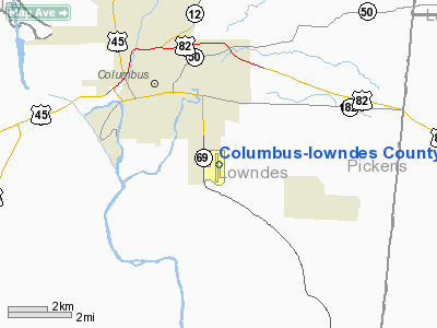
Columbus-Lowndes County Airport (IATA: UBS, ICAO: KUBS, FAA LID: UBS) is a public airport located three miles (5 km) southeast of the central business district of Columbus, in Lowndes County, Mississippi, United States. It is owned by the City of Columbus and Lowndes County.
Facilities and aircraft
Columbus-Lowndes County Airport covers an area of 215 acres (87 ha) which contains one asphalt paved runway (18/36) measuring 4,500 x 100 ft (1,372 x 30 m). For the 12-month period ending February 2, 2007, the airport had 13,200 aircraft operations, an average of 36 per day: 96% general aviation, 2% air taxi and 2% military.
The above content comes from Wikipedia and is published under free licenses – click here to read more.
Location & QuickFacts
| FAA Information Effective: | 2008-09-25 |
| Airport Identifier: | UBS |
| Airport Status: | Operational |
| Longitude/Latitude: | 088-22-49.1390W/33-27-55.4280N
-88.380316/33.465397 (Estimated) |
| Elevation: | 188 ft / 57.30 m (Estimated) |
| Land: | 215 acres |
| From nearest city: | 3 nautical miles SE of Columbus, MS |
| Location: | Lowndes County, MS |
| Magnetic Variation: | 01E (1985) |
Owner & Manager
| Ownership: | Publicly owned |
| Owner: | City Of Columbus & Lowndes County |
| Address: | 523 Main St, Po Box 1408
Columbus, MS 39703 |
| Phone number: | 662-328-7021 |
| Manager: | Mike Taloney |
| Address: | 368 Fabritek Drive
Columbus, MS 39702 |
| Phone number: | 662-327-6907 |
Airport Operations and Facilities
| Airport Use: | Open to public |
| Wind indicator: | Yes |
| Segmented Circle: | Yes |
| Control Tower: | No |
| Lighting Schedule: | DUSK-DAWN
MIRL RY 18/36 OPER DUSK-2200. AFTER 2200 ACTVT - CTAF. |
| Beacon Color: | Clear-Green (lighted land airport) |
| Landing fee charge: | No |
| Sectional chart: | Memphis |
| Region: | ASO - Southern |
| Boundary ARTCC: | ZME - Memphis |
| Tie-in FSS: | GWO - Greenwood |
| FSS on Airport: | No |
| FSS Toll Free: | 1-800-WX-BRIEF |
| NOTAMs Facility: | GWO (NOTAM-d service avaliable) |
| Federal Agreements: | NGY |
Airport Communications
| CTAF: | 122.800 |
| Unicom: | 122.800 |
Airport Services
| Fuel available: | 100LLA
FOR FUEL SERVICE AFTER HOURS, CALL (662) 242-8120. |
| Airframe Repair: | MAJOR |
| Power Plant Repair: | MAJOR |
| Bottled Oxygen: | NONE |
| Bulk Oxygen: | NONE |
Runway Information
Runway 18/36
| Dimension: | 4500 x 100 ft / 1371.6 x 30.5 m |
| Surface: | ASPH, Good Condition |
| Weight Limit: | Single wheel: 40000 lbs.
Dual wheel: 70000 lbs.
Dual tandem wheel: 120000 lbs. |
| Edge Lights: | Medium |
| |
Runway 18 |
Runway 36 |
| Longitude: | 088-22-51.7000W | 088-22-50.9000W |
| Latitude: | 33-28-17.4240N | 33-27-32.9100N |
| Alignment: | 127 | 127 |
| Traffic Pattern: | Left | Left |
| Markings: | Non-precision instrument, Good Condition
RY 18/36 MARKINGS FADED. | Non-precision instrument, Good Condition |
| Crossing Height: | 25.00 ft | 0.00 ft |
| VASI: | 2-box on left side
VASI OTS INDEF. | |
| Visual Glide Angle: | 3.00° | 0.00° |
| Obstruction: | 68 ft trees, 2510.0 ft from runway, 300 ft left of centerline, 34:1 slope to clear | 65 ft trees, 2075.0 ft from runway, 28:1 slope to clear |
|
Radio Navigation Aids
| ID |
Type |
Name |
Ch |
Freq |
Var |
Dist |
| AIV | NDB | Aliceville | | 254.00 | | 23.3 nm |
| STF | NDB | Bryan | | 281.00 | 02E | 23.7 nm |
| FDF | NDB | Fayette | | 204.00 | 00E | 32.1 nm |
| LMS | NDB | Louisville | | 212.00 | 00E | 39.3 nm |
| NJW | TACAN | Joe Williams | 61Y | | 01E | 46.3 nm |
| IGB | VORTAC | Bigbee | 109X | 116.20 | 04E | 6.8 nm |
| CBM | VORTAC | Caledonia | 099X | 115.20 | 00E | 11.0 nm |
| LDK | VORTAC | Crimson | 125X | 117.80 | 03E | 44.1 nm |
| HAB | VORTAC | Hamilton | 041X | 110.40 | 02E | 47.6 nm |
Remarks
- TWY LGTS OTS EXC CENTER CONNECTOR INDEFLY.
- (PAY PHONE) PAY PHONE AVAILABLE.
Images and information placed above are from
http://www.airport-data.com/airport/UBS/
We thank them for the data!
| General Info
|
| Country |
United States
|
| State |
MISSISSIPPI
|
| FAA ID |
UBS
|
| Latitude |
33-27-55.428N
|
| Longitude |
088-22-49.139W
|
| Elevation |
188 feet
|
| Near City |
COLUMBUS
|
We don't guarantee the information is fresh and accurate. The data may
be wrong or outdated.
For more up-to-date information please refer to other sources.
|
|


