 |
|
Cleveland Municipal Airport |
| Cleveland Municipal Airport |
 |
| USGS aerial photo - 13 February 1996 |
| IATA: none – ICAO: KRNV – FAA LID: RNV |
| Summary |
| Airport type |
Public |
| Owner |
City of Cleveland |
| Serves |
Cleveland, Mississippi |
| Location |
Cleveland, Mississippi |
| Elevation AMSL |
139 ft / 42 m |
| Coordinates |
33°45′40″N 090°45′28″W / 33.76111°N 90.75778°W / 33.76111; -90.75778 |
| Runways |
| Direction |
Length |
Surface |
| ft |
m |
| 17/35 |
4,002 |
1,220 |
Asphalt |
| Statistics (2007) |
| Aircraft operations |
57,850 |
| Based aircraft |
51 |
| Source: Federal Aviation Administration |
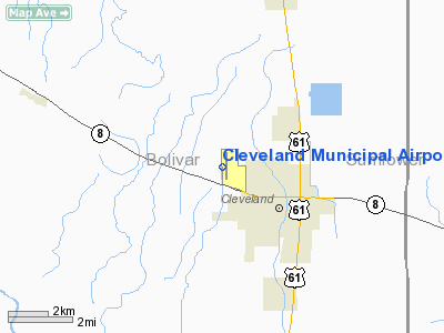
Cleveland Municipal Airport (ICAO: KRNV, FAA LID: RNV) is a city-owned public-use airport located two nautical miles (4 km) northwest of the central business district of Cleveland, a city in Bolivar County, Mississippi, United States. The airport serves the general aviation community, with no scheduled commercial airline service.
Although most U.S. airports use the same three-letter location identifier for the FAA and IATA, this airport is assigned RNV by the FAA but has no designation from the IATA. History
The airport was built by the United States Army Air Force and opened in April 1942 as a contract basic flying training airfield. Known as Cleveland Army Airfield, It was operated by the 3224th Air Base Unit, Contract Elementary Flying School (AAFFTC), Cleveland School of Aviation. Students were trained on Fairchild PT-23 and Boeing-Stearman PT-17 trainers.
It operated until 14 October 1944 when the last class graduated. The equipment and aircraft at the base were declared excess and sold in November. The airfield was then turned over to civil authorities as an airport.
Facilities and aircraft
Cleveland Municipal Airport covers an area of 133 acres (54 ha) at an elevation of 139 feet (42 m) above mean sea level. It has one asphalt paved runway designated 17/35 which measures 4,002 by 75 feet (1,220 x 23 m). For the 12-month period ending November 28, 2007, the airport had 57,850 general aviation aircraft operations, an average of 158 per day. At that time there were 51 aircraft based at this airport: 88% single-engine, 10% multi-engine and 2% helicopter.
The above content comes from Wikipedia and is published under free licenses – click here to read more.
Location & QuickFacts
| FAA Information Effective: | 2008-09-25 |
| Airport Identifier: | RNV |
| Airport Status: | Operational |
| Longitude/Latitude: | 090-45-28.3000W/33-45-40.1000N
-90.757861/33.761139 (Estimated) |
| Elevation: | 139 ft / 42.37 m (Surveyed) |
| Land: | 133 acres |
| From nearest city: | 2 nautical miles NW of Cleveland, MS |
| Location: | Bolivar County, MS |
| Magnetic Variation: | 04E (1980) |
Owner & Manager
| Ownership: | Publicly owned |
| Owner: | City Of Cleveland |
| Address: | 100 North St
Cleveland, MS 38732 |
| Phone number: | 662-843-5365 |
| Manager: | Alton Vance |
| Address: | Po Box 1439
Cleveland, MS 38732 |
| Phone number: | 662-843-8936 |
Airport Operations and Facilities
| Airport Use: | Open to public |
| Wind indicator: | Yes |
| Segmented Circle: | Yes |
| Control Tower: | No |
| Lighting Schedule: | DUSK-DAWN
ACTVT MIRL RY 17/35 - CTAF. |
| Beacon Color: | Clear-Green (lighted land airport) |
| Landing fee charge: | No |
| Sectional chart: | Memphis |
| Region: | ASO - Southern |
| Boundary ARTCC: | ZME - Memphis |
| Tie-in FSS: | GWO - Greenwood |
| FSS on Airport: | No |
| FSS Toll Free: | 1-800-WX-BRIEF |
| NOTAMs Facility: | GWO (NOTAM-d service avaliable) |
| Federal Agreements: | NGY |
Airport Communications
| CTAF: | 122.725 |
| Unicom: | 122.725 |
Airport Services
| Fuel available: | 100LLA |
| Airframe Repair: | MAJOR |
| Power Plant Repair: | MAJOR |
| Bottled Oxygen: | NONE |
| Bulk Oxygen: | NONE |
Runway Information
Runway 17/35
| Dimension: | 4002 x 75 ft / 1219.8 x 22.9 m |
| Surface: | ASPH, Good Condition |
| Weight Limit: | Single wheel: 26000 lbs. |
| Edge Lights: | Medium |
| |
Runway 17 |
Runway 35 |
| Longitude: | 090-45-29.2446W | 090-45-27.4632W |
| Latitude: | 33-45-59.8967N | 33-45-20.3371N |
| Elevation: | 139.00 ft | 139.00 ft |
| Alignment: | 127 | 127 |
| Traffic Pattern: | Left | Left |
| Markings: | Non-precision instrument, Good Condition | Non-precision instrument, Good Condition |
| Crossing Height: | 63.00 ft | 40.00 ft |
| VASI: | 4-light PAPI on left side | 4-light PAPI on left side |
| Visual Glide Angle: | 3.00° | 3.00° |
| Obstruction: | 54 ft trees, 1250.0 ft from runway, 400 ft left of centerline, 19:1 slope to clear | 40 ft trees, 700.0 ft from runway, 300 ft left of centerline, 12:1 slope to clear |
|
Radio Navigation Aids
| ID |
Type |
Name |
Ch |
Freq |
Var |
Dist |
| RNV | NDB | Renova | | 272.00 | 04E | 2.8 nm |
| IDL | NDB | Indianola | | 284.00 | 03E | 17.4 nm |
| MTQ | NDB | Metcalf | | 359.00 | 03E | 23.1 nm |
| CKM | NDB | Clarksdale | | 341.00 | 02E | 34.2 nm |
| SBQ | NDB | Scobey | | 245.00 | 01E | 44.8 nm |
| HEE | NDB | Thompson-robbins | | 251.00 | 01E | 48.9 nm |
| GLH | VOR/DME | Greenville | 039X | 110.20 | 04E | 18.2 nm |
| UJM | VOR/DME | Marvell | 033X | 109.60 | 01E | 49.1 nm |
| MON | VOR/DME | Monticello | 053X | 111.60 | 04E | 49.4 nm |
| SQS | VORTAC | Sidon | 094X | 114.70 | 03E | 30.0 nm |
Remarks
- PUBLIC PHONE AVBL IN PRE-FLIGHT ROOM 662-843-8016.
- HVY CONCENTRATION OF STUDENT ACTIVITY ON & INVOF ARPT - PLEASE CHECK FIELD.
- PAEW INVOF RY 17/35 & TWY INDEFLY.
- EXISTED PRIOR TO 1959.
Images and information placed above are from
http://www.airport-data.com/airport/RNV/
We thank them for the data!
| General Info
|
| Country |
United States
|
| State |
MISSISSIPPI
|
| FAA ID |
RNV
|
| Latitude |
33-45-40.106N
|
| Longitude |
090-45-28.351W
|
| Elevation |
140 feet
|
| Near City |
CLEVELAND
|
We don't guarantee the information is fresh and accurate. The data may
be wrong or outdated.
For more up-to-date information please refer to other sources.
|
|


