 |
|
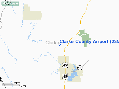
Location & QuickFacts
| FAA Information Effective: | 2008-09-25 |
| Airport Identifier: | 23M |
| Airport Status: | Operational |
| Longitude/Latitude: | 088-44-20.1620W/32-05-05.5360N
-88.738934/32.084871 (Estimated) |
| Elevation: | 320 ft / 97.54 m (Estimated) |
| Land: | 67 acres |
| From nearest city: | 3 nautical miles N of Quitman, MS |
| Location: | Clarke County, MS |
| Magnetic Variation: | 02E (1985) |
Owner & Manager
| Ownership: | Publicly owned |
| Owner: | City Of Quitman Clarke Co |
| Address: | Po Box 616
Quitman, MS 39355 |
| Phone number: | 601-776-3567
PHONE AT BOARD OF SUPERVISORS OFFICE. |
| Manager: | Airport Board |
| Address: | 429 County Rd Nr 153
Quitman, MS 39355 |
| Phone number: | 601-776-6312
TELEPHONE INSIDE TERMINAL, 601-776-6312. |
Airport Operations and Facilities
| Airport Use: | Open to public |
| Wind indicator: | Yes |
| Segmented Circle: | Yes |
| Control Tower: | No |
| Lighting Schedule: | DUSK-DAWN
AFTER 2200 ACTVT MIRL RY 16/34 & PAPI RY 16 - CTAF. |
| Beacon Color: | Clear-Green (lighted land airport) |
| Landing fee charge: | No |
| Sectional chart: | Memphis |
| Region: | ASO - Southern |
| Boundary ARTCC: | ZME - Memphis |
| Tie-in FSS: | GWO - Greenwood |
| FSS on Airport: | No |
| FSS Toll Free: | 1-800-WX-BRIEF |
| NOTAMs Facility: | GWO (NOTAM-d service avaliable) |
| Federal Agreements: | NGY |
Airport Communications
| CTAF: | 122.800 |
| Unicom: | 122.800 |
Airport Services
| Fuel available: | 100LLMOGAS |
| Airframe Repair: | NONE |
| Power Plant Repair: | NONE |
| Bottled Oxygen: | NONE |
| Bulk Oxygen: | NONE |
Runway Information
Runway 16/34
| Dimension: | 3200 x 60 ft / 975.4 x 18.3 m |
| Surface: | ASPH, Good Condition |
| Weight Limit: | Single wheel: 12500 lbs. |
| Edge Lights: | Medium |
| |
Runway 16 |
Runway 34 |
| Traffic Pattern: | Left | Left |
| Markings: | Basic, Good Condition | Basic, Good Condition |
| Displaced threshold: | 245.00 ft | 245.00 ft |
| VASI: | 2-light PAPI on left side
PAPI UNSBL BYD 5 DEG LEFT OF COURSE. | |
| Obstruction: | 41 ft trees, 1200.0 ft from runway, 24:1 slope to clear
RWY 16 APCH RATIO 35:1 TO DSPLCD THLD. | 68 ft trees, 1250.0 ft from runway, 15:1 slope to clear
RY 34 APCH RATIO 21:1 TO DSPLCD THLD. |
|
Radio Navigation Aids
| ID |
Type |
Name |
Ch |
Freq |
Var |
Dist |
| ME | NDB | Savoy | | 356.00 | 01E | 9.9 nm |
| BCZ | NDB | Choctaw | | 228.00 | 01E | 31.5 nm |
| THJ | NDB | Tallahala | | 346.00 | 00E | 33.2 nm |
| RZO | NDB | Marengo | | 391.00 | 01E | 41.8 nm |
| MPE | NDB | Philadelphia | | 219.00 | 01E | 47.1 nm |
| NMM | TACAN | Meridian | 056X | | 01E | 31.3 nm |
| NJW | TACAN | Joe Williams | 61Y | | 01E | 43.0 nm |
| MEI | VORTAC | Meridian | 117X | 117.00 | 05E | 18.0 nm |
| EWA | VORTAC | Kewanee | 085X | 113.80 | 04E | 22.2 nm |
Remarks
- GROUND DROPS ABRUPTLY FROM RY 34 THLD.
- RY 16 GROUND DROPS ABRUPTLY 200' FROM THLD.
- ULTRALIGHT ACTIVITY ON & INVOF ARPT.
Images and information placed above are from
http://www.airport-data.com/airport/23M/
We thank them for the data!
| General Info
|
| Country |
United States
|
| State |
MISSISSIPPI
|
| FAA ID |
23M
|
| Latitude |
32-05-05.536N
|
| Longitude |
088-44-20.162W
|
| Elevation |
320 feet
|
| Near City |
QUITMAN
|
We don't guarantee the information is fresh and accurate. The data may
be wrong or outdated.
For more up-to-date information please refer to other sources.
|
|


