 |
|
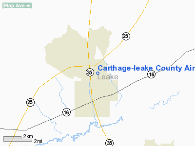
Carthage-leake County Airport |
Location & QuickFacts
| FAA Information Effective: | 2008-09-25 |
| Airport Identifier: | 08M |
| Airport Status: | Operational |
| Longitude/Latitude: | 089-31-48.2570W/32-45-40.4860N
-89.530071/32.761246 (Estimated) |
| Elevation: | 454 ft / 138.38 m (Estimated) |
| Land: | 77 acres |
| From nearest city: | 2 nautical miles N of Carthage, MS |
| Location: | Leake County, MS |
| Magnetic Variation: | 02E (1985) |
Owner & Manager
| Ownership: | Publicly owned |
| Owner: | City Of Carthage |
| Address: | 212 Main St
Carthage, MS 39051 |
| Phone number: | 601-267-8322
JIMMY COOK, MAYOR. |
| Manager: | Tony Gordon
CHAIRMAN OF AIRPORT ADVISORY COMMITTEE. |
| Address: | 212 Main St
Carthage, MS 39051 |
| Phone number: | 601-267-9327 |
Airport Operations and Facilities
| Airport Use: | Open to public |
| Wind indicator: | Yes |
| Segmented Circle: | Yes |
| Control Tower: | No |
| Lighting Schedule: | DUSK-DAWN
ACTVT MIRL RY 17/35 - CTAF. |
| Beacon Color: | Clear-Green (lighted land airport) |
| Landing fee charge: | No |
| Sectional chart: | Memphis |
| Region: | ASO - Southern |
| Boundary ARTCC: | ZME - Memphis |
| Tie-in FSS: | GWO - Greenwood |
| FSS on Airport: | No |
| FSS Toll Free: | 1-800-WX-BRIEF |
| NOTAMs Facility: | GWO (NOTAM-d service avaliable) |
| Federal Agreements: | NGY |
Airport Communications
Airport Services
| Fuel available: | 100LL
FOR FUEL CALL 601-267-7717. |
| Airframe Repair: | MAJOR |
| Power Plant Repair: | MAJOR |
| Bottled Oxygen: | NONE |
| Bulk Oxygen: | NONE |
Runway Information
Runway 17/35
| Dimension: | 3000 x 50 ft / 914.4 x 15.2 m |
| Surface: | ASPH, Good Condition |
| Weight Limit: | Single wheel: 20000 lbs. |
| Edge Lights: | Medium |
| |
Runway 17 |
Runway 35 |
| Traffic Pattern: | Left | Left |
| Markings: | Basic, Good Condition | Basic, Good Condition |
| Obstruction: | 34 ft trees, 951.0 ft from runway, 22:1 slope to clear | 41 ft trees, 1772.0 ft from runway, 200 ft left of centerline, 38:1 slope to clear |
|
Radio Navigation Aids
| ID |
Type |
Name |
Ch |
Freq |
Var |
Dist |
| OSX | NDB | Kosciusko | | 269.00 | 00W | 19.8 nm |
| MPE | NDB | Philadelphia | | 219.00 | 01E | 20.6 nm |
| LMS | NDB | Louisville | | 212.00 | 00E | 33.0 nm |
| JH | NDB | Brenz | | 260.00 | 02E | 42.5 nm |
| ME | NDB | Savoy | | 356.00 | 01E | 49.3 nm |
| NJW | TACAN | Joe Williams | 61Y | | 01E | 35.2 nm |
| JAN | VORTAC | Jackson | 073X | 112.60 | 05E | 35.7 nm |
| MEI | VORTAC | Meridian | 117X | 117.00 | 05E | 43.4 nm |
| JAN | VOT | Jackson | | 111.00 | | 38.3 nm |
Images and information placed above are from
http://www.airport-data.com/airport/08M/
We thank them for the data!
| General Info
|
| Country |
United States
|
| State |
MISSISSIPPI
|
| FAA ID |
08M
|
| Latitude |
32-45-40.486N
|
| Longitude |
089-31-48.257W
|
| Elevation |
454 feet
|
| Near City |
CARTHAGE
|
We don't guarantee the information is fresh and accurate. The data may
be wrong or outdated.
For more up-to-date information please refer to other sources.
|
|


