 |
|
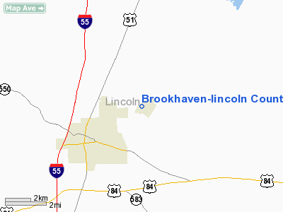
Brookhaven-lincoln County Airport |
Location & QuickFacts
| FAA Information Effective: | 2008-09-25 |
| Airport Identifier: | 1R7 |
| Airport Status: | Operational |
| Longitude/Latitude: | 090-24-33.5370W/31-36-21.0510N
-90.409316/31.605848 (Estimated) |
| Elevation: | 489 ft / 149.05 m (Surveyed) |
| Land: | 146 acres |
| From nearest city: | 3 nautical miles NE of Brookhaven, MS |
| Location: | Lincoln County, MS |
| Magnetic Variation: | 03E (1985) |
Owner & Manager
| Ownership: | Publicly owned |
| Owner: | City Of Brookhaven |
| Address: | 300 South 1st St
Brookhaven, MS 39601 |
| Phone number: | 601-833-2362 |
| Manager: | Clifford Britt
ADDNL CTC ROBERT MASSENGILL, MAYOR. |
| Address: | 1216 Heucks Retreat Road
Brookhaven, MS 39601 |
| Phone number: | 601-833-0999 |
Airport Operations and Facilities
| Airport Use: | Open to public |
| Wind indicator: | Yes |
| Segmented Circle: | Yes |
| Control Tower: | No |
| Lighting Schedule: | DUSK-DAWN
MIRL RY 04/22 PRESET LOW INTST DUSK-DAWN, TO INCR INTST - CTAF. |
| Beacon Color: | Clear-Green (lighted land airport) |
| Landing fee charge: | No |
| Sectional chart: | New Orleans |
| Region: | ASO - Southern |
| Boundary ARTCC: | ZHU - Houston |
| Tie-in FSS: | GWO - Greenwood |
| FSS on Airport: | No |
| FSS Toll Free: | 1-800-WX-BRIEF |
| NOTAMs Facility: | GWO (NOTAM-d service avaliable) |
| Federal Agreements: | NGY3 |
Airport Communications
| CTAF: | 122.800 |
| Unicom: | 122.800 |
Airport Services
| Fuel available: | 100LLA
FUEL SVC AVBL 24 HRS WITH CREDIT CARD. |
| Airframe Repair: | MAJOR |
| Power Plant Repair: | MAJOR |
| Bottled Oxygen: | NONE |
| Bulk Oxygen: | NONE |
Runway Information
Runway 04/22
| Dimension: | 5000 x 75 ft / 1524.0 x 22.9 m |
| Surface: | ASPH, Good Condition |
| Weight Limit: | Single wheel: 27000 lbs. |
| Edge Lights: | Medium |
| |
Runway 04 |
Runway 22 |
| Longitude: | 090-24-54.8980W | 090-24-12.1760W |
| Latitude: | 31-36-04.3790N | 31-36-37.7220N |
| Elevation: | 489.00 ft | 484.00 ft |
| Alignment: | 48 | 127 |
| Traffic Pattern: | Left | Left |
| Markings: | Non-precision instrument, Good Condition | Non-precision instrument, Good Condition |
| Crossing Height: | 40.00 ft | 40.00 ft |
| Displaced threshold: | 632.00 ft | 1000.00 ft |
| VASI: | 2-light PAPI on left side | 2-light PAPI on left side |
| Visual Glide Angle: | 3.00° | 3.00° |
| Obstruction: | 39 ft road, 675.0 ft from runway, 100 ft left of centerline, 13:1 slope to clear
RY 04 RY 04 APCH RATIO 37:1 FROM DSPLCD THLD. | 45 ft trees, 660.0 ft from runway, 50 ft left of centerline, 10:1 slope to clear
RY 22 RY 22 APCH RATIO 36:1 FROM DSPLCD THLD. |
|
Radio Navigation Aids
| ID |
Type |
Name |
Ch |
Freq |
Var |
Dist |
| BVV | NDB | Brookhaven | | 407.00 | 03E | 0.1 nm |
| MC | NDB | Ferni | | 413.00 | 03E | 21.7 nm |
| FOH | NDB | Foxworth | | 331.00 | 05E | 35.6 nm |
| RYB | NDB | Raymond | | 375.00 | 03E | 41.8 nm |
| HAH | NDB | Natchez-adams County | | 388.00 | 03E | 45.5 nm |
| VKS | NDB | Vicksburg | | 382.00 | 03E | 46.0 nm |
| JH | NDB | Brenz | | 260.00 | 02E | 49.1 nm |
| TV | NDB | Savry | | 344.00 | 02E | 49.7 nm |
| HEZ | VOR/DME | Natchez | 037X | 110.00 | 03E | 45.6 nm |
| MCB | VORTAC | Mc Comb | 114X | 116.70 | 03E | 19.7 nm |
| JAN | VOT | Jackson | | 111.00 | | 45.8 nm |
Remarks
Images and information placed above are from
http://www.airport-data.com/airport/1R7/
We thank them for the data!
| General Info
|
| Country |
United States
|
| State |
MISSISSIPPI
|
| FAA ID |
1R7
|
| Latitude |
31-36-21.051N
|
| Longitude |
090-24-33.537W
|
| Elevation |
489 feet
|
| Near City |
BROOKHAVEN
|
We don't guarantee the information is fresh and accurate. The data may
be wrong or outdated.
For more up-to-date information please refer to other sources.
|
|


