 |
|
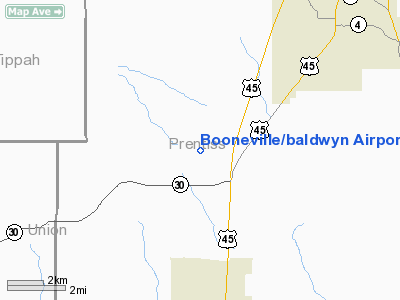
Booneville/baldwyn Airport |
Location & QuickFacts
| FAA Information Effective: | 2008-09-25 |
| Airport Identifier: | 8M1 |
| Airport Status: | Operational |
| Longitude/Latitude: | 088-38-54.5807W/34-35-30.7453N
-88.648495/34.591874 (Estimated) |
| Elevation: | 384 ft / 117.04 m (Surveyed) |
| Land: | 62 acres |
| From nearest city: | 6 nautical miles SW of Booneville/baldwyn, MS |
| Location: | Prentiss County, MS |
| Magnetic Variation: | 01E (1985) |
Owner & Manager
| Ownership: | Publicly owned |
| Owner: | Booneville & Baldwyn Cities
BALDWYN & COUNTY OF PRENTISS. HOWARD DAVIDSON, CHAIRMAN ARPT BOARD. |
| Address: | Co Of Prentiss, P.o. Box 610
Booneville, MS 38829 |
| Phone number: | 662-728-4462 |
| Manager: | Jim Kelly |
| Address: | P.o. Box 288
Baldwyn, MS 38824 |
| Phone number: | 662-365-8811
AFTER HRS CALL 662-365-2493. |
Airport Operations and Facilities
| Airport Use: | Open to public |
| Wind indicator: | Yes |
| Segmented Circle: | Yes |
| Control Tower: | No |
| Lighting Schedule: | DUSK-DAWN
ACTIVATE MIRL RY 15/33 - CTAF. |
| Beacon Color: | Clear-Green (lighted land airport) |
| Landing fee charge: | No |
| Sectional chart: | Memphis |
| Region: | ASO - Southern |
| Boundary ARTCC: | ZME - Memphis |
| Tie-in FSS: | GWO - Greenwood |
| FSS on Airport: | No |
| FSS Toll Free: | 1-800-WX-BRIEF |
| NOTAMs Facility: | GWO (NOTAM-d service avaliable) |
| Federal Agreements: | NGY |
Airport Communications
| CTAF: | 122.800 |
| Unicom: | 122.800 |
Airport Services
| Airframe Repair: | MINOR
MINOR AIRFRAME RPRS UPON REQUEST. |
| Power Plant Repair: | MINOR
MINOR PWR PLANT RPRS UPON REQUEST. |
| Bottled Oxygen: | NONE |
| Bulk Oxygen: | NONE |
Runway Information
Runway 15/33
| Dimension: | 5000 x 75 ft / 1524.0 x 22.9 m |
| Surface: | ASPH, Good Condition |
| Weight Limit: | Single wheel: 20000 lbs. |
| Edge Lights: | Medium |
| |
Runway 15 |
Runway 33 |
| Longitude: | 088-39-11.1120W | 088-38-38.0494W |
| Latitude: | 34-35-51.3699N | 34-35-10.1207N |
| Elevation: | 384.00 ft | 374.00 ft |
| Alignment: | 127 | 127 |
| Traffic Pattern: | Left | Left |
| Markings: | Non-precision instrument, Good Condition | Non-precision instrument, Good Condition |
| Runway End Identifier: | Yes | Yes |
| Obstruction: | 78 ft trees, 1071.0 ft from runway, 225 ft right of centerline, 11:1 slope to clear | 91 ft trees, 1250.0 ft from runway, 100 ft right of centerline, 11:1 slope to clear |
|
Radio Navigation Aids
| ID |
Type |
Name |
Ch |
Freq |
Var |
Dist |
| SZY | NDB | Sibley | | 386.00 | 01E | 39.3 nm |
| BAV | NDB | Hardeman | | 404.00 | 01E | 42.1 nm |
| HHY | NDB | Pinhook | | 346.00 | 01W | 45.4 nm |
| OTB | VOR/DME | Tupelo | 035X | 109.80 | 04E | 23.3 nm |
| HAB | VORTAC | Hamilton | 041X | 110.40 | 02E | 39.5 nm |
| HLI | VORTAC | Holly Springs | 071X | 112.40 | 03E | 43.3 nm |
Remarks
Images and information placed above are from
http://www.airport-data.com/airport/8M1/
We thank them for the data!
| General Info
|
| Country |
United States
|
| State |
MISSISSIPPI
|
| FAA ID |
8M1
|
| Latitude |
34-35-26.774N
|
| Longitude |
088-38-51.461W
|
| Elevation |
384 feet
|
| Near City |
BOONEVILLE/BALDWYN
|
We don't guarantee the information is fresh and accurate. The data may
be wrong or outdated.
For more up-to-date information please refer to other sources.
|
|


