 |
|
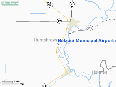
Belzoni Municipal Airport |
Location & QuickFacts
| FAA Information Effective: | 2008-09-25 |
| Airport Identifier: | 1M2 |
| Airport Status: | Operational |
| Longitude/Latitude: | 090-30-55.0250W/33-08-42.6500N
-90.515285/33.145181 (Estimated) |
| Elevation: | 110 ft / 33.53 m (Surveyed) |
| Land: | 75 acres |
| From nearest city: | 3 nautical miles SW of Belzoni, MS |
| Location: | Humphreys County, MS |
| Magnetic Variation: | 03E (1985) |
Owner & Manager
| Ownership: | Publicly owned |
| Owner: | City Of Belzoni |
| Address: | Po Box 674
Belzoni, MS 39038 |
| Phone number: | 662-247-1343 |
| Manager: | Jerry Halbrook
CHAIRMAN ARPT BOARD; CELL PHONE 662-836-7783. |
| Address: | 3775 St. Hwy. 12w
Belzoni, MS 39038 |
| Phone number: | 662-247-1938
AG OPER 662-247-4829, 662-247-0056, OR 662-247-3737. |
Airport Operations and Facilities
| Airport Use: | Open to public |
| Wind indicator: | Yes |
| Segmented Circle: | No |
| Control Tower: | No |
| Lighting Schedule: | DUSK-DAWN
MIRL RY 03/21 PRESET LOW INTST; HIGHER INTST ACTVT-CTAF. |
| Beacon Color: | Clear-Green (lighted land airport) |
| Landing fee charge: | No |
| Sectional chart: | Memphis |
| Region: | ASO - Southern |
| Traffic Pattern Alt: | 1100 ft |
| Boundary ARTCC: | ZME - Memphis |
| Tie-in FSS: | GWO - Greenwood |
| FSS on Airport: | No |
| FSS Toll Free: | 1-800-WX-BRIEF |
| NOTAMs Facility: | GWO (NOTAM-d service avaliable) |
| Federal Agreements: | NGY |
Airport Communications
Airport Services
| Airframe Repair: | NONE |
| Power Plant Repair: | NONE |
| Bottled Oxygen: | NONE |
| Bulk Oxygen: | NONE |
Runway Information
Runway 03/21
| Dimension: | 3000 x 50 ft / 914.4 x 15.2 m |
| Surface: | ASPH, |
| Weight Limit: | Single wheel: 24000 lbs. |
| Edge Lights: | Medium |
| |
Runway 03 |
Runway 21 |
| Longitude: | 090-31-04.2000W | 090-30-45.7580W |
| Latitude: | 33-08-30.0510N | 33-08-55.3460N |
| Elevation: | 109.00 ft | 109.00 ft |
| Alignment: | 32 | 127 |
| Traffic Pattern: | Left | Left |
| Markings: | Basic, Good Condition | Basic, Good Condition |
| Obstruction: | 28 ft pline, 1400.0 ft from runway, 25 ft left of centerline, 42:1 slope to clear | , 50:1 slope to clear |
|
Radio Navigation Aids
| ID |
Type |
Name |
Ch |
Freq |
Var |
Dist |
| IDL | NDB | Indianola | | 284.00 | 03E | 21.7 nm |
| MTQ | NDB | Metcalf | | 359.00 | 03E | 28.9 nm |
| BLE | NDB | Lake Providence | | 278.00 | 03E | 38.9 nm |
| RNV | NDB | Renova | | 272.00 | 04E | 41.7 nm |
| JH | NDB | Brenz | | 260.00 | 02E | 45.8 nm |
| OSX | NDB | Kosciusko | | 269.00 | 00W | 49.2 nm |
| GLH | VOR/DME | Greenville | 039X | 110.20 | 04E | 32.7 nm |
| SQS | VORTAC | Sidon | 094X | 114.70 | 03E | 22.6 nm |
| JAN | VORTAC | Jackson | 073X | 112.60 | 05E | 42.2 nm |
Remarks
- RY 03 HAS 4 FT DITCH 100 FT FM THR.
- RY 21 HAS 4 FT DITCH 130 FT FM THR.
Images and information placed above are from
http://www.airport-data.com/airport/1M2/
We thank them for the data!
| General Info
|
| Country |
United States
|
| State |
MISSISSIPPI
|
| FAA ID |
1M2
|
| Latitude |
33-08-42.650N
|
| Longitude |
090-30-55.025W
|
| Elevation |
110 feet
|
| Near City |
BELZONI
|
We don't guarantee the information is fresh and accurate. The data may
be wrong or outdated.
For more up-to-date information please refer to other sources.
|
|


