 |
|
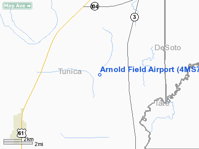
Location & QuickFacts
| FAA Information Effective: | 2008-09-25 |
| Airport Identifier: | 4MS7 |
| Airport Status: | Operational |
| Longitude/Latitude: | 090-16-51.0000W/34-44-54.4000N
-90.280833/34.748444 (Estimated) |
| Elevation: | 195 ft / 59.44 m (Estimated) |
| Land: | 5 acres |
| From nearest city: | 5 nautical miles NE of Tunica, MS |
| Location: | Tunica County, MS |
| Magnetic Variation: | 01E (1995) |
Owner & Manager
| Ownership: | Privately owned |
| Owner: | Edgar O. Haley Iii |
| Address: | 801 Buster Street
Senatobia, MS 38668 |
| Phone number: | 601-562-7544 |
| Manager: | Edgar O. Haley Iii |
| Address: | 801 Buster Street
Senatobia, MS 38668 |
| Phone number: | 601-562-7544 |
Airport Operations and Facilities
| Airport Use: | Private |
| Wind indicator: | Yes |
| Segmented Circle: | No |
| Control Tower: | No |
| Sectional chart: | Memphis |
| Region: | ASO - Southern |
| Boundary ARTCC: | ZME - Memphis |
| Tie-in FSS: | GWO - Greenwood |
| FSS Toll Free: | 1-800-WX-BRIEF |
Runway Information
Runway 14/32
| Dimension: | 1550 x 50 ft / 472.4 x 15.2 m |
| Surface: | TURF, |
| |
Runway 14 |
Runway 32 |
| Traffic Pattern: | Left | Left |
|
Radio Navigation Aids
| ID |
Type |
Name |
Ch |
Freq |
Var |
Dist |
| ME | NDB | Elvis | | 287.00 | 01E | 21.5 nm |
| HEE | NDB | Thompson-robbins | | 251.00 | 01E | 22.3 nm |
| AWM | NDB | West Memphis | | 362.00 | 01E | 23.6 nm |
| FCY | NDB | Forrest City | | 332.00 | 01E | 26.9 nm |
| OLV | NDB | Olive Branch | | 275.00 | 01E | 28.0 nm |
| SPQ | NDB | Spain | | 414.00 | 04E | 29.5 nm |
| CKM | NDB | Clarksdale | | 341.00 | 02E | 29.7 nm |
| MIG | NDB | Millington | | 232.00 | 04E | 36.2 nm |
| BKZ | NDB | Brinkley | | 242.00 | 02E | 45.0 nm |
| UJM | VOR/DME | Marvell | 033X | 109.60 | 01E | 22.1 nm |
| GQE | VOR/DME | Gilmore | 077X | 113.00 | 04E | 37.3 nm |
| MEM | VORTAC | Memphis | 122X | 117.50 | 01E | 21.7 nm |
| HLI | VORTAC | Holly Springs | 071X | 112.40 | 03E | 38.8 nm |
| MEM | VOT | Memphis Metropolitn | | 111.00 | | 23.4 nm |
Remarks
Images and information placed above are from
http://www.airport-data.com/airport/4MS7/
We thank them for the data!
| General Info
|
| Country |
United States
|
| State |
MISSISSIPPI
|
| FAA ID |
4MS7
|
| Latitude |
34-44-54.400N
|
| Longitude |
090-16-51.000W
|
| Elevation |
195 feet
|
| Near City |
TUNICA
|
We don't guarantee the information is fresh and accurate. The data may
be wrong or outdated.
For more up-to-date information please refer to other sources.
|
|


