 |
|
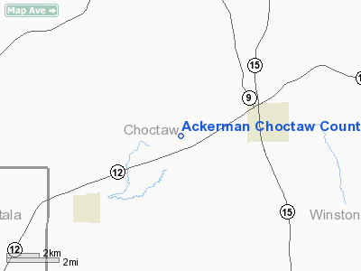
Ackerman Choctaw County Airport |
Location & QuickFacts
| FAA Information Effective: | 2008-09-25 |
| Airport Identifier: | 9M4 |
| Airport Status: | Operational |
| Longitude/Latitude: | 089-13-42.2410W/33-18-12.4470N
-89.228400/33.303458 (Estimated) |
| Elevation: | 552 ft / 168.25 m (Surveyed) |
| Land: | 73 acres |
| From nearest city: | 3 nautical miles W of Ackerman, MS |
| Location: | Choctaw County, MS |
| Magnetic Variation: | 02E (1985) |
Owner & Manager
| Ownership: | Publicly owned |
| Owner: | Ackerman City & Choctaw Co |
| Address: | 119 E Main St/box 394
Ackerman, MS 39735 |
| Phone number: | 662-285-6251 |
| Manager: | Mike Brasher
BRUCE BRUNEY, MAYOR, CITY OF ACKERMAN 662-285-6251. PRESIDENT CHOCTAW COUNTY BOARD OF SUPERVISORS 662-285-6329. |
| Address: | P O Box 394, 214 E. Quinn St.
Ackerman, MS 39735 |
| Phone number: | 662-285-6251
MAINT. SHOP-662-285-3329,CELL 662-285-8573 |
Airport Operations and Facilities
| Airport Use: | Open to public |
| Wind indicator: | Yes |
| Segmented Circle: | Yes |
| Control Tower: | No |
| Lighting Schedule: | DUSK-DAWN |
| Beacon Color: | Clear-Green (lighted land airport)
ROTG BCN OTS INDEFLY. |
| Landing fee charge: | No |
| Sectional chart: | Memphis |
| Region: | ASO - Southern |
| Boundary ARTCC: | ZME - Memphis |
| Tie-in FSS: | GWO - Greenwood |
| FSS on Airport: | No |
| FSS Toll Free: | 1-800-WX-BRIEF |
| NOTAMs Facility: | GWO (NOTAM-d service avaliable) |
| Federal Agreements: | NGY |
Airport Communications
Airport Services
| Airframe Repair: | NONE |
| Power Plant Repair: | NONE |
| Bottled Oxygen: | NONE |
| Bulk Oxygen: | NONE |
Runway Information
Runway 01/19
| Dimension: | 3000 x 75 ft / 914.4 x 22.9 m |
| Surface: | ASPH, Good Condition
PAVEMENT HAS CRACKS AND LOOSE ROCKS ON RY. |
| Weight Limit: | Single wheel: 19500 lbs. |
| Edge Lights: | Medium |
| |
Runway 01 |
Runway 19 |
| Traffic Pattern: | Left | Left |
| Markings: | Basic, Good Condition | Basic, Good Condition |
| Crossing Height: | 42.00 ft | 34.00 ft |
| VASI: | 2-light PAPI on left side | 2-light PAPI on left side |
| Visual Glide Angle: | 3.00° | 3.00° |
| Obstruction: | , 50:1 slope to clear | 78 ft trees, 1209.0 ft from runway, 12:1 slope to clear |
|
Radio Navigation Aids
| ID |
Type |
Name |
Ch |
Freq |
Var |
Dist |
| LMS | NDB | Louisville | | 212.00 | 00E | 12.8 nm |
| OSX | NDB | Kosciusko | | 269.00 | 00W | 20.2 nm |
| STF | NDB | Bryan | | 281.00 | 02E | 20.5 nm |
| MPE | NDB | Philadelphia | | 219.00 | 01E | 30.8 nm |
| SBQ | NDB | Scobey | | 245.00 | 01E | 47.9 nm |
| NJW | TACAN | Joe Williams | 61Y | | 01E | 36.4 nm |
| IGB | VORTAC | Bigbee | 109X | 116.20 | 04E | 37.5 nm |
| CBM | VORTAC | Caledonia | 099X | 115.20 | 00E | 44.5 nm |
Remarks
- WILDLIFE ON AND INVOF RY.
Images and information placed above are from
http://www.airport-data.com/airport/9M4/
We thank them for the data!
| General Info
|
| Country |
United States
|
| State |
MISSISSIPPI
|
| FAA ID |
9M4
|
| Latitude |
33-18-12.447N
|
| Longitude |
089-13-42.241W
|
| Elevation |
552 feet
|
| Near City |
ACKERMAN
|
We don't guarantee the information is fresh and accurate. The data may
be wrong or outdated.
For more up-to-date information please refer to other sources.
|
|


