 |
|
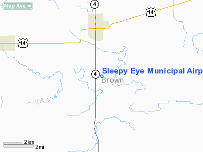
Sleepy Eye Municipal Airport |
Location & QuickFacts
| FAA Information Effective: | 2008-09-25 |
| Airport Identifier: | Y58 |
| Airport Status: | Operational |
| Longitude/Latitude: | 094-43-00.9340W/44-14-59.8580N
-94.716926/44.249961 (Estimated) |
| Elevation: | 1004 ft / 306.02 m (Surveyed) |
| Land: | 160 acres |
| From nearest city: | 3 nautical miles SE of Sleepy Eye, MN |
| Location: | Brown County, MN |
| Magnetic Variation: | 04E (1985) |
Owner & Manager
| Ownership: | Publicly owned |
| Owner: | City Of Sleepy Eye |
| Address: | 200 Main St. E
Sleepy Eye, MN 56085 |
| Phone number: | 507-794-3731 |
| Manager: | Charles Moldaschel |
| Address: | 26227 - 200th Street
Sleepy Eye, MN 56085 |
| Phone number: | 507-794-6022
ADDNL PHONE (507) 794-7318/7759. |
Airport Operations and Facilities
| Airport Use: | Open to public |
| Wind indicator: | Yes |
| Segmented Circle: | No |
| Control Tower: | No |
| Lighting Schedule: | DUSK-DAWN |
| Landing fee charge: | No |
| Sectional chart: | Omaha |
| Region: | AGL - Great Lakes |
| Boundary ARTCC: | ZMP - Minneapolis |
| Tie-in FSS: | PNM - Princeton |
| FSS on Airport: | No |
| FSS Toll Free: | 1-800-WX-BRIEF |
| NOTAMs Facility: | PNM (NOTAM-d service avaliable) |
| Federal Agreements: | 1 |
Airport Communications
Airport Services
| Bottled Oxygen: | NONE |
| Bulk Oxygen: | NONE |
Runway Information
Runway 04/22
| Dimension: | 2570 x 300 ft / 783.3 x 91.4 m |
| Surface: | TURF, Good Condition |
| |
Runway 04 |
Runway 22 |
| Longitude: | 094-42-45.0900W | 094-42-24.4756W |
| Latitude: | 44-14-47.7000N | 44-15-08.3040N |
| Elevation: | 992.00 ft | 0.00 ft |
| Traffic Pattern: | Left | Left |
| Runway End Identifier: | No | No |
| Centerline Lights: | No | No |
| Touchdown Lights: | No | No |
| Obstruction: | , 50:1 slope to clear | 43 ft trees, 900.0 ft from runway, 150 ft left of centerline, 20:1 slope to clear |
|
Runway 14/32
| Dimension: | 2500 x 300 ft / 762.0 x 91.4 m |
| Surface: | TURF, Good Condition |
| Edge Lights: | Non-standard lighting system
NSTD LIRL DUE TO VARIABLE SPACING. |
| |
Runway 14 |
Runway 32 |
| Traffic Pattern: | Left | Left |
| Runway End Identifier: | No | No |
| Centerline Lights: | No | No |
| Touchdown Lights: | No | No |
| Obstruction: | 17 ft road, 420.0 ft from runway, 150 ft left of centerline, 24:1 slope to clear | 25 ft trees, 210.0 ft from runway, 125 ft left of centerline, 8:1 slope to clear |
|
Radio Navigation Aids
| ID |
Type |
Name |
Ch |
Freq |
Var |
Dist |
| JYG | NDB | St James | | 260.00 | 04E | 17.4 nm |
| MWM | NDB | Windom | | 203.00 | 03E | 26.6 nm |
| MJQ | NDB | Jackson | | 353.00 | 04E | 38.1 nm |
| HCD | NDB | Hutchinson | | 209.00 | 04E | 39.2 nm |
| GYL | NDB | Glencoe | | 407.00 | 03E | 40.9 nm |
| SBU | NDB | Blue Earth | | 332.00 | 04E | 47.5 nm |
| ULM | NDB/DME | New Ulm | 050X | 272.00 | 04E | 10.3 nm |
| RWF | VOR/DME | Redwood Falls | 080X | 113.30 | 07E | 22.0 nm |
| MKT | VOR/DME | Mankato | 045X | 110.80 | 07E | 34.7 nm |
| FRM | VOR/DME | Fairmont | 039X | 110.20 | 07E | 38.5 nm |
| MML | VOR/DME | Marshall | 047X | 111.00 | 05E | 49.1 nm |
Remarks
- SEWAGE DISPOSAL PONDS 1600' NORTH OF ARPT.
- LGTD IRRIGATION BOOM 600'R OF RWY 14.
- EXISTED PRIOR TO 1959.
Images and information placed above are from
http://www.airport-data.com/airport/Y58/
We thank them for the data!
| General Info
|
| Country |
United States
|
| State |
MINNESOTA
|
| FAA ID |
Y58
|
| Latitude |
44-14-59.858N
|
| Longitude |
094-43-00.934W
|
| Elevation |
1004 feet
|
| Near City |
SLEEPY EYE
|
We don't guarantee the information is fresh and accurate. The data may
be wrong or outdated.
For more up-to-date information please refer to other sources.
|
|


