 |
|
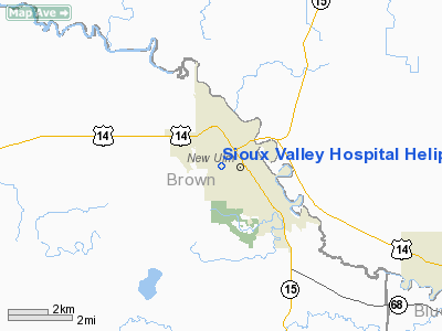
Sioux Valley Hospital Heliport |
Location & QuickFacts
| FAA Information Effective: | 2008-09-25 |
| Airport Identifier: | MY84 |
| Airport Status: | Operational |
| Longitude/Latitude: | 094-28-31.9040W/44-18-45.8640N
-94.475529/44.312740 (Estimated) |
| Elevation: | 879 ft / 267.92 m (Estimated) |
| Land: | 0 acres |
| From nearest city: | 2 nautical miles SW of New Ulm, MN |
| Location: | Brown County, MN |
| Magnetic Variation: | 05E (1985) |
Owner & Manager
| Ownership: | Privately owned |
| Owner: | New Ulm Medical Center |
| Address: | 1324 Fifth St N P.o. Box 577
New Ulm, MN 56073 |
| Phone number: | 507-354-2111 |
| Manager: | Dave Wenk |
| Address: | 1324 Fifth North Street
New Ulm, MN 56073 |
| Phone number: | 507-354-2111 |
Airport Operations and Facilities
| Airport Use: | Private |
| Wind indicator: | Yes |
| Segmented Circle: | No |
| Control Tower: | No |
| Lighting Schedule: | PHONE REQ
FOR PERIMETER LGTS CALL 507-354-2111. |
| Sectional chart: | Omaha |
| Region: | AGL - Great Lakes |
| Boundary ARTCC: | ZMP - Minneapolis |
| Tie-in FSS: | PNM - Princeton |
| FSS Toll Free: | 1-800-WX-BRIEF |
Runway Information
Helipad H1
| Dimension: | 50 x 50 ft / 15.2 x 15.2 m |
| Surface: | CONC, Good Condition |
| |
Runway H1 |
Runway |
| Traffic Pattern: | Left | Left |
|
Radio Navigation Aids
| ID |
Type |
Name |
Ch |
Freq |
Var |
Dist |
| JYG | NDB | St James | | 260.00 | 04E | 19.9 nm |
| GYL | NDB | Glencoe | | 407.00 | 03E | 31.7 nm |
| HCD | NDB | Hutchinson | | 209.00 | 04E | 32.9 nm |
| MWM | NDB | Windom | | 203.00 | 03E | 36.5 nm |
| ACQ | NDB | Waseca | | 371.00 | 02E | 42.4 nm |
| MJQ | NDB | Jackson | | 353.00 | 04E | 45.7 nm |
| SBU | NDB | Blue Earth | | 332.00 | 04E | 46.0 nm |
| ULM | NDB/DME | New Ulm | 050X | 272.00 | 04E | 1.0 nm |
| MKT | VOR/DME | Mankato | 045X | 110.80 | 07E | 24.9 nm |
| RWF | VOR/DME | Redwood Falls | 080X | 113.30 | 07E | 29.5 nm |
| FRM | VOR/DME | Fairmont | 039X | 110.20 | 07E | 40.1 nm |
| FOW | VOR/DME | Halfway | 049X | 111.20 | 02E | 48.0 nm |
| DWN | VORTAC | Darwin | 027X | 109.00 | 07E | 46.6 nm |
Remarks
- ALL APCH/DEPARTURES CONDUCTED 325 DEG CLOCKWISE TO 335 DEG AND 95 DEG CLOCKWISE. MAINTAIN WIND INDICATOR. NO NIGHT OPNS UNLESS AREA & WIND INDICATOR ARE LGTD. UNAUTHORIZED PERSONS BE KEPT OUT OF LANDING AREA DURING OPNS. BE IN ACCORDANCE WITH LOCAL FIRE CODES.
Images and information placed above are from
http://www.airport-data.com/airport/MY84/
We thank them for the data!
| General Info
|
| Country |
United States
|
| State |
MINNESOTA
|
| FAA ID |
MY84
|
| Latitude |
44-18-45.864N
|
| Longitude |
094-28-31.904W
|
| Elevation |
879 feet
|
| Near City |
NEW ULM
|
We don't guarantee the information is fresh and accurate. The data may
be wrong or outdated.
For more up-to-date information please refer to other sources.
|
|


