 |
|
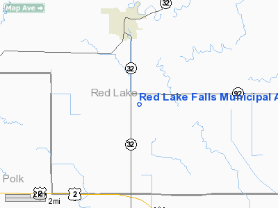
Red Lake Falls Municipal Airport |
Location & QuickFacts
| FAA Information Effective: | 2008-09-25 |
| Airport Identifier: | D81 |
| Airport Status: | Operational |
| Longitude/Latitude: | 096-15-28.1730W/47-49-29.8820N
-96.257826/47.824967 (Estimated) |
| Elevation: | 1061 ft / 323.39 m (Estimated) |
| Land: | 148 acres |
| From nearest city: | 3 nautical miles S of Red Lake Falls, MN |
| Location: | Red Lake County, MN |
| Magnetic Variation: | 05E (1985) |
Owner & Manager
| Ownership: | Publicly owned |
| Owner: | City Of Red Lake Falls |
| Address: | 108 - 2nd Street Sw, Box 37
Red Lake Falls, MN 56750 |
| Phone number: | 218-253-2684 |
| Manager: | Scott Larson |
| Address: | 108 - 2nd Street Sw, Box 37
Red Lake Falls, MN 56750 |
| Phone number: | 218-253-2684 |
Airport Operations and Facilities
| Airport Use: | Open to public |
| Wind indicator: | Yes |
| Segmented Circle: | No |
| Control Tower: | No |
| Lighting Schedule: | DUSK-DAWN |
| Beacon Color: | Clear-Green (lighted land airport) |
| Landing fee charge: | No |
| Sectional chart: | Twin Cities |
| Region: | AGL - Great Lakes |
| Boundary ARTCC: | ZMP - Minneapolis |
| Tie-in FSS: | PNM - Princeton |
| FSS on Airport: | No |
| FSS Toll Free: | 1-800-WX-BRIEF |
| NOTAMs Facility: | PNM (NOTAM-d service avaliable) |
Airport Communications
Airport Services
| Airframe Repair: | NONE |
| Power Plant Repair: | NONE |
| Bottled Oxygen: | NONE |
| Bulk Oxygen: | NONE |
Runway Information
Runway 15/33
| Dimension: | 2500 x 60 ft / 762.0 x 18.3 m |
| Surface: | ASPH, Good Condition |
| Edge Lights: | Non-standard lighting system
NSTD LIRL; LGTS 40 FT OFF SIDES OF RY. |
| |
Runway 15 |
Runway 33 |
| Longitude: | 096-15-43.6700W | 096-15-21.6700W |
| Latitude: | 47-49-52.0900N | 47-49-17.6600N |
| Elevation: | 1060.00 ft | 1060.00 ft |
| Traffic Pattern: | Left | Left |
| Markings: | Basic, Good Condition | Basic, Good Condition |
| Runway End Identifier: | No | No |
| Centerline Lights: | No | No |
| Touchdown Lights: | No | No |
|
Radio Navigation Aids
| ID |
Type |
Name |
Ch |
Freq |
Var |
Dist |
| CKN | NDB | Crookston | | 400.00 | 07E | 14.5 nm |
| FSE | NDB | Fosston | | 224.00 | 05E | 24.3 nm |
| RDR | TACAN | Red River | 111X | | 06E | 46.9 nm |
| TVF | VOR/DME | Thief River Falls | 021X | 108.40 | 08E | 15.0 nm |
| GFK | VOR/DME | Grand Forks | 090X | 114.30 | 09E | 38.2 nm |
Remarks
- ULTRALIGHTS ON & INVOF ARPT.
Images and information placed above are from
http://www.airport-data.com/airport/D81/
We thank them for the data!
| General Info
|
| Country |
United States
|
| State |
MINNESOTA
|
| FAA ID |
D81
|
| Latitude |
47-49-29.882N
|
| Longitude |
096-15-28.173W
|
| Elevation |
1061 feet
|
| Near City |
RED LAKE FALLS
|
We don't guarantee the information is fresh and accurate. The data may
be wrong or outdated.
For more up-to-date information please refer to other sources.
|
|


