 |
|
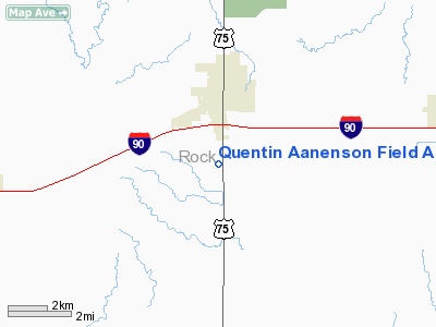
Quentin Aanenson Field Airport |
Location & QuickFacts
| FAA Information Effective: | 2008-09-25 |
| Airport Identifier: | LYV |
| Airport Status: | Operational |
| Longitude/Latitude: | 096-12-56.8290W/43-37-16.2060N
-96.215786/43.621168 (Estimated) |
| Elevation: | 1431 ft / 436.17 m (Estimated) |
| Land: | 85 acres |
| From nearest city: | 2 nautical miles S of Luverne, MN |
| Location: | Rock County, MN |
| Magnetic Variation: | 06E (1985) |
Owner & Manager
| Ownership: | Publicly owned |
| Owner: | City Of Luverne |
| Address: | 305 Luverne St., Box 659
Luverne, MN 56156 |
| Phone number: | 507-449-2388 |
| Manager: | Ken Vos |
| Address: | 305 Luverne St., Box 659
Luverne, MN 56156 |
| Phone number: | 507-449-2388. |
Airport Operations and Facilities
| Airport Use: | Open to public |
| Wind indicator: | Yes |
| Segmented Circle: | No |
| Control Tower: | No |
| Lighting Schedule: | DUSK-DAWN |
| Beacon Color: | Clear-Green (lighted land airport) |
| Landing fee charge: | No |
| Sectional chart: | Omaha |
| Region: | AGL - Great Lakes |
| Boundary ARTCC: | ZMP - Minneapolis |
| Tie-in FSS: | PNM - Princeton |
| FSS on Airport: | No |
| FSS Toll Free: | 1-800-WX-BRIEF |
| NOTAMs Facility: | LYV (NOTAM-d service avaliable) |
| Federal Agreements: | NY1 |
Airport Communications
| CTAF: | 122.700 |
| Unicom: | 122.700 |
Airport Services
| Fuel available: | 100LL
24 HR SELF SVC CREDIT CARD FUEL AVBL. |
| Bottled Oxygen: | NONE |
| Bulk Oxygen: | NONE |
Runway Information
Runway 17/35
| Dimension: | 2503 x 75 ft / 762.9 x 22.9 m |
| Surface: | ASPH, Good Condition |
| Weight Limit: | Single wheel: 17000 lbs.
Dual wheel: 23000 lbs. |
| Edge Lights: | Low |
| |
Runway 17 |
Runway 35 |
| Longitude: | 096-12-59.0820W | 096-12-54.5750W |
| Latitude: | 43-37-28.4580N | 43-37-03.9550N |
| Elevation: | 1431.00 ft | 1424.00 ft |
| Traffic Pattern: | Left | Left |
| Markings: | Basic, Good Condition | Basic, Good Condition |
| Runway End Identifier: | No | No |
| Centerline Lights: | No | No |
| Touchdown Lights: | No | No |
| Obstruction: | 45 ft pline, 2200.0 ft from runway, 44:1 slope to clear | 17 ft road, 490.0 ft from runway, 17:1 slope to clear |
|
Radio Navigation Aids
| ID |
Type |
Name |
Ch |
Freq |
Var |
Dist |
| ISB | NDB | Sibley | | 269.00 | 05E | 25.3 nm |
| FS | NDB | Rokky | | 245.00 | 06E | 27.8 nm |
| SOY | NDB | Sioux Center | | 368.00 | 06E | 29.4 nm |
| SHL | NDB | Sheldon | | 338.00 | 05E | 29.6 nm |
| ORC | NDB | Orange City | | 521.00 | 05E | 38.5 nm |
| MDS | NDB | Wentworth | | 400.00 | 05E | 44.6 nm |
| PQN | NDB/DME | Pipestone | 028X | 284.00 | 06E | 22.2 nm |
| OTG | VOR/DME | Worthington | 043X | 110.60 | 08E | 27.6 nm |
| DDL | VOR/DME | Sheldon | 023X | 108.60 | 05E | 29.7 nm |
| BKX | VOR/DME | Brookings | 025X | 108.80 | 06E | 48.5 nm |
| FSD | VORTAC | Sioux Falls | 097X | 115.00 | 09E | 24.7 nm |
Images and information placed above are from
http://www.airport-data.com/airport/LYV/
We thank them for the data!
| General Info
|
| Country |
United States
|
| State |
MINNESOTA
|
| FAA ID |
LYV
|
| Latitude |
43-37-16.206N
|
| Longitude |
096-12-56.829W
|
| Elevation |
1431 feet
|
| Near City |
LUVERNE
|
We don't guarantee the information is fresh and accurate. The data may
be wrong or outdated.
For more up-to-date information please refer to other sources.
|
|


