 |
|
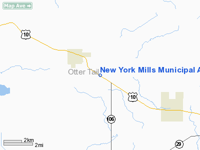
New York Mills Municipal Airport |
Location & QuickFacts
| FAA Information Effective: | 2008-09-25 |
| Airport Identifier: | 25Y |
| Airport Status: | Operational |
| Longitude/Latitude: | 095-20-15.1220W/46-30-07.8580N
-95.337534/46.502183 (Estimated) |
| Elevation: | 1401 ft / 427.02 m (Surveyed) |
| Land: | 62 acres |
| From nearest city: | 2 nautical miles SE of New York Mills, MN |
| Location: | Otter Tail County, MN |
| Magnetic Variation: | 05E (1985) |
Owner & Manager
| Ownership: | Publicly owned |
| Owner: | City Of New York Mills |
| Address: | Box H
New York Mills, MN 56567 |
| Phone number: | 218-385-2213 |
| Manager: | Tim Vaughn |
| Address: | Box 190
New York Mills, MN 56567 |
| Phone number: | 218-385-2855 |
Airport Operations and Facilities
| Airport Use: | Open to public |
| Wind indicator: | Yes |
| Segmented Circle: | No |
| Control Tower: | No |
| Lighting Schedule: | DUSK-DAWN |
| Beacon Color: | Clear-Green (lighted land airport) |
| Landing fee charge: | No |
| Sectional chart: | Twin Cities |
| Region: | AGL - Great Lakes |
| Boundary ARTCC: | ZMP - Minneapolis |
| Tie-in FSS: | PNM - Princeton |
| FSS on Airport: | No |
| FSS Toll Free: | 1-800-WX-BRIEF |
| NOTAMs Facility: | PNM (NOTAM-d service avaliable) |
Airport Communications
Airport Services
| Airframe Repair: | NONE |
| Power Plant Repair: | NONE |
| Bottled Oxygen: | NONE |
| Bulk Oxygen: | NONE |
Runway Information
Runway 12/30
| Dimension: | 2500 x 196 ft / 762.0 x 59.7 m |
| Surface: | TURF, Good Condition |
| Edge Lights: | Non-standard lighting system
NSTD LIRL; SPACING. |
| |
Runway 12 |
Runway 30 |
| Longitude: | 095-20-27.8900W | 095-19-57.3500W |
| Latitude: | 46-30-13.7600N | 46-30-00.9500N |
| Elevation: | 1401.00 ft | 1390.00 ft |
| Traffic Pattern: | Left | Left |
| Obstruction: | 17 ft road, 560.0 ft from runway, 32:1 slope to clear | 8 ft trees, 150.0 ft from runway, 70 ft right of centerline, 26:1 slope to clear |
|
Radio Navigation Aids
| ID |
Type |
Name |
Ch |
Freq |
Var |
Dist |
| SAZ | NDB | Staples | | 257.00 | 04E | 23.2 nm |
| PK | NDB | Spida | | 269.00 | 04E | 24.9 nm |
| PWC | NDB | Pine River | | 330.00 | 03E | 41.6 nm |
| EE | NDB | Tamie | | 374.00 | 04E | 42.7 nm |
| XCR | NDB | Ripley | | 404.00 | 03E | 48.5 nm |
| RYM | TACAN | Camp Ripley | 048X | | 03E | 47.7 nm |
| PKD | VOR/DME | Park Rapids | 043X | 110.60 | 04E | 26.2 nm |
| DTL | VOR/DME | Detroit Lakes | 049X | 111.20 | 05E | 29.9 nm |
| AXN | VOR/DME | Alexandria | 075X | 112.80 | 07E | 33.0 nm |
| FFM | VOR/DME | Fergus Falls | 041X | 110.40 | 05E | 36.3 nm |
Remarks
Images and information placed above are from
http://www.airport-data.com/airport/25Y/
We thank them for the data!
| General Info
|
| Country |
United States
|
| State |
MINNESOTA
|
| FAA ID |
25Y
|
| Latitude |
46-30-07.858N
|
| Longitude |
095-20-15.122W
|
| Elevation |
1401 feet
|
| Near City |
NEW YORK MILLS
|
We don't guarantee the information is fresh and accurate. The data may
be wrong or outdated.
For more up-to-date information please refer to other sources.
|
|


