 |
|
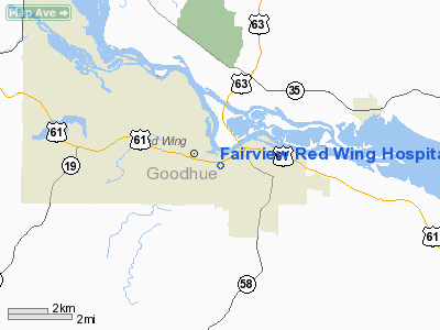
Fairview Red Wing Hospital Heliport |
Location & QuickFacts
| FAA Information Effective: | 2008-09-25 |
| Airport Identifier: | MN82 |
| Airport Status: | Operational |
| Longitude/Latitude: | 092-32-46.6860W/44-33-36.8830N
-92.546302/44.560245 (Estimated) |
| Elevation: | 793 ft / 241.71 m (Estimated) |
| Land: | 0 acres |
| From nearest city: | 1 nautical miles NW of Red Wing, MN |
| Location: | Goodhue County, MN |
| Magnetic Variation: | 02E (1990) |
Owner & Manager
| Ownership: | Privately owned |
| Owner: | St. John's Regional Health |
| Address: | 1407 W 4th St
Red Wing, MN 55066 |
| Phone number: | 612-388-6721 |
| Manager: | Glenn A Mattson |
| Address: | 1407 W 4th St
Red Wing, MN 55066 |
| Phone number: | 612-385-3365 |
Airport Operations and Facilities
| Airport Use: | Private
MEDICAL USE. |
| Wind indicator: | Yes |
| Segmented Circle: | No |
| Control Tower: | No |
| Lighting Schedule: | PHONE REQ
PHONE 612-385-3365 FOR PERIMETER LGTS. |
| Sectional chart: | Green Bay |
| Region: | AGL - Great Lakes |
| Boundary ARTCC: | ZMP - Minneapolis |
| Tie-in FSS: | PNM - Princeton |
| FSS Toll Free: | 1-800-WX-BRIEF |
Runway Information
Helipad H1
| Dimension: | 105 x 90 ft / 32.0 x 27.4 m |
| Surface: | ASPH, Good Condition |
| |
Runway H1 |
Runway |
| Traffic Pattern: | Left | Left |
|
Radio Navigation Aids
| ID |
Type |
Name |
Ch |
Freq |
Var |
Dist |
| PPI | NDB | Hopey | | 400.00 | 03E | 25.3 nm |
| MS | NDB | Narco | | 266.00 | 02E | 28.2 nm |
| RNH | NDB | New Richmond | | 257.00 | 02E | 35.3 nm |
| AHH | NDB | Ameron | | 278.00 | 01E | 44.0 nm |
| OEO | NDB | Osceola | | 233.00 | 01E | 45.5 nm |
| MSP | VOR/DME | Minneapolis | 100X | 115.30 | 02E | 35.7 nm |
| FOW | VOR/DME | Halfway | 049X | 111.20 | 02E | 41.4 nm |
| FCM | VOR/DME | Flying Cloud | 055X | 111.80 | 06E | 42.0 nm |
| ONA | VOR/DME | Winona | 051X | 111.40 | 01E | 46.4 nm |
| RST | VOR/DME | Rochester | 057X | 112.00 | 05E | 46.8 nm |
| FGT | VORTAC | Farmington | 104X | 115.70 | 06E | 27.5 nm |
| GEP | VORTAC | Gopher | 120X | 117.30 | 06E | 49.8 nm |
| EAU | VORTAC | Eau Claire | 076X | 112.90 | 04E | 49.9 nm |
| STP | VOT | St Paul | | 114.40 | | 31.7 nm |
| MSP | VOT | Minneapolis St Paul | | 111.00 | | 34.6 nm |
Remarks
- OPERS ARE COND FM 120 TO 180; AREA IS MKD; WIND IND IS MAINTAINED; VEHICLES REMOVED WHEN HELIPAD IN USE; TREES ARE REMOVED.
Images and information placed above are from
http://www.airport-data.com/airport/MN82/
We thank them for the data!
| General Info
|
| Country |
United States
|
| State |
MINNESOTA
|
| FAA ID |
MN82
|
| Latitude |
44-33-36.883N
|
| Longitude |
092-32-46.686W
|
| Elevation |
793 feet
|
| Near City |
RED WING
|
We don't guarantee the information is fresh and accurate. The data may
be wrong or outdated.
For more up-to-date information please refer to other sources.
|
|


