 |
|
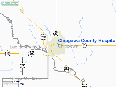
Chippewa County Hospital Heliport |
Location & QuickFacts
| FAA Information Effective: | 2008-09-25 |
| Airport Identifier: | 2MN3 |
| Airport Status: | Operational |
| Longitude/Latitude: | 095-42-42.5930W/44-57-09.3450N
-95.711831/44.952596 (Estimated) |
| Elevation: | 1024 ft / 312.12 m (Estimated) |
| Land: | 0 acres |
| From nearest city: | 1 nautical miles NE of Montevideo, MN |
| Location: | Chippewa County, MN |
| Magnetic Variation: | 05E (1995) |
Owner & Manager
| Ownership: | Privately owned |
| Owner: | Chippewa Co. Montevideo Hosp. |
| Address: | 824 North 11th Street
Montevideo, MN 56265 |
| Phone number: | 612-269-8877 |
| Manager: | Mark E. Paulson |
| Address: | 824 North 11th Street
Montevideo, MN 56265 |
| Phone number: | 612-269-8877 |
Airport Operations and Facilities
| Airport Use: | Private |
| Wind indicator: | Yes |
| Segmented Circle: | No |
| Control Tower: | No |
| Sectional chart: | Twin Cities |
| Region: | AGL - Great Lakes |
| Boundary ARTCC: | ZMP - Minneapolis |
| Tie-in FSS: | PNM - Princeton |
| FSS on Airport: | No |
| FSS Toll Free: | 1-800-WX-BRIEF |
Runway Information
Helipad H1
| Dimension: | 45 x 45 ft / 13.7 x 13.7 m |
| Surface: | CONC, |
| |
Runway H1 |
Runway |
| Traffic Pattern: | Left | Left |
|
Radio Navigation Aids
| ID |
Type |
Name |
Ch |
Freq |
Var |
Dist |
| DXX | NDB | Dawson/madison | | 341.00 | 06E | 20.0 nm |
| AQP | NDB | Appleton | | 356.00 | 05E | 20.8 nm |
| BBB | NDB | Benson | | 239.00 | 05E | 22.7 nm |
| VVV | NDB | Ortonville | | 332.00 | 05E | 36.7 nm |
| GHW | NDB | Glenwood | | 346.00 | 03E | 44.8 nm |
| MVE | VOR/DME | Montevideo | 053X | 111.60 | 05E | 1.2 nm |
| BDH | VOR/DME | Willmar | 84X | 113.70 | 04E | 26.7 nm |
| ILL | VOR/DME | Willmar | 084X | 113.70 | 04E | 28.2 nm |
| MML | VOR/DME | Marshall | 047X | 111.00 | 05E | 30.7 nm |
| RWF | VOR/DME | Redwood Falls | 080X | 113.30 | 07E | 38.4 nm |
| MOX | VOR/DME | Morris | 033X | 109.60 | 05E | 38.4 nm |
Remarks
- PRVDD APCH/DEP 350-150 DEGS; AREA MKD & CLEAR; TWO-WAY RADIO CTC WITH HOSPITAL DURING OPNS; FIRE EXTINGUISHER.
Images and information placed above are from
http://www.airport-data.com/airport/2MN3/
We thank them for the data!
| General Info
|
| Country |
United States
|
| State |
MINNESOTA
|
| FAA ID |
2MN3
|
| Latitude |
44-57-09.345N
|
| Longitude |
095-42-42.593W
|
| Elevation |
1024 feet
|
| Near City |
MONTEVIDEO
|
We don't guarantee the information is fresh and accurate. The data may
be wrong or outdated.
For more up-to-date information please refer to other sources.
|
|


