 |
|
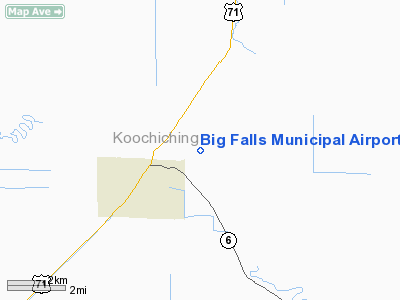
Big Falls Municipal Airport |
Location & QuickFacts
| FAA Information Effective: | 2008-09-25 |
| Airport Identifier: | 7Y9 |
| Airport Status: | Operational |
| Longitude/Latitude: | 093-45-52.8000W/48-11-54.3000N
-93.764667/48.198417 (Estimated) |
| Elevation: | 1232 ft / 375.51 m (Estimated) |
| Land: | 280 acres |
| From nearest city: | 3 nautical miles NE of Big Falls, MN |
| Location: | Koochiching County, MN |
| Magnetic Variation: | 03E (1985) |
Owner & Manager
| Ownership: | Publicly owned |
| Owner: | City Of Big Falls |
| Address: | Box 196
Big Falls, MN 56627 |
| Phone number: | 218-276-2282 |
| Manager: | Terry Baird |
| Address: | P.o. Box 196
Big Falls, MN 56627 |
| Phone number: | 218-276-2328 |
Airport Operations and Facilities
| Airport Use: | Open to public |
| Wind indicator: | Yes |
| Segmented Circle: | No |
| Control Tower: | No |
| Lighting Schedule: | DUSK-DAWN |
| Landing fee charge: | No |
| Sectional chart: | Twin Cities |
| Region: | AGL - Great Lakes |
| Boundary ARTCC: | ZMP - Minneapolis |
| Tie-in FSS: | PNM - Princeton |
| FSS on Airport: | No |
| FSS Toll Free: | 1-800-WX-BRIEF |
| NOTAMs Facility: | PNM (NOTAM-d service avaliable) |
| Federal Agreements: | 1 |
Airport Communications
Airport Services
Runway Information
Runway 11/29
| Dimension: | 2850 x 100 ft / 868.7 x 30.5 m |
| Surface: | TURF, Fair Condition |
| Edge Lights: | Non-standard lighting system
NSTD LIRL DUE TO SPACING. |
| |
Runway 11 |
Runway 29 |
| Longitude: | 093-46-11.0600W | 093-45-34.5700W |
| Latitude: | 48-12-01.3200N | 48-11-47.3200N |
| Traffic Pattern: | Left | Left |
| Obstruction: | 62 ft trees, 1907.0 ft from runway, 62 ft right of centerline, 30:1 slope to clear | 85 ft trees, 1741.0 ft from runway, 299 ft right of centerline, 20:1 slope to clear |
|
Radio Navigation Aids
| ID |
Type |
Name |
Ch |
Freq |
Var |
Dist |
| FOZ | NDB | Bigfork | | 345.00 | 02E | 25.3 nm |
| IN | NDB | Raize | | 353.00 | 06E | 25.8 nm |
| YAG | NDB | Fort Frances | | 376.00 | 02E | 30.9 nm |
| ORB | NDB | Orr | | 341.00 | 02E | 37.8 nm |
| CQM | NDB | Cook | | 233.00 | 01E | 48.8 nm |
| BDE | VOR/DME | Baudette | 053X | 111.60 | 04E | 46.1 nm |
| INL | VORTAC | International Falls | 047X | 111.00 | 06E | 26.3 nm |
Remarks
- ARPT CLSD WINTER MONTHS.
- ULTRALIGHT TRAFFIC ON & INVOF ARPT.
Images and information placed above are from
http://www.airport-data.com/airport/7Y9/
We thank them for the data!
| General Info
|
| Country |
United States
|
| State |
MINNESOTA
|
| FAA ID |
7Y9
|
| Latitude |
48-11-44.822N
|
| Longitude |
093-46-00.639W
|
| Elevation |
1232 feet
|
| Near City |
BIG FALLS
|
We don't guarantee the information is fresh and accurate. The data may
be wrong or outdated.
For more up-to-date information please refer to other sources.
|
|


