 |
|
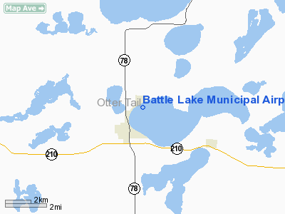
Battle Lake Municipal Airport |
Location & QuickFacts
| FAA Information Effective: | 2008-09-25 |
| Airport Identifier: | 00MN |
| Airport Status: | Operational |
| Longitude/Latitude: | 095-42-01.1670W/46-17-59.8570N
-95.700324/46.299960 (Estimated) |
| Elevation: | 1365 ft / 416.05 m (Estimated) |
| Land: | 43 acres |
| From nearest city: | 2 nautical miles NE of Battle Lake, MN |
| Location: | Otter Tail County, MN |
| Magnetic Variation: | 05E (1985) |
Owner & Manager
| Ownership: | Publicly owned |
| Owner: | City Of Battle Lake |
| Address: | 108 East Main St
Battle Lake, MN 56515 |
| Phone number: | 218-864-0424 |
| Manager: | Bert Olson
CITY CLERK. |
| Address: | P.o. Box 386
Battle Lake, MN 56515 |
| Phone number: | 218-864-8982 |
Airport Operations and Facilities
| Airport Use: | Private |
| Wind indicator: | Yes |
| Segmented Circle: | No |
| Control Tower: | No |
| Lighting Schedule: | DUSK-DAWN
LIRL RY 06/24 & ARPT BCN OTS NOV THRU MAR. |
| Beacon Color: | Clear-Green (lighted land airport) |
| Landing fee charge: | No |
| Sectional chart: | Twin Cities |
| Region: | AGL - Great Lakes |
| Boundary ARTCC: | ZMP - Minneapolis |
| Tie-in FSS: | PNM - Princeton |
| FSS on Airport: | No |
| FSS Toll Free: | 1-800-WX-BRIEF |
Airport Services
| Bottled Oxygen: | NONE |
| Bulk Oxygen: | NONE |
Runway Information
Runway 06/24
| Dimension: | 2949 x 200 ft / 898.9 x 61.0 m |
| Surface: | TURF, Good Condition |
| Edge Lights: | Non-standard lighting system
NSTD LIRL; NSTD SPACING. |
| |
Runway 06 |
Runway 24 |
| Traffic Pattern: | Left | Left |
|
Radio Navigation Aids
| ID |
Type |
Name |
Ch |
Freq |
Var |
Dist |
| EE | NDB | Tamie | | 374.00 | 04E | 34.7 nm |
| SAZ | NDB | Staples | | 257.00 | 04E | 37.5 nm |
| BWP | NDB | Breckenridge-wahpeton | | 233.00 | 05E | 37.7 nm |
| GHW | NDB | Glenwood | | 346.00 | 03E | 42.5 nm |
| PK | NDB | Spida | | 269.00 | 04E | 43.9 nm |
| ETH | NDB | Wheaton | | 326.00 | 05E | 47.0 nm |
| FFM | VOR/DME | Fergus Falls | 041X | 110.40 | 05E | 19.0 nm |
| AXN | VOR/DME | Alexandria | 075X | 112.80 | 07E | 28.3 nm |
| DTL | VOR/DME | Detroit Lakes | 049X | 111.20 | 05E | 32.5 nm |
| PKD | VOR/DME | Park Rapids | 043X | 110.60 | 04E | 44.4 nm |
| MOX | VOR/DME | Morris | 033X | 109.60 | 05E | 45.5 nm |
Remarks
Images and information placed above are from
http://www.airport-data.com/airport/00MN/
We thank them for the data!
| General Info
|
| Country |
United States
|
| State |
MINNESOTA
|
| FAA ID |
00MN
|
| Latitude |
46-17-59.857N
|
| Longitude |
095-42-01.167W
|
| Elevation |
1365 feet
|
| Near City |
BATTLE LAKE
|
We don't guarantee the information is fresh and accurate. The data may
be wrong or outdated.
For more up-to-date information please refer to other sources.
|
|


