 |
|
Location & QuickFacts
| FAA Information Effective: | 2008-09-25 |
| Airport Identifier: | 5D5 |
| Airport Status: | Operational |
| Longitude/Latitude: | 085-34-18.3040W/45-09-53.9970N
-85.571751/45.164999 (Estimated) |
| Elevation: | 628 ft / 191.41 m (Surveyed) |
| Land: | 50 acres |
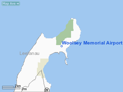
| From nearest city: | 3 nautical miles NE of Northport, MI |
| Location: | Leelanau County, MI |
| Magnetic Variation: | 05W (1985) |
Owner & Manager
| Ownership: | Publicly owned |
| Owner: | Leelanau Twp |
| Address: | 119 E. Nagonaba, P.o. Box 338
Northport, MI 49670 |
| Phone number: | 231-386-5282 |
| Manager: | Forbes R. Houghan |
| Address: | P.o. Box 718
Northport, MI 49670 |
| Phone number: | 231-386-7541 |
Airport Operations and Facilities
| Airport Use: | Open to public |
| Wind indicator: | Yes |
| Segmented Circle: | Yes |
| Control Tower: | No |
| Lighting Schedule: | RDO-CTL
ACTVT LIRL RY 09/27 - CTAF. |
| Landing fee charge: | No |
| Sectional chart: | Green Bay |
| Region: | AGL - Great Lakes |
| Boundary ARTCC: | ZMP - Minneapolis |
| Tie-in FSS: | LAN - Lansing |
| FSS on Airport: | No |
| FSS Toll Free: | 1-800-WX-BRIEF |
| NOTAMs Facility: | LAN (NOTAM-d service avaliable) |
Airport Communications
Airport Services
Runway Information
Runway 09/27
| Dimension: | 3663 x 120 ft / 1116.5 x 36.6 m |
| Surface: | TURF, Good Condition |
| Edge Lights: | Low |
| |
Runway 09 |
Runway 27 |
| Longitude: | 085-35-18.6100W | 085-34-27.3300W |
| Latitude: | 45-09-53.3400N | 45-09-54.1300N |
| Elevation: | 628.00 ft | 628.00 ft |
| Traffic Pattern: | Left | Left |
| Displaced threshold: | 266.00 ft | 0.00 ft |
| Obstruction: | 14 ft road, 35.0 ft from runway, 2:1 slope to clear
APCH RATIO 20:1 AT DSPLCD THR. | 16 ft trees, 320.0 ft from runway, 120 ft left of centerline, 20:1 slope to clear
RWY 27 APCH RATIO 34:1 BASED ON STRAIGHT OUT OVER 43 FT TREES, 1462 FT DSTC. |
|
Runway 16/34
| Dimension: | 2670 x 150 ft / 813.8 x 45.7 m |
| Surface: | TURF, Fair Condition |
| |
Runway 16 |
Runway 34 |
| Longitude: | 085-34-43.5000W | 085-34-30.2500W |
| Latitude: | 45-10-18.1100N | 45-09-53.6800N |
| Elevation: | 628.00 ft | 628.00 ft |
| Traffic Pattern: | Left | Left |
| Displaced threshold: | 800.00 ft | 269.00 ft |
| Obstruction: | 20 ft trees, 105 ft right of centerline
APCH RATIO 20 TO DSPLCD THLD OVR +48 FT TREE, 960 FT DSTC, 125 FT R. | 40 ft trees, 200.0 ft from runway, 145 ft right of centerline, 5:1 slope to clear
APCH RATIO 11:1 TO DSPLCD OVR +42 FT TREE, 462 FT FRM DSPLCD THR, 25:1 OVR 17 FT BLDG, BLDG, 425 FT FM DSPLCD THR. |
|
Radio Navigation Aids
| ID |
Type |
Name |
Ch |
Freq |
Var |
Dist |
| CVX | NDB | Charlevoix | | 392.00 | 05W | 15.2 nm |
| CXK | NDB | Clam Lake | | 251.00 | 05W | 21.3 nm |
| TV | NDB | Gwenn | | 365.00 | 05W | 26.6 nm |
| BFA | NDB | Boyne Falls | | 263.00 | 06W | 27.5 nm |
| SJX | NDB | St James | | 382.00 | 05W | 31.8 nm |
| GYG | NDB | Grayling | | 359.00 | 06W | 40.3 nm |
| CGG | VOR | Grayling | | 109.80 | 06W | 46.2 nm |
| GLR | VOR/DME | Gaylord | 029X | 109.20 | 06W | 37.9 nm |
| TVC | VORTAC | Traverse City | 093X | 114.60 | 02W | 29.9 nm |
| PLN | VORTAC | Pellston | 055X | 111.80 | 06W | 47.4 nm |
Remarks
- ARPT CLSD NOV-MAR & WHEN SNOW COVERED.
- BIRDS & DEER ON AND INVOF ARPT.
- RY 09/27 SLOPES UP E TO W, & RY 16/34 SLOPES UP N TO S.
- EST PRIOR TO 1959.
Images and information placed above are from
http://www.airport-data.com/airport/5D5/
We thank them for the data!
| General Info
|
| Country |
United States
|
| State |
MICHIGAN
|
| FAA ID |
5D5
|
| Latitude |
45-09-53.997N
|
| Longitude |
085-34-18.304W
|
| Elevation |
628 feet
|
| Near City |
NORTHPORT
|
We don't guarantee the information is fresh and accurate. The data may
be wrong or outdated.
For more up-to-date information please refer to other sources.
|
|


