 |
|
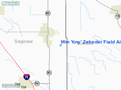
WM 'tiny' Zehnder Field Airport |
Location & QuickFacts
| FAA Information Effective: | 2008-09-25 |
| Airport Identifier: | 66G |
| Airport Status: | Operational |
| Longitude/Latitude: | 083-42-34.8640W/43-18-50.0870N
-83.709684/43.313913 (Estimated) |
| Elevation: | 645 ft / 196.60 m (Estimated) |
| Land: | 20 acres |
| From nearest city: | 2 nautical miles SE of Frankenmuth, MI |
| Location: | Saginaw County, MI |
| Magnetic Variation: | 06W (1985) |
Owner & Manager
| Ownership: | Privately owned |
| Owner: | Frankenmuth Airport Inc |
| Address: | P O Box 15
Frankenmuth, MI 48734 |
| Phone number: | 517-624-4652 |
| Manager: | James J. Pollick |
| Address: | P.o. Box 15
Frankenmuth, MI 48734 |
| Phone number: | 989-652-9371
MGR CELL . 989-652-9371 MGR RES |
Airport Operations and Facilities
| Airport Use: | Open to public |
| Wind indicator: | Yes |
| Segmented Circle: | Yes |
| Control Tower: | No |
| Landing fee charge: | No |
| Sectional chart: | Detroit |
| Region: | AGL - Great Lakes |
| Boundary ARTCC: | ZOB - Cleveland |
| Tie-in FSS: | LAN - Lansing |
| FSS on Airport: | No |
| FSS Toll Free: | 1-800-WX-BRIEF |
| NOTAMs Facility: | LAN (NOTAM-d service avaliable) |
Airport Communications
Airport Services
| Airframe Repair: | NONE |
| Power Plant Repair: | NONE |
| Bottled Oxygen: | NONE |
| Bulk Oxygen: | NONE |
Runway Information
Runway 09/27
| Dimension: | 2530 x 100 ft / 771.1 x 30.5 m |
| Surface: | TURF, Good Condition |
| Edge Lights: | Low
LIRL NOT FOR PUBLIC USE. |
| |
Runway 09 |
Runway 27 |
| Longitude: | 083-42-51.7600W | 083-42-17.9500W |
| Latitude: | 43-18-50.0700N | 43-18-50.0700N |
| Elevation: | 645.00 ft | 645.00 ft |
| Traffic Pattern: | Left | Left |
| Displaced threshold: | 400.00 ft | 0.00 ft |
| Obstruction: | 17 ft road, 107.0 ft from runway, 6:1 slope to clear
+34' TREES 95' RIGHT OF EXTNDD CNTRLN.
APCH RATIO 11:1 AT DSPLCD THLD OVER 69 FT TREE, 759 FT DSTC, 100 FT R. | 100 ft pline, 2500.0 ft from runway, 25:1 slope to clear
+80' PLINE RIGHT AND LEFT OF EXTNDD CNTRLN. |
|
Radio Navigation Aids
| ID |
Type |
Name |
Ch |
Freq |
Var |
Dist |
| HYX | NDB | Browne | | 385.00 | 06W | 9.6 nm |
| OZW | NDB | Howell | | 243.00 | 05W | 42.7 nm |
| AMN | NDB | Alma | | 329.00 | 05W | 47.0 nm |
| MBS | VOR/DME | Saginaw | 076X | 112.90 | 03W | 20.7 nm |
| BAX | VOR/DME | Bad Axe | 019X | 108.20 | 05W | 42.4 nm |
| MOP | VOR/DME | Mount Pleasant | 043X | 110.60 | 05W | 48.5 nm |
| FNT | VORTAC | Flint | 116X | 116.90 | 06W | 20.9 nm |
| PSI | VORTAC | Pontiac | 047X | 111.00 | 03W | 37.7 nm |
| ECK | VORTAC | Peck | 087X | 114.00 | 07W | 43.5 nm |
Remarks
- RY 09/27 SOFT IN SPRING & AFTER HEAVY RAIN.
- SNOW REMOVAL INTERMITTENT; VERIFY COND CALL 989-652-3652 OR 989-652-9371.
- RY 09 -7 FT DITCH 60 FT FM THLD.
Images and information placed above are from
http://www.airport-data.com/airport/66G/
We thank them for the data!
| General Info
|
| Country |
United States
|
| State |
MICHIGAN
|
| FAA ID |
66G
|
| Latitude |
43-18-50.087N
|
| Longitude |
083-42-34.864W
|
| Elevation |
645 feet
|
| Near City |
FRANKENMUTH
|
We don't guarantee the information is fresh and accurate. The data may
be wrong or outdated.
For more up-to-date information please refer to other sources.
|
|


