 |
|
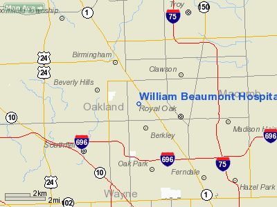
William Beaumont Hospital Heliport |
Location & QuickFacts
| FAA Information Effective: | 2008-09-25 |
| Airport Identifier: | 32MI |
| Airport Status: | Operational |
| Longitude/Latitude: | 083-11-34.0000W/42-30-54.0000N
-83.192778/42.515000 (Estimated) |
| Elevation: | 705 ft / 214.88 m (Estimated) |
| Land: | 0 acres |
| From nearest city: | 1 nautical miles W of Royal Oak, MI |
| Location: | Oakland County, MI |
| Magnetic Variation: | 06W (1990) |
Owner & Manager
| Ownership: | Privately owned |
| Owner: | William Beaumont Hospital |
| Address: | 3601 W 13 Mile Rd
Royal Oak, MI 48072 |
| Address: |
|
Airport Operations and Facilities
| Airport Use: | Private
MEDICAL USE. |
| Segmented Circle: | No |
| Control Tower: | No |
| Lighting Schedule: | DUSK-DAWN |
| Sectional chart: | Detroit |
| Region: | AGL - Great Lakes |
| Boundary ARTCC: | ZOB - Cleveland |
| Tie-in FSS: | LAN - Lansing |
| FSS on Airport: | No |
| FSS Toll Free: | 1-800-WX-BRIEF |
Runway Information
Helipad H1
| Dimension: | 66 x 66 ft / 20.1 x 20.1 m |
| Surface: | CONC, |
| |
Runway H1 |
Runway |
| Traffic Pattern: | Left | Left |
|
Radio Navigation Aids
| ID |
Type |
Name |
Ch |
Freq |
Var |
Dist |
| VQ | NDB | Cargl | | 230.00 | 05W | 14.2 nm |
| G | NDB | Golf | | 398.00 | 05W | 17.5 nm |
| QG | NDB | Windsor | | 353.00 | 06W | 18.8 nm |
| RYS | NDB | Grosse Ile | | 419.00 | 06W | 24.9 nm |
| OZW | NDB | Howell | | 243.00 | 05W | 35.9 nm |
| TCU | NDB | Tecumseh | | 239.00 | 04W | 42.0 nm |
| ZR | NDB | Sarnia | | 404.00 | 06W | 49.5 nm |
| PT | NDB | Pelee Island | | 283.00 | 05W | 50.0 nm |
| MTC | TACAN | Selfridge | 064X | | 06W | 17.0 nm |
| DXO | VOR/DME | Detroit | 081X | 113.40 | 06W | 19.7 nm |
| YQG | VOR/DME | Windsor | 085X | 113.80 | 06W | 22.7 nm |
| PSI | VORTAC | Pontiac | 047X | 111.00 | 03W | 18.7 nm |
| SVM | VORTAC | Salem | 090X | 114.30 | 03W | 18.9 nm |
| CRL | VORTAC | Carleton | 104X | 115.70 | 03W | 30.4 nm |
| FNT | VORTAC | Flint | 116X | 116.90 | 06W | 36.6 nm |
| ECK | VORTAC | Peck | 087X | 114.00 | 07W | 49.2 nm |
| DET | VOT | Detroit City | | 111.60 | | 10.2 nm |
| DTW | VOT | Detroit Met Wayne | | 109.80 | | 18.9 nm |
| YIP | VOT | Willow Run | | 112.00 | | 22.3 nm |
Remarks
- PRVDD APCH/DEP RTE OPERS FROM 020-055 DEGS & FROM 200-340 DEGS; TKOF/LNDG AREA MARKED; WIND INDICATOR IS MAINTAINED; LGT POLE 130 FT SW REMOVED OR LOWERED TO 16 FT; & STOP SIGN TO NE CORNER IS LOWERED TO 4 FT TO PROVIDE TAIL ROTOR CLEARANCE.
Images and information placed above are from
http://www.airport-data.com/airport/32MI/
We thank them for the data!
| General Info
|
| Country |
United States
|
| State |
MICHIGAN
|
| FAA ID |
32MI
|
| Latitude |
42-31-20.125N
|
| Longitude |
083-11-39.743W
|
| Elevation |
710 feet
|
| Near City |
ROYAL OAK
|
We don't guarantee the information is fresh and accurate. The data may
be wrong or outdated.
For more up-to-date information please refer to other sources.
|
|


