 |
|
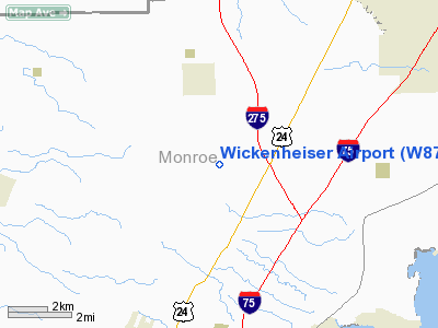
Location & QuickFacts
| FAA Information Effective: | 2008-09-25 |
| Airport Identifier: | W87 |
| Airport Status: | Operational |
| Longitude/Latitude: | 083-22-37.7550W/42-01-05.1600N
-83.377154/42.018100 (Estimated) |
| Elevation: | 610 ft / 185.93 m (Estimated) |
| Land: | 38 acres |
| From nearest city: | 3 nautical miles S of Carleton, MI |
| Location: | Monroe County, MI |
| Magnetic Variation: | 05W (1985) |
Owner & Manager
| Ownership: | Privately owned |
| Owner: | Cletus Wickenheiser |
| Address: | 9660 Grafton Rd
Carleton, MI 48117 |
| Phone number: | 734-654-6249 |
| Manager: | Cletus Wickenheiser |
| Address: | 9660 Grafton Rd
Carleton, MI 48117 |
| Phone number: | 734-654-6249 |
Airport Operations and Facilities
| Airport Use: | Open to public |
| Wind indicator: | Yes |
| Segmented Circle: | No |
| Control Tower: | No |
| Landing fee charge: | No |
| Sectional chart: | Detroit |
| Region: | AGL - Great Lakes |
| Boundary ARTCC: | ZOB - Cleveland |
| Tie-in FSS: | LAN - Lansing |
| FSS on Airport: | No |
| FSS Toll Free: | 1-800-WX-BRIEF |
| NOTAMs Facility: | LAN (NOTAM-d service avaliable) |
Airport Communications
Airport Services
| Fuel available: | 100LL |
| Airframe Repair: | MINOR
ACFT MAINT BY PRIOR ARRANGEMENT; CALL AMGR ON 734-654-6249. |
| Power Plant Repair: | MINOR |
Runway Information
Runway 09/27
| Dimension: | 1920 x 60 ft / 585.2 x 18.3 m |
| Surface: | TURF, Good Condition |
| |
Runway 09 |
Runway 27 |
| Longitude: | 083-22-44.7000W | 083-22-19.2600W |
| Latitude: | 42-01-00.7800N | 42-01-00.4800N |
| Elevation: | 610.00 ft | 610.00 ft |
| Traffic Pattern: | Left | Left |
| Displaced threshold: | 660.00 ft | 0.00 ft |
| Obstruction: | 15 ft pline, 5.0 ft from runway
RWY 09 APCH RATIO 0:1 AT DSPLCD THLD; CNTRLN OBSTN +20 FT TREES 57 FT L. | 53 ft trees, 1326.0 ft from runway, 25:1 slope to clear |
|
Runway 18/36
| Dimension: | 2575 x 60 ft / 784.9 x 18.3 m |
| Surface: | TURF, Good Condition |
| |
Runway 18 |
Runway 36 |
| Longitude: | 083-22-34.4100W | 083-22-40.2800W |
| Latitude: | 42-01-19.2500N | 42-00-54.4500N |
| Elevation: | 610.00 ft | 610.00 ft |
| Traffic Pattern: | Left | Left |
| Displaced threshold: | 1000.00 ft | 0.00 ft |
| Obstruction: | 30 ft pline, 15.0 ft from runway
RWY 18 APCH RATIO 20:1 AT DSPLCD THLD; CONTROLLING OBSTN +49 FT TREE 40 FT LEFT 990 FT. | 70 ft trees, 2400.0 ft from runway, 34:1 slope to clear |
|
Radio Navigation Aids
| ID |
Type |
Name |
Ch |
Freq |
Var |
Dist |
| RYS | NDB | Grosse Ile | | 419.00 | 06W | 11.2 nm |
| G | NDB | Golf | | 398.00 | 05W | 20.0 nm |
| TCU | NDB | Tecumseh | | 239.00 | 04W | 22.5 nm |
| VQ | NDB | Cargl | | 230.00 | 05W | 27.7 nm |
| QG | NDB | Windsor | | 353.00 | 06W | 28.8 nm |
| ADG | NDB | Adrian | | 278.00 | 06W | 32.6 nm |
| PT | NDB | Pelee Island | | 283.00 | 05W | 34.7 nm |
| PCW | NDB | Port Clinton | | 423.00 | 06W | 37.7 nm |
| USE | NDB | Fulton | | 375.00 | 05W | 41.8 nm |
| OZW | NDB | Howell | | 243.00 | 05W | 45.9 nm |
| FZI | NDB | Fostoria | | 379.00 | 05W | 49.8 nm |
| TOL | TACAN | Toledo | 072X | | 05W | 31.8 nm |
| MTC | TACAN | Selfridge | 064X | | 06W | 43.2 nm |
| DXO | VOR/DME | Detroit | 081X | 113.40 | 06W | 11.7 nm |
| YQG | VOR/DME | Windsor | 085X | 113.80 | 06W | 28.1 nm |
| VWV | VOR/DME | Waterville | 078X | 113.10 | 02W | 36.0 nm |
| SKY | VOR/DME | Sandusky | 029X | 109.20 | 04W | 47.8 nm |
| CRL | VORTAC | Carleton | 104X | 115.70 | 03W | 4.0 nm |
| SVM | VORTAC | Salem | 090X | 114.30 | 03W | 25.4 nm |
| PSI | VORTAC | Pontiac | 047X | 111.00 | 03W | 41.6 nm |
| DTW | VOT | Detroit Met Wayne | | 109.80 | | 12.6 nm |
| YIP | VOT | Willow Run | | 112.00 | | 14.5 nm |
| DET | VOT | Detroit City | | 111.60 | | 28.3 nm |
Remarks
- RYS 27 & 36 APCH MAY BE OBSTRUCTED BY 6 FT CORN CROP DURING GROWING SEASON.
Images and information placed above are from
http://www.airport-data.com/airport/W87/
We thank them for the data!
| General Info
|
| Country |
United States
|
| State |
MICHIGAN
|
| FAA ID |
W87
|
| Latitude |
42-01-05.160N
|
| Longitude |
083-22-37.755W
|
| Elevation |
610 feet
|
| Near City |
CARLETON
|
We don't guarantee the information is fresh and accurate. The data may
be wrong or outdated.
For more up-to-date information please refer to other sources.
|
|


